Big Rock, Virginia

Last updated

Big Rock
Mine in Big Rock, Virginia.jpg
Coal tipple in Big Rock
USA Virginia location map.svg
Red pog.svg
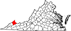
Big Rock
Location within the Commonwealth of Virginia
Usa edcp location map.svg
Red pog.svg
Big Rock
Big Rock (the United States)
Coordinates: 37°21′11″N82°11′20″W / 37.35306°N 82.18889°W / 37.35306; -82.18889
CountryUnited States
State Virginia
County Buchanan
Population
 (2020)
  Total199
Time zone UTC−5 (Eastern (EST))
  Summer (DST) UTC−4 (EDT)
GNIS feature ID1495268 [1]

Big Rock is an unincorporated community and census-designated place (CDP)in Buchanan County, Virginia located at the convergence of County Route 650 and U.S. Route 460, a short distance from the Kentucky state line. It was first listed as a CDP in the 2020 census with a population of 199. [2]

A post office was established at Big Rock in 1854. [3] The boulder from which the community likely took its name was destroyed in the 1930s by the building of the railroad. [4]

Related Research Articles

<span class="mw-page-title-main">Buchanan County, Virginia</span> County in Virginia, United States

Buchanan County is a United States county in far western Virginia, the only county in the state to border both West Virginia and Kentucky. The county is part of the Southwest Virginia region and lies in the rugged Appalachian Plateau portion of the Appalachian Mountains. Its county seat is Grundy.

<span class="mw-page-title-main">Sonoita, Arizona</span> CDP in Santa Cruz County, Arizona

Sonoita is a census-designated place (CDP) in Santa Cruz County, Arizona, United States. The population was 803 at the 2020 census.

<span class="mw-page-title-main">Buchanan, Virginia</span> Town in Virginia, United States

Buchanan is a town in Botetourt County, Virginia, United States. The population was 1,196 at the 2020 census. It is part of the Roanoke Metropolitan Statistical Area. It was the western terminus of the James River and Kanawha Canal when construction on the canal ended.

<span class="mw-page-title-main">Chantilly, Virginia</span> CDP in Virginia, United States

Chantilly is a census-designated place (CDP) in western Fairfax County, Virginia. The population was 24,301 as of the 2020 census. Chantilly is named after an early-19th-century mansion and farm, which in turn took the name of an 18th-century plantation that was located in Westmoreland County, Virginia. The name "Chantilly" originated in France with the Château de Chantilly, about 28 miles north of Paris.

<span class="mw-page-title-main">Dryden, Virginia</span> Census-designated place in Virginia, United States

Dryden is an unincorporated community and census-designated place (CDP) in Lee County, Virginia, United States. The population was 1,208 at the 2010 census.

<span class="mw-page-title-main">Keokee, Virginia</span> Census-designated place in Virginia, United States

Keokee is an unincorporated community and census-designated place (CDP) in Lee County, Virginia, United States. The population was 416 at the 2010 census.

<span class="mw-page-title-main">Alum Creek, West Virginia</span> Census-designated place in West Virginia, United States

Alum Creek is a census-designated place (CDP) in Kanawha and Lincoln counties along the Coal River in the U.S. state of West Virginia. It includes the unincorporated communities of Alum Creek, Forks of Coal, and Priestley. The CDP had a population of 1,749 at the 2010 census, down from 1,839 at the 2000 census.

<span class="mw-page-title-main">Tornado, West Virginia</span> Census-designated place in West Virginia, United States

Tornado, also called Upper Falls, is a census-designated place (CDP) in Kanawha County, West Virginia, United States.

<span class="mw-page-title-main">Whitewood, Virginia</span> Unincorporated community in Virginia, United States

Whitewood is an unincorporated community in Buchanan County, Virginia. As of the 2000 census, the Whitewood area had a population of 485. It is located along the Dismal River, which is part of the watershed of the Big Sandy River.

McConnell is an unincorporated community and census-designated place (CDP) in Logan County, West Virginia, United States, on the Guyandotte River. As of the 2010 census, its population was 514. It was established in 1933.

<span class="mw-page-title-main">Breaks, Virginia</span> Unincorporated community in Virginia, United States

Breaks is a small unincorporated community and census-designated place (CDP) mostly in Buchanan County, Virginia, United States. A small portion of the CDP is in Dickenson County. Breaks is located very close to the Kentucky border and is east of Breaks Interstate Park. Breaks gets its name in reference to the "break" in Pine Mountain, a mountain range that spans along the Kentucky-Virginia border and ends near the community of Breaks. It was first listed as a CDP in the 2020 census with a population of 144.

<span class="mw-page-title-main">Passapatanzy, Virginia</span> Census-designated place in Virginia, United States

Passapatanzy is an unincorporated community and census-designated place (CDP) in King George County, Virginia, United States. The population as of the 2010 census was 1,283.

<span class="mw-page-title-main">Franktown, Virginia</span> Human settlement in United States of America

Franktown is an unincorporated community and census-designated place in Northampton County, Virginia, United States. It was first listed as a CDP in the 2020 census with a population of 61.

Verdunville is an unincorporated community and census-designated place (CDP) in Logan County, West Virginia, United States. It is 3.5 miles (5.6 km) west of Logan, the county seat. Verdunville has a post office with ZIP code 25649. The Verdunville CDP includes the neighboring community of Shegon. As of the 2010 census, the total CDP population was 687.

Stollings is an unincorporated community and census-designated place (CDP) in central Logan County, West Virginia, United States. As of the 2010 census, it had a population of 316.

Sugarland Run is a planned community and census-designated place in Loudoun County, Virginia, United States. The population at the 2010 census was 11,799. In 2020, it was estimated to be 12,956. Sugarland Run is part of the Washington metropolitan area and is 26 miles (42 km) by road northwest of Washington, D.C.

<span class="mw-page-title-main">Neibert, West Virginia</span> Census-designated place in West Virginia, United States

Neibert is an unincorporated community and census-designated place (CDP) in Logan County, West Virginia, United States. Its population was 183 as of the 2010 census.

<span class="mw-page-title-main">Stickleyville, Virginia</span> Census-designated place in Virginia, United States

Stickleyville is an unincorporated community and census-designated place (CDP) in Lee County, Virginia, United States. It has also been known as Stickleysville. The community was first listed as a CDP for the 2020 census.

One Loudoun is a census-designated place (CDP) in Loudoun County, Virginia, United States. It is a mixed-use development just south of Virginia State Route 7, 29 miles (47 km) northwest of Washington, D.C., and 7 miles (11 km) southeast of Leesburg. One Loudoun was developed since the 2010 census, so it was not recognized as a census-designated place until the 2020 census. The community has an Ashburn mailing address.

Big Stone Gap East is an unincorporated area and census-designated place (CDP) in Wise County, Virginia, United States. It was first listed as a CDP in the 2020 census with a population of 687.

References

  1. U.S. Geological Survey Geographic Names Information System: Big Rock, Virginia
  2. "Big Rock CDP, Virginia". United States Census Bureau . Retrieved April 7, 2022.
  3. "Buchanan County". Jim Forte Postal History. Archived from the original on September 28, 2014. Retrieved September 28, 2014.
  4. Tennis, Joe (2004). Southwest Virginia Crossroads: An Almanac of Place Names and Places to See. The Overmountain Press. p. 4. ISBN   978-1-57072-256-1.