Whitewood | |
|---|---|
Unincorporated community | |
 Whitewood, Va. | |
 Whitewood Location within the Commonwealth of Virginia  Whitewood Whitewood (the United States) | |
| Coordinates: 37°14′08″N81°51′25″W / 37.23556°N 81.85694°W | |
| Country | United States |
| State | Virginia |
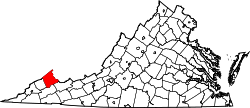
| County | Buchanan |
| Population (2000) | |
• Total | 485 |
| Time zone | UTC−5 (Eastern (EST)) |
| • Summer (DST) | UTC−4 (EDT) |
| ZIP codes | 24657 |
| Area code | (276) |
Whitewood is an unincorporated community in Buchanan County, Virginia, United States. As of the 2000 census, the Whitewood area had a population of 485. [1] It is located along the Dismal River, which is part of the watershed of the Big Sandy River.