Related Research Articles
Mount Hope is a city in Fayette County, West Virginia, United States. The population was 1,414 at the 2010 census.
Waterloo is an unincorporated community in New Kent County, Virginia, United States.

Burgess is an unincorporated community in Northumberland County, in the U.S. state of Virginia. The ZIP Code is 22432.
Brokenhead Ojibway Nation is an Anishinaabe (Saulteaux/Ojibwa) First Nation located approximately 64 kilometres (40 mi) northeast of Winnipeg, Manitoba.
Janey is an unincorporated community in Buchanan County, Virginia, in the United States.
Leemaster is an unincorporated community in Buchanan County, Virginia, in the United States.
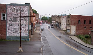
Pearly is an unincorporated community in Buchanan County, Virginia, in the United States.
Vicey is an unincorporated community in Buchanan County, Virginia, in the United States.
Weller is an unincorporated community in Buchanan County, Virginia, in the United States.
Bartlick is an unincorporated community in Dickenson County, Virginia, in the United States.
Blowing Rock is an unincorporated community in Dickenson County, Virginia, in the United States.
Colley is an unincorporated community in Dickenson County, Virginia, in the United States.
Darwin is an unincorporated community in Dickenson County, Virginia, in the United States.
Flemingtown is an unincorporated community in Dickenson County, Virginia, in the United States.
Nancy is an unincorporated community in Dickenson County, Virginia, in the United States.
Silver Run is a stream in the U.S. state of West Virginia. It is a tributary of the North Fork Hughes River.
Marys Hollow is a valley in Crawford County in the U.S. state of Missouri. The headwaters of the intermittent stream in the valley are at 37°53′29″N91°11′09″W and the confluence with Huzzah Creek is at 37°54′27″N91°10′04″W.
Hackney is an unincorporated community in northwest Greene County, in the U.S. state of Missouri. The community was a mill site on the north bank of a meander in the Little Sac River. The old iron Hackney Mill Bridge directly south of the community was constructed in 1895-96 and was replaced in 1996.
Brownfield is an unincorporated community in northeastern Laclede County, in the U.S. state of Missouri. The community is located just over one mile southeast of the Laclede-Pulaski county line and one mile east of Missouri Route K. It is within the Mark Twain National Forest and the Gasconade River lies just one mile to the east.
Higdon is an unincorporated community in northeast Madison County, in the U.S. state of Missouri.
References
- ↑ U.S. Geological Survey Geographic Names Information System: Thomas, Virginia
- ↑ Tennis, Joe (2004). Southwest Virginia Crossroads: An Almanac of Place Names and Places to See. The Overmountain Press. p. 4. ISBN 978-1-57072-256-1.
Municipalities and communities of Buchanan County, Virginia, United States | ||
|---|---|---|
| Town |  | |
| CDPs | ||
| Other communities |
| |
| Footnotes | ‡This populated place also has portions in an adjacent county or counties | |
Coordinates: 37°20′42″N82°10′04″W / 37.34500°N 82.16778°W
| | This Buchanan County, Virginia state location article is a stub. You can help Wikipedia by expanding it. |