Prater, Virginia

Last updated

Prater
Unincorporated community
USA Virginia location map.svg
Red pog.svg
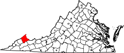
Prater
Location within the Commonwealth of Virginia
Usa edcp location map.svg
Red pog.svg
Prater
Prater (the United States)
Coordinates: 37°12′56″N82°11′58″W / 37.21556°N 82.19944°W / 37.21556; -82.19944
CountryUnited States
State Virginia
County Buchanan
Time zone UTC−5 (Eastern (EST))
  Summer (DST) UTC−4 (EDT)
GNIS feature ID1499911 [1]

Prater is an unincorporated community located in Buchanan County, Virginia. It is near the intersection of Virginia State Route 83 and County Route 604 in the western portion of the county. The community was the home of Russell Prater Elementary School until 2014.

A post office was established at Prater in 1877, and remained in operation until it was discontinued in 1965. [2] According to tradition, Prater was named for the Prater brothers of pioneer settlers. [3]

Related Research Articles

<span class="mw-page-title-main">Buchanan County, Virginia</span> County in Virginia, United States

Buchanan County is a United States county in far western Virginia, the only county in the state to border both West Virginia and Kentucky. The county is part of the Southwest Virginia region and lies in the rugged Appalachian Plateau portion of the Appalachian Mountains. Its county seat is Grundy.

<span class="mw-page-title-main">Virginia State Route 80</span>

State Route 80 is a primary state highway in the southwest part of the U.S. state of Virginia. It runs from the Kentucky state line at Breaks Interstate Park east to U.S. Route 11 near Meadowview. Kentucky Route 80 and Missouri's Route 80 continue the number west to Matthews, Missouri. The entire length of SR 80 is part of U.S. Bicycle Route 76.

<span class="mw-page-title-main">Virginia State Route 83</span>

State Route 83 is a primary state highway in the U.S. state of Virginia. The state highway runs 61.71 miles (99.31 km) from U.S. Route 23 Business in Pound east to the West Virginia state line in Paynesville, where the highway continues as West Virginia Route 83. SR 83 is the main highway of Dickenson County, where it connects the county's three towns of Clintwood, Clinchco, and Haysi. The state highway connects those towns with Pound in Wise County and Grundy in Buchanan County, and connects Grundy with McDowell County, West Virginia.

<span class="mw-page-title-main">Oakwood, Virginia</span> Unincorporated community in Virginia, United States

Oakwood is an unincorporated town in Buchanan County, Virginia, located at the intersection of U.S. Route 460 and Secondary Route 624. The Appalachian College of Pharmacy is in Oakwood, on the campus of the former Garden High School.

<span class="mw-page-title-main">Hurley, Virginia</span> Unincorporated community in Virginia, United States

Hurley is an unincorporated community in Buchanan County, Virginia located at the convergence of County Routes 643, 646, 650, and 697, a short distance from the Kentucky and West Virginia state lines.

<span class="mw-page-title-main">Big Rock, Virginia</span> Unincorporated community in Virginia, United States

Big Rock is an unincorporated community and census-designated place (CDP)in Buchanan County, Virginia located at the convergence of County Route 650 and U.S. Route 460, a short distance from the Kentucky state line. It was first listed as a CDP in the 2020 census with a population of 199.

Keen Mountain is an unincorporated community in Buchanan County, Virginia located on U.S. Route 460, just south of the community of Oakwood, Virginia.

Deel is an unincorporated community in Buchanan County, Virginia, United States. Deel is located on U.S. Route 460 3 miles (4.8 km) south-southeast of Grundy.

Mavisdale is an unincorporated community in Buchanan County, Virginia, United States. Mavisdale is located on State Route 624 7.5 miles (12.1 km) southeast of Grundy. Mavisdale has a post office with ZIP code 24627.

Stacy is an unincorporated community in Buchanan County, in the U.S. state of Virginia.

Jewell Valley is an unincorporated community in southwestern Virginia, located in Buchanan County, Virginia, United States. Jewell Valley is 16.5 miles (26.6 km) east of Grundy.

<span class="mw-page-title-main">Patterson, Buchanan County, Virginia</span> Unincorporated community in Virginia, United States

Patterson is an unincorporated community in Buchanan County, Virginia, United States. Patterson is located on State Route 641 6.8 miles (10.9 km) east of Grundy. Patterson had a post office from September 11, 1936, to July 27, 1991.

Bearwallow is an unincorporated community in Buchanan County, Virginia, United States. Bearwallow is located in the extreme northeastern corner of the county on Virginia State Route 616, approximately 19.8 miles (31.9 km) east-southeast of Grundy. A short distance to the east of Bearwallow lies the intersection of Buchanan County with Tazewell County, Virginia and McDowell County, West Virginia.

Grimsleyville is an unincorporated community in Buchanan County, Virginia, in the United States.

Mount Heron is an unincorporated community in Buchanan County, Virginia, in the United States.

Page is an unincorporated community in Buchanan County, Virginia, in the United States.

Roseann is an unincorporated community in Buchanan County, Virginia, in the United States.

Roth is an unincorporated community in Buchanan County, Virginia, United States.

Slate is an unincorporated community in Buchanan County, Virginia, in the United States.

Venia is an unincorporated community in Buchanan County, Virginia, in the United States.

References

  1. U.S. Geological Survey Geographic Names Information System: Prater, Virginia
  2. "Buchanan County". Jim Forte Postal History. Retrieved September 28, 2014.
  3. Tennis, Joe (2004). Southwest Virginia Crossroads: An Almanac of Place Names and Places to See. The Overmountain Press. p. 4. ISBN   978-1-57072-256-1.