Harman, Virginia | |
|---|---|
Unincorporated community | |
 Harman, Virginia  Harman, Virginia | |
| Coordinates: 37°17′35″N82°12′07″W / 37.29306°N 82.20194°W | |
| Country | United States |
| State | Virginia |
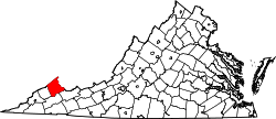
| County | Buchanan |
| Elevation | 1,220 ft (370 m) |
| Time zone | UTC-5 (Eastern (EST)) |
| • Summer (DST) | UTC-4 (EDT) |
| Area code | 276 |
| GNIS feature ID | 1495655 [1] |
Harman is an unincorporated community in Buchanan County, in the U.S. state of Virginia.
The Harman post office was established in 1935. [2] It was named for the Harman family who owned the local coal mine. [3]