Keen Mountain | |
|---|---|
Unincorporated community | |
 Keen Mountain Location within the Commonwealth of Virginia  Keen Mountain Keen Mountain (the United States) | |
| Coordinates: 37°12′14″N81°58′48″W / 37.20389°N 81.98000°W | |
| Country | United States |
| State | Virginia |
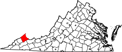
| County | Buchanan |
| Time zone | UTC−5 (Eastern (EST)) |
| • Summer (DST) | UTC−4 (EDT) |
| ZIP codes | South Grundy, VA 24631 |
| GNIS feature ID | 1495773 [1] |
Keen Mountain is an unincorporated community in Buchanan County, Virginia, United States, located on U.S. Route 460, just south of the community of Oakwood.
The Keen Mountain post office was established in 1937. [2] The community was named in honor of William Keen and family, pioneer settlers. [3]