Klickitat County is a county located in the U.S. state of Washington. As of the 2020 census, the population was 22,735. The county seat and largest city is Goldendale. The county is named after the Klickitat tribe.

Van Horne is a city in Benton County, Iowa, United States. The population was 774 at the 2020 census. It is part of the Cedar Rapids Metropolitan Statistical Area.

Hayesville is a city in Keokuk County, Iowa, United States. The population was 41 at the time of the 2020 census.
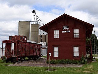
Walker is a city in Linn County, Iowa. The population was 688 at the 2020 census. It is part of the Cedar Rapids, Iowa metropolitan area.

Morning Sun is a city in Morning Sun Township, Louisa County, Iowa, United States. The population was 752 at the time of the 2020 census. It is part of the Muscatine Micropolitan Statistical Area.

West Chester is a city in Washington County, Iowa, United States. It is part of the Iowa City, Iowa Metropolitan Statistical Area. The population was 144 at the time of the 2020 census.

Chautauqua is a city in Chautauqua County, Kansas, United States. As of the 2020 census, the population of the city was 108.

Onaga is a city in Pottawatomie County, Kansas, United States. As of the 2020 census, the population of the city was 679.

Barnes is a city in Washington County, Kansas, United States. As of the 2020 census, the population of the city was 165.

Washington is a city on the south banks of the Missouri River, 50 miles west of St. Louis, Missouri. With an estimated population of 15,075, it is the largest city in Franklin County, Missouri. It is notable for being the "corncob pipe capital of the world," with Missouri Meerschaum located on the city's riverfront.

Schell City is a city in northeast Vernon County, Missouri, United States. The population was 249 at the 2010 census.

Napoleon is a city in Logan County, North Dakota, United States. It is the county seat of Logan County. The population was 749 at the 2020 census.

Riverbend is an unincorporated community and census-designated place (CDP) in King County, Washington, United States. The population was 2,123 at the 2020 census.

Harrington is a city in Lincoln County, Washington, United States. The population was 429 at the 2020 census. It was named after W.P. Harrington, a banker from Colusa, California, who had heavily invested in local land.

East Cathlamet is a census-designated place (CDP) in Wahkiakum County, Washington, on the eastern border of the town of Cathlamet. The population was 578 as of the 2020 census. The East Cathlamet community is part of the Wahkiakum School District, a K-12 school district of about 430 students. The name "Kathlamet" (Cathlamet) comes from the Kathlamet tribe, which in their language, means "rocky shore."
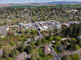
Palouse is a city in Whitman County, Washington, United States. The population was 1,015 at the 2020 census.

Glen Dale is a city in Marshall County, West Virginia, United States, along the Ohio River. It is part of the Wheeling, West Virginia Metropolitan Statistical Area. The population was 1,514 at the 2020 census. Glen Dale was incorporated in 1924. It is in the northwest part of the county, which is above the Mason–Dixon line and forms the base of the Northern Panhandle of West Virginia.

Coulee Dam is a town in Douglas, Grant, and Okanogan counties in the state of Washington. The Douglas County portion of Coulee Dam is part of the Wenatchee–East Wenatchee Metropolitan Statistical Area. The population was 1,211 as of the 2020 census.

Milton is a city in King and Pierce counties in the U.S. state of Washington. The population was 8,697 at the time of the 2020 census. Milton borders the larger but newer town of Edgewood.

Carson is a small census-designated place in the Columbia River Gorge National Scenic Area, north of the Columbia River in Skamania County, in the southwestern part of Washington, United States. The population was 2,323 at the 2020 census.