Montana is a landlocked state in the Northwestern United States. Montana has several nicknames, although none are official, including "Big Sky Country" and "The Treasure State", and slogans that include "Land of the Shining Mountains" and more recently "The Last Best Place".

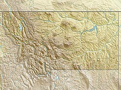
The Absaroka Range is a sub-range of the Rocky Mountains in the United States. The range stretches about 150 mi (240 km) across the Montana-Wyoming border, and 75 miles at its widest, forming the eastern boundary of Yellowstone National Park along Paradise Valley (Montana), and the western side of the Bighorn Basin. The range borders the Beartooth Mountains to the north and the Wind River Range to the south. The northern edge of the range rests along I-90 and Livingston, Montana. The highest peak in the range is Francs Peak, located in Wyoming at 13,153 ft (4,009 m). There are 46 other peaks over 12,000 ft (3,700 m).

The Bighorn Mountains are a mountain range in northern Wyoming and southern Montana in the United States, forming a northwest-trending spur from the Rocky Mountains extending approximately 200 miles (320 km) northward on the Great Plains. They are separated from the Absaroka Range, which lie on the main branch of the Rockies in western Wyoming, by the Bighorn Basin. Much of the land is contained within the Bighorn National Forest.

The Beartooth Mountains are located in south central Montana and northwest Wyoming, U.S. and are part of the 944,000 acres (382,000 ha) Absaroka-Beartooth Wilderness, within Custer, Gallatin and Shoshone National Forests. The Beartooths are the location of Granite Peak, which at 12,807 feet (3,904 m) is the highest point in the state of Montana. The mountains are just northeast of Yellowstone National Park and are part of the Greater Yellowstone Ecosystem. The mountains are traversed by road via the Beartooth Highway with the highest elevation at Beartooth Pass 10,947 ft (3,337 m)). The name of the mountain range is attributed to a rugged peak found in the range, Beartooth Peak, that has the appearance of a bear's tooth.

The Beaverhead-Deerlodge National Forest is the largest of the National Forests in Montana, United States. Covering 3.36 million acres (13,600 km2), the forest is broken into nine separate sections and stretches across eight counties in the southwestern area of the state. President Theodore Roosevelt named the two forests in 1908 and they were merged in 1996. Forest headquarters are located in Dillon, Montana. In Roosevelt's original legislation, the Deerlodge National Forest was called the Big Hole Forest Reserve. He created this reserve because the Anaconda Copper Mining Company, based in Butte, Montana, had begun to clearcut the upper Big Hole River watershed. The subsequent erosion, exacerbated by smoke pollution from the Anaconda smelter, was devastating the region. Ranchers and conservationists alike complained to Roosevelt, who made several trips to the area.
(Munday 2001)
The Pinnacles may refer to different geological formations:

The Tobacco Root Mountains lie in the northern Rocky Mountains, between the Jefferson and Madison Rivers in southwest Montana. The highest peak is Hollowtop at 10,604 feet (3,232 m). The range contains 43 peaks rising to elevations greater than 10,000 feet.
Black Butte may refer to:
There are many mountains called Boulder Mountain, including:

The Gallatin Range is a mountain range of the Rocky Mountains, located in the U.S. states of Montana and Wyoming. It includes more than 10 mountains over 10,000 feet (3,000 m). The highest peak in the range is Electric Peak at 10,969 feet (3,343 m).

The Cabinet Mountains are part of the Rocky Mountains, located in northwest Montana and the Idaho panhandle, in the United States. The mountains cover an area of 2,134 square miles (5,527 km²). The Cabinet Mountains lie south of the Purcell Mountains, between the Kootenai River and Clark Fork River and Idaho's Lake Pend Oreille. The Cabinet Mountains lie to the east of the Purcell Trench. The Cabinet Mountains form the north side of the Clark Fork River valley in Idaho and Montana. The Cabinet Mountains Wilderness is located east of the Bull River near Noxon, Montana in roughly the center of the range.

The Madison Range is a mountain range located in the Rocky Mountains of Montana and Idaho in the United States. The range was named in honor of future President of the United States, then U.S. Secretary of State James Madison by Meriwether Lewis as the Lewis and Clark Expedition travelled through Montana in 1805. The range extends 80 miles (130 km) from West Yellowstone, Montana to Bozeman, Montana and is flanked by the Madison River on the west and the Gallatin River to the east. The highest point in the range is Hilgard Peak at 11,316 ft (3,449 m), a remote peak that wasn't climbed until 1948.

The Little Belt Mountains are a section of the Rocky Mountains in the U.S. state of Montana. Situated mainly in the Lewis and Clark National Forest, the mountains are used for logging and recreation for the residents of Great Falls, Montana. Showdown is a ski area located within the mountains located off US Highway 89 which splits the mountains in half connecting White Sulphur Springs and Belt, MT. The highest point in the Little Belt Range is Big Baldy Mountain at 9,175 feet (2,797 m).

The Flathead Range is a mountain range of the Northern Rocky Mountains located south-east of Whitefish, Montana in the Great Bear Wilderness, part of the Bob Marshall Wilderness Complex. It is east of the Swan Range and southeast of the Whitefish Range. Its west side is drained by the South Fork Flathead River which forms Hungry Horse Reservoir.

The Beaverhead Mountains, highest point Scott Peak, el. 11,393 feet (3,473 m), are a mountain range straddling the Continental Divide in the U.S. states of Montana and Idaho. They are a sub-range of the Bitterroot Range, and divide Beaverhead County, Montana from Lemhi County, Idaho and Clark County, Idaho.

The Big Snowy Mountains, el. 8,681 feet (2,646 m), are a mountain range south of Lewistown, Montana in Fergus County, Montana. One of the few points of significant elevation in the area, this is considered one of Montana's island ranges. The smaller Little Snowy Mountains are a contiguous range immediately to the east.
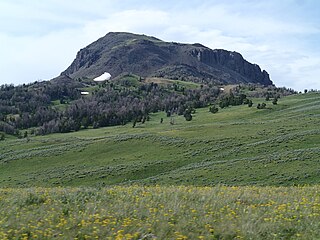
The Gravelly Range, highest peak Black Butte, el. 10,542 feet (3,213 m), is a mountain range southwest of Cameron, Montana in Madison County, Montana.