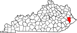
Blue River, Kentucky

Last updated

Blue River, Kentucky
USA Kentucky location map.svg
Red pog.svg
Blue River
Location within the state of Kentucky
Usa edcp location map.svg
Red pog.svg
Blue River
Blue River (the United States)
Coordinates: 37°37′9″N82°50′38″W / 37.61917°N 82.84389°W / 37.61917; -82.84389
Country United States
State Kentucky
County Floyd
Elevation
666 ft (203 m)
Time zone UTC-5 (Eastern (EST))
  Summer (DST) UTC-4 (EST)
ZIP codes
41607
GNIS feature ID507534 [1]

Blue River is an unincorporated community in Floyd County, Kentucky, United States.

Contents

Geography

Blue River is located on Kentucky Route 404, with a northern terminus on Kentucky Route 1210. [2]

Notable person

References

  1. U.S. Geological Survey Geographic Names Information System: Blue River, Kentucky
  2. Division of Planning (n.d.). "Official Milepoint Route Log Extract (Floyd County)". Highway Information System. Kentucky Transportation Cabinet . Retrieved June 18, 2016.
  3. Deaton, Jarrid (2010), "Shredding Away: Blue River native releasing thrash metal CD", Floyd County Times, archived from the original on March 15, 2012, retrieved May 24, 2011