Ivel, Kentucky | |
---|---|
Coordinates: 37°35′28″N82°40′6″W / 37.59111°N 82.66833°W Coordinates: 37°35′28″N82°40′6″W / 37.59111°N 82.66833°W | |
Country | United States |
State | Kentucky |
County | Floyd |
Elevation | 643 ft (196 m) |
Time zone | UTC-5 (Eastern (EST)) |
• Summer (DST) | UTC-4 (EDT) |
ZIP codes | 41642 |
GNIS feature ID | 508321 [1] |
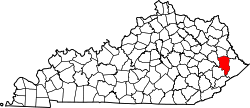
Ivel is an unincorporated community and coal town in Floyd County, Kentucky, United States.
A post office was established in the community in 1905. The town takes its name from the Ivy Creek. [2]
A census-designated place (CDP) is a concentration of population defined by the United States Census Bureau for statistical purposes only. CDPs have been used in each decennial census since 1980 as the counterparts of incorporated places, such as self-governing cities, towns, and villages, for the purposes of gathering and correlating statistical data. CDPs are populated areas that generally include one officially designated but currently unincorporated community, for which the CDP is named, plus surrounding inhabited countryside of varying dimensions and, occasionally, other, smaller unincorporated communities as well. CDPs include small rural communities, edge cities, colonias located along the Mexico–United States border, and unincorporated resort and retirement communities and their environs.
Biggleswade is a market town and civil parish in Central Bedfordshire, part of the ceremonial county of Bedfordshire, England. It lies on the River Ivel, 11 miles (18 km) south-east of Bedford. Its estimated population was 20,200 in mid-2017, its growth encouraged by good road and rail links to London. The King's Reach development, begun in 2010, will provide 2,000 new homes to the east of the town.
Sandy is a market town and civil parish in Central Bedfordshire, England. It lies 8 miles (13 km) to the east of Bedford, 18 miles (29 km) to the south west of Cambridge and 43 miles (69 km) north of Central London. The town has a population of around 13,400 based on 2015 estimates.
The River Ivel is a north-flowing river in the western part of east of England. It is primarily in Bedfordshire; it is a tributary of the River Great Ouse and has sources including in the Barton Hills.
The Breeze was a local radio station serving Yeovil, South Somerset and West Dorset in England.
Hemyock is a village and civil parish in Devon, England. It is about 8 miles north-west of Honiton and 5 miles (8 km) south of the Somerset town of Wellington. The 2011 Census recorded the parish's population as 1,519. Hemyock is part of the electoral ward of Upper Culm. The population of this ward at the above census was 4,039. The River Culm flows through Hemyock. Hemyock was the former home of the St Ivel dairy processing plant, formerly where the butter-spreads 'St Ivel Gold' and 'Utterly-Butterly' were produced before being moved to a factory in the north of England.
Shefford is a town and civil parish located near Luton in the Central Bedfordshire district of Bedfordshire, England. At the 2001 census it had a population of 4,928, and was estimated to have grown to 5,770 by 2007. The population at the 2011 Census had risen to 5,881.
Stotfold is a small town and civil parish in Bedfordshire, England.
Blunham is a village and civil parish in the Central Bedfordshire district of Bedfordshire, England, about 8 miles (13 km) east of Bedford. At the 2011 census date its population was 946. The River Ivel forms the parish's eastern boundary in places and the River Great Ouse its western and northern boundaries. The village is just over 0.6 miles (1 km) to the west of the A1 road, and Route 51 of the National Cycle Network passes to the south.
The River Flit is a short river in Bedfordshire, England. Its name is not ancient, but rather a back formation from Flitton which originally meant that the river was spelt with as Flitt rather than Flit.
Langford is a village and civil parish in the Central Bedfordshire district of the county of Bedfordshire, England about 10 miles (16 km) south-east of the county town of Bedford. The 2011 census gives the population as 3,091.
Northill is a village and civil parish in the Central Bedfordshire district of the county of Bedfordshire, England about 6.5 miles (10 km) southeast of the county town of Bedford.
Stanford is a hamlet in the Central Bedfordshire district of the county of Bedfordshire, England about 8.5 miles (14 km) south-east of the county town of Bedford. Its population is included within Southill civil parish.
Tempsford is a village and civil parish in the Central Bedfordshire district of the county of Bedfordshire, England, about 7 miles (11 km) east north-east of the county town of Bedford.
The Riddy is an 8.4 hectare flood meadow and Local Nature Reserve located in Sandy, Bedfordshire, United Kingdom, bordering the River Ivel. Owned by Sandy Town Council but managed by both the Wildlife Trust for Bedfordshire, Cambridgeshire and Northamptonshire and Bedfordshire Rural Communities Charity, the 7.7 hectares site gains its name from a small stream which flows through the eastern end of the reserve. The different habitats in the Riddy support a diverse range of species, including a multiplicity of grasses and flowering plants in the meadows, aquatic plants and water voles which inhabit the ditches, ponds and stream, and birds which feed and hunt across the reserve.
The Ivelchester and Langport Navigation was a scheme to make the River Ivel navigable from Langport to Ilchester, in Somerset, England. Work started in 1795, but the scheme was effectively bankrupt by 1797, and construction of the locks was never completed.
The River Yeo, also known as the River Ivel, is a tributary of the River Parrett in north Dorset and south Somerset, England.
Lower Caldecote is a hamlet in the civil parish of Northill and part of the Central Bedfordshire district of Bedfordshire, England. The county town of Bedford is 7.5 miles (12 km) to the west.
Ivel may refer to:
Ivel is a village in Poshtkuh Rural District, Chahardangeh District, Sari County, Mazandaran Province, Iran. At the 2006 census, its population was 137, in 49 families.