Drift, Kentucky | |
---|---|
Coordinates: 37°28′49″N82°44′52″W / 37.48028°N 82.74778°W Coordinates: 37°28′49″N82°44′52″W / 37.48028°N 82.74778°W | |
Country | United States |
State | Kentucky |
County | Floyd |
Population (2000) | |
• Total | 569 |
Time zone | UTC-5 (Eastern (EST)) |
• Summer (DST) | UTC-4 (EDT) |
ZIP codes | 41619 |
Area code(s) | 606 |
GNIS feature ID | 491113 |
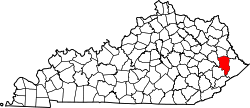
Drift, Kentucky is an unincorporated community and coal town in Floyd County, Kentucky, United States. As of the census of 2000, there were 569 people living in the ZIP Code Tabulation Area (ZCTA) for Drift's ZIP code (41619). [1]
Drift is located at 37°28′49″N82°44′52″W / 37.48028°N 82.74778°W (37.4803778, -82.7476587) at an elevation of 715 feet (218 m). [2]
A post office was established in the community in 1909. The origins of the name Drift are unclear: it may have been named for a local mine or for driftwood found in a nearby creek. [3]
Keystone is an unincorporated census-designated place in Hillsborough County, Florida, United States. The population was 24,039 at the 2010 census, up from 14,627 at the 2000 census. The ZIP Codes encompassing the CDP area are 33556 and 33558.
Clyde Township is a civil township of St. Clair County in the U.S. state of Michigan. The population was 5,579 at the 2010 Census.
Ira Township is a civil township of St. Clair County in the U.S. state of Michigan. The population was 5,178 at the 2010 Census.
Isom is a small unincorporated community in Letcher County, Kentucky, United States. It is located at the junction of KY 7, KY 15 and KY 1148 nine miles (14.4 km) northwest of Whitesburg. As of the 2000 United States Census, the approximate population of the area in the Isom zip code was 1,078.
Cornettsville is an unincorporated community in Perry County, Kentucky, United States, within the state's eastern mountain region known for coal mining. The population is 792 as of the 2000 United States Census. The town was named for one of the early pioneers to the area, William Jesse Cornett, whose log cabin and burial site can still be seen today.
South Williamson is a census-designated place (CDP) in the Appalachian Mountains of northeastern Pike County, Kentucky, United States, on the border with West Virginia. It is separated from Williamson, West Virginia by the Tug Fork River. The community is located near U.S. Route 119 about 23 miles (37 km) east of Pikeville, Kentucky and 28 miles (45 km) southwest of Logan, West Virginia.
Pedro is an unincorporated community in central Elizabeth Township, Lawrence County, Ohio, United States. Although it is unincorporated, it has a post office, with ZIP code of 45659.
Varney is an unincorporated community in Pike County, Kentucky, United States. Its ZIP Code is 41571; the population of the 41571 ZIP Code Tabulation Area (ZCTA) was 543 at the 2000 census.
Cerulean is a census-designated place and unincorporated community in Trigg County, Kentucky, United States. At one time, it was a city, incorporated as Cerulean Springs. It lies along Kentucky Routes 124 and 126 northeast of the city of Cadiz, the county seat of Trigg County. Its elevation is 512 feet (156 m), and it is located at 36°57′34″N87°42′36″W. Although it is unincorporated, it has a post office, with the ZIP code of 42215.
Alpha is an unincorporated community in Clinton County, Kentucky, United States. It lies along Route 90 northeast of the city of Albany, the county seat of Clinton County. Its elevation is 1,014 feet (309 m), and it is located at 36°45′44″N85°0′37″W. Although it is unincorporated, it has a post office, with the ZIP code of 42603.
Rome is an unincorporated community along the Ohio River in southeastern Tobin Township, Perry County, in the U.S. state of Indiana.
Buffalo is an unincorporated community and census-designated place (CDP) in southern LaRue County, Kentucky, United States. Its population was 498 as of the 2010 census. It lies along Kentucky Route 61 south of the city of Hodgenville, the county seat of LaRue County. Its elevation is 748 feet (228 m), and it is located at 37°30′43″N85°41′55″W. Although Buffalo is unincorporated, it has a post office, with the ZIP code of 42716.
Laura is an unincorporated community in Martin County, Kentucky, United States. It is located at 37°43′33″N82°26′35″W at an elevation of 676 feet. The zip code is 41250.
Letcher is an unincorporated community in Letcher County, Kentucky. It is served by a post office that is assigned zip code 41832.
River is an unincorporated community in Johnson County, Kentucky, United States. The post office was first established on September 6, 1890, and its current ZIP code is 41254. Its telephone area code is 606. Its geographic coordinates are.
Ermine is an unincorporated community in Letcher County, Kentucky, United States. Its ZIP Code is 41815.
Unity, Kentucky is a small unincorporated community and former coal mining community that formerly had a U.S. Post Office located two miles west of Catlettsburg. Kentucky Route 168 passes through the hamlet. Catletts Creek, a tributary of the Ohio River, runs through the community of Unity. Unity was served by the Catletts Creek School, later named Eidson Elementary, from 1962 to 1993, when all students were transferred to Catlettsburg Elementary. The hamlet of Unity is virtually non-existent today, as most residents of Unity refer to Catlettsburg as their home, since it is the postal zip code used.
Betsy Layne is a census-designated place (CDP) and coal town in Floyd County, Kentucky, United States. It was established in 1875 along the Levisa Fork. The post office opened on May 1, 1908, with Clayton S. Hitchins as postmaster. Its ZIP code is 41605. The 2010 census reported the population to be 688. Stage actress Bette Henritze is a native of Betsy Layne.
Lynn Garden is a community and neighborhood in Kingsport, Tennessee.
Dundas is an unincorporated community in Vinton County, in the U.S. state of Ohio.