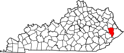
Auxier, Kentucky | |
---|---|
Coordinates: 37°44′08″N82°45′58″W / 37.73556°N 82.76611°W | |
Country | United States |
State | Kentucky |
County | Floyd |
Area | |
• Total | 0.96 sq mi (2.49 km2) |
• Land | 0.92 sq mi (2.39 km2) |
• Water | 0.04 sq mi (0.10 km2) |
Elevation | 820 ft (250 m) |
Population (2020) | |
• Total | 715 |
• Density | 775.49/sq mi (299.27/km2) |
Time zone | UTC-5 (Eastern (EST)) |
• Summer (DST) | UTC-4 (EDT) |
ZIP code | 41602 |
FIPS code | 21-02764 |
GNIS feature ID | 2629568 [2] |
Auxier is an unincorporated community and census-designated place (CDP) in Floyd County, Kentucky, United States. [3] The 2010 United States Census reported that Auxier's population was 669, of which 661 persons were white and 2 persons were black. [4]
Auxier had its start around 1900 as a coal town. [5] The community was named for the local Auxier family. [5]
Auxier is located along the northern edge of Floyd County, bordered to the south, east, and northeast by the Levisa Fork and to the north by Johnson County. Prestonsburg, the Floyd County seat, is 6 miles (10 km) to the south. According to the U.S. Census Bureau, the Auxier CDP has a total area of 0.97 square miles (2.5 km2), of which 0.93 square miles (2.4 km2) is land and 0.04 square miles (0.1 km2), or 3.85%, is water. [6]
Census | Pop. | Note | %± |
---|---|---|---|
2020 | 715 | — | |
U.S. Decennial Census [7] |
Lindale is an unincorporated community and census-designated place (CDP) in Floyd County, Georgia, United States. It is part of the Rome, Georgia Metropolitan Statistical Area. The population was 4,191 at the 2010 census.
Phelps is a census-designated place (CDP) in Pike County, Kentucky, United States. The population was 1,053 at the 2000 census. It is the easternmost census-designated community in Kentucky.
Switzer is an unincorporated community and census-designated place (CDP) in Logan County, West Virginia, United States. The CDP includes the neighboring unincorporated community of Micco. The total CDP population was 595 at the 2010 census.
Farmersville is a rural Mennonite settlement and a census-designated place (CDP) in West Earl Township, Lancaster County, Pennsylvania, United States. As of the 2010 census the population was 991.
Rio Rico is an unincorporated community and census-designated place (CDP) in Santa Cruz County, Arizona, United States. The population was 18,962 at the 2010 census. The Rio Rico CDP replaced the former CDP's of Rio Rico Northwest, Rio Rico Northeast, Rio Rico Southwest, and Rio Rico Southeast.
Symsonia is an unincorporated community and census-designated place (CDP) in Graves County, Kentucky, United States. The community lies in the far northeastern part of the county, 13 miles (21 km) southeast of Paducah, 11 miles (18 km) northwest of Benton, and 15 miles (24 km) northeast of the county seat Mayfield, in the Jackson Purchase region of the state. As of the 2010 census, the population of Symsonia was 615.
Kent is an unincorporated community and census-designated place (CDP) in Republican Township, Jefferson County, Indiana, United States. As of the 2010 census it had a population of 70.
Verona is an unincorporated community and census-designated place (CDP) in Boone County, Kentucky, United States. The population was 1,455 at the 2010 census.
Belleview is an unincorporated community and census-designated place (CDP) in Boone County, Kentucky, United States. The population was 343 at the 2010 census.
Burna is an unincorporated community and census-designated place (CDP) in central Livingston County, Kentucky, United States. As of the 2010 census the population was 257. It is home to the North Livingston Elementary School and Livingston County Middle School.
Betsy Layne is a census-designated place (CDP) and coal town in Floyd County, Kentucky, United States. It was established in 1875 along the Levisa Fork. The post office opened on May 1, 1908, with Clayton S. Hitchins as postmaster. Its ZIP code is 41605. The 2010 census reported the population to be 688. Stage actress Bette Henritze was a native of Betsy Layne.
Artemus is an unincorporated community and census-designated place in Knox County, Kentucky, United States. As of the 2010 United States Census the population was 590.
Dwale is an unincorporated community and census-designated place in Floyd County, Kentucky, United States. The 2010 United States Census reported that Dwale's population was 329, of which 312 persons were white and 9 persons were Asian.
Maytown is an unincorporated community and census-designated place in Floyd County, Kentucky, United States.
Beechmont is a census-designated place and unincorporated community in Muhlenberg County, Kentucky, United States. As of the 2020 census, the population was 776, up from 689 in 2010.
Cleaton is an unincorporated community and census-designated place in Muhlenberg County, Kentucky, United States. As of the 2020 census, it had a population of 168.
Cawood is a census-designated place (CDP) and coal town in Harlan County, Kentucky, United States. The population was 731 at the 2010 census.
Dunmor is an unincorporated community and census-designated place (CDP) in Muhlenberg and Logan counties, Kentucky, United States. As of the 2020 census it had a population of 322.
Flat Lick is an unincorporated community and census-designated place (CDP) in Knox County, Kentucky, United States. As of the 2010 census, the population was 960.
Doe Valley is an unincorporated community and census-designated place (CDP) in Meade County, Kentucky, United States. Its population was 2,270 as of the 2020 census.