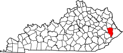
Garrett, Kentucky | |
---|---|
Coordinates: 37°28′47″N82°49′54″W / 37.47972°N 82.83167°W Coordinates: 37°28′47″N82°49′54″W / 37.47972°N 82.83167°W | |
Country | United States |
State | Kentucky |
County | Floyd |
Elevation | 876 ft (267 m) |
Time zone | UTC-5 (Eastern (EST)) |
• Summer (DST) | UTC-4 (EST) |
ZIP codes | 41630 |
GNIS feature ID | 492717 [1] |
Garrett is an unincorporated community and coal town in Floyd County, Kentucky, United States. It is located at the intersection of Kentucky Route 80 and Kentucky Route 7. CSX E&BV Subdivision also passes through the center of town between Front Street and State Route 7.
The town was founded by the Elk Horn Coal Company.
A post office was established in 1910 and named "Ballard". In 1914 the name was changed to Garrett, for brothers John and Robert Garrett, both Baltimore bankers and coal company financiers. [2]
Between July 26th and July 28th the nearby town of Jackson, KY recorded 8 inches of precipitation leading to widespread destruction and loss of life in and around Garrett.
Johnson County is a county located in the U.S. state of Kentucky. As of the 2010 census, the population was 23,356. Its county seat is Paintsville. The county was formed in 1843 and named for Richard Mentor Johnson, War of 1812 general, United States Representative, Senator, and Vice President of the United States. Johnson County is classified as a moist county, which is a county in which alcohol sales are not allowed, but containing a "wet" city, in this case Paintsville, where alcoholic beverage sales are allowed.
Floyd County is a county located in the U.S. state of Kentucky. As of the 2020 census, the population was 35,942. Its county seat is Prestonsburg. The county, founded in 1800, is named for Colonel John Floyd (1750–1783).
Prestonsburg is a small home rule-class city in and the county seat of Floyd County, Kentucky, United States. It is in the eastern part of the state in the valley of the Big Sandy River. The population was 3,255 at the time of the 2010 census, down from 3,612 at the 2000 census.
Martin is a home rule-class city in Floyd County, Kentucky, in the United States. The population was 634 as of the 2010 census.
Wayland is a home rule-class city in Floyd County, Kentucky, United States. The population was 426 at the 2010 census, up from 298 at the 2000 census.
Wheelwright is a home rule-class city in Floyd County, Kentucky, United States. The population was 780 at the 2010 census, down from 1,042 in 2000.
Jenkins is a home rule-class city in Letcher County, Kentucky, United States. The population was 2,203 as of the 2010 census.
Inez is a home rule-class city in and the county seat of Martin County, Kentucky, United States. The population was 717 at the 2010 census.
Warfield is a home rule-class city in Martin County, Kentucky, United States. The population was 269 at the 2010 census.
Highsplint is a former coal town with an extinct post office in Harlan County, Kentucky, United States. It was named for the High Splint and Seagraves Coal Companies which operated a mine in the town at that time. Highsplint's first post office was established on February 7, 1918, with John D. Casey as postmaster, remaining in operation until 1974.
David is an unincorporated community and coal town in Floyd County, Kentucky, United States along County Route 404. Located in the Appalachian Mountains, it lies approximately 100 miles (160 km) southeast of Lexington. The town was named for David L. Francis, president of Princess Elkhorn Coal Company which originally built and owned the town. It bears the postal ZIP code 41616. The U.S. Census of 2000 recorded a population of 435.
Royalton is an unincorporated community in Magoffin County, Kentucky, United States. It lies along Route 7 southeast of the city of Salyersville, the county seat of Magoffin County. Its elevation is 879 feet (268 m). Although it is unincorporated it had a post office, with the ZIP code 41464.
Betsy Layne is a census-designated place (CDP) and coal town in Floyd County, Kentucky, United States. It was established in 1875 along the Levisa Fork. The post office opened on May 1, 1908, with Clayton S. Hitchins as postmaster. Its ZIP code is 41605. The 2010 census reported the population to be 688. Stage actress Bette Henritze was a native of Betsy Layne.
Auxier is an unincorporated community and census-designated place (CDP) in Floyd County, Kentucky, United States. The 2010 United States Census reported that Auxier's population was 669, of which 661 persons were white and 2 persons were black.
Hi Hat is an unincorporated community and coal town located in Floyd County, Kentucky, United States. Their post office is still open.
Hot Spot is an unincorporated community and former coal town in Letcher County, Kentucky, United States. It was named for the Hot Spot Coal Company. Other names for the community have been Smoot Creek, Dalna, Elsiecoal, and Premium. It has frequently been noted on lists of unusual place names.
Hueysville, also known as Bosco, is an unincorporated community in Floyd County, Kentucky, United States. It has a post office with a ZIP Code of 41640. Hueysville is located on Salt Lick Creek Road west of Kentucky Route 550. CSX Transportation's E&BV Subdivision passes through Hueysville.
Ivel is an unincorporated community and coal town in Floyd County, Kentucky, United States.
Emma is an unincorporated community and coal town in Floyd County, Kentucky, United States.
Kentucky Route 550 (KY 550) is a 43.212 miles (69.543 km) state highway in eastern Kentucky that runs from Kentucky Routes 15 and 80 in northwestern Hazard to Kentucky Route 80 and Judge Road in Eastern via Darfork, Dwarf, Fisty, Carrie, Hindman, Garner, Mousie, Lackey, Garrett, and Eastern.