Bolivar, Mississippi | |
|---|---|
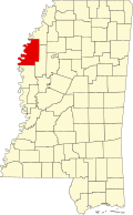
 Bolivar Location within the U.S. state of Mississippi | |
| Coordinates: 33°39′38″N91°03′07″W / 33.66056°N 91.05194°W | |
| Country | |
| State | |
| County | Bolivar |
| Founded | December 12, 1835 |
| Named after | Simón Bolívar |
| Area | |
• Total | 0.25 sq mi (0.65 km2) |
| • Land | 0.25 sq mi (0.65 km2) |
| • Water | 0.00 sq mi (0.00 km2) |
| Elevation | 141 ft (43 m) |
| Population (2020) | |
• Total | 39 |
| • Density | 156.00/sq mi (60.32/km2) |
| Time zone | UTC-6 (Central (CST)) |
| • Summer (DST) | UTC-5 (CDT) |
| ZIP code | 38725 |
| GNIS feature ID | 2812715 [2] |
Bolivar is a census-designated place and unincorporated community in Bolivar County, Mississippi, United States.
Contents
Bolivar was once the county seat, and Bolivar Landing was its port on the Mississippi River. Now permanently cut off from the river, Bolivar is a quiescent residential hamlet, while Bolivar Landing, immediately north and across the immense Mississippi Levee, is a cottage community on Lake Whittington. It was first named as a CDP in the 2020 Census which listed a population of 39. [3]