
Apollo Bay is a coastal town in southwestern Victoria, Australia. It is situated on the eastern side of Cape Otway, along the edge of the Barham River and on the Great Ocean Road, in the Colac Otway Shire. The town had a population of 1,598 at the 2016 census.

Winchelsea is a town in Victoria, Australia. The town is located in the Surf Coast Shire local government area, the suburb or locality of Winchelsea is predominantly within Surf Coast Shire with a small section within the Colac Otway Shire. Winchelsea is located on the Barwon River 115 km south-west of Melbourne and close to Geelong.

Kennett River is a small seaside town in Victoria, Australia.

Wye River is a small town in Victoria, Australia. It is also the name given to the waterway which flows through the town and into the sea at this point. Situated some 155 km west of Melbourne, on the Otway Coast part of the scenic Great Ocean Road, the Wye River township is a popular tourist destination about 15 km west of the resort town of Lorne, Victoria. It became a popular place for Melburnians to holiday after the Great Ocean Road was officially opened in 1932. The postcode of Wye River is 3234. At the 2016 census, Wye River had a permanent population of 66 although its holiday population is ten times that number.

Johanna is a small locality on the coast of Victoria, Australia located west of Cape Otway in the Colac Otway Shire. It is named after the schooner Joanna that was wrecked at the mouth of the Johanna River on 22 September 1843.

The Shire of Winchelsea was a local government area about 110 kilometres (68 mi) southwest of Melbourne, the state capital of Victoria, Australia. The shire covered an area of 1,294 square kilometres (499.6 sq mi), and existed from 1860 until 1994.
Modewarre is a locality in the Surf Coast Shire, Victoria, Australia. The town adjoins Lake Modewarre. In the 2016 census, Modewarre had a population of 276 people.

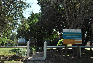
Buckley is a rural locality in the Surf Coast Shire, Victoria, Australia. It was formerly known as Laketown. In the 2016 census, Buckley had a population of 211 people.
Wurdiboluc is a rural locality in the Surf Coast Shire, Victoria, Australia. In the 2016 census, Wurdiboluc had a population of 569 people.
Mount Moriac is a rural locality in the Surf Coast Shire, Victoria, Australia. In the 2016 census, Mount Moriac had a population of 240 people.
Bambra is a rural locality in the Surf Coast Shire, Victoria, Australia. In the 2016 census, Bambra had a population of 101 people. It is named after an Aboriginal word for mushroom.
Ombersley is a rural locality in Victoria, Australia. Most of the locality is in Colac Otway Shire, with a portion being in adjacent Surf Coast Shire. In the 2016 census, Ombersley had a population of 97.
Paraparap is a rural locality in the Surf Coast Shire, Victoria, Australia. At the 2016 census, Paraparap had a population of 151 people.
Pennyroyal is a rural locality in Victoria, Australia. Most of the locality is situated in the Surf Coast Shire; a small section is situated in the Shire of Colac Otway. In the 2016 census, Pennyroyal had a population of 86.
Winchelsea South is a rural locality in the Surf Coast Shire, Victoria, Australia. In the 2016 census, Winchelsea South had a population of 179 people.
Eastern View is a small coastal location in the Surf Coast Shire, Victoria, Australia.
Benwerrin is a rural locality in the Surf Coast Shire, Victoria, Australia.
Separation Creek is a small coastal locality in the Shire of Colac Otway, Victoria, Australia. In the 2016 census, Separation Creek had a population of 19.

Hesse is a rural locality in the Golden Plains Shire, Victoria, Australia. In the 2016 census, Hesse had a population of 19 people.
Wongarra is a coastal locality in the Shire of Colac Otway, Victoria, Australia. In the 2016 census, Wongarra had a population of 37.
