Related Research Articles

Wheeler Peak is the tallest mountain in the Snake Range and in White Pine County, in Nevada, United States. The summit elevation of 13,065 feet (3,982 m) makes it the second-highest peak in Nevada, just behind Boundary Peak. With a topographic prominence of 7,563 feet (2,305 m), Wheeler Peak is the most topographically prominent peak in White Pine County and the second-most prominent peak in Nevada, just behind Mount Charleston. The mountain is located in Great Basin National Park and was named for George Wheeler, leader of the Wheeler Survey of the late 19th century.

Mount Nebo is the southernmost and highest mountain in the Wasatch Range of Utah, in the United States, and the centerpiece of the Mount Nebo Wilderness, inside the Uinta National Forest. It is named after the biblical Mount Nebo in Jordan, overlooking Israel from the east of the Jordan River, which is said to be the place of Moses' death.

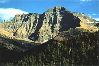
Mount Cleveland is the highest mountain in Glacier National Park, located in Montana, United States. It is also the highest point in the Lewis Range, which spans part of the northern portion of the park and extends into Canada. It is located approximately 3 mi (4.8 km) southeast of the southern end of Waterton Lake, and approximately 5 mi (8.0 km) south of the US–Canada border. The east side of the future national park was purchased by the federal government from the Blackfoot Confederacy in 1895 during the second term of President Grover Cleveland. According to the United States Board on Geographic Names, the mountain is named for the former president.

The Elkhorn Mountains are a mountain range in southwestern Montana, part of the Rocky Mountains and are roughly 300,000 acres (1200 km²) in size. It is an inactive volcanic mountain range with the highest point being Crow Peak at 9,414 ft (2,869 m), right next to Elkhorn Peak, 9,381 ft (2,859 m). The range is surrounded by the cities of Helena, Montana City, Townsend, Whitehall, and Boulder and is part of the Helena National Forest in Montana's Jefferson County.

Kintla Peak is a pyramidal peak in the Livingston Range of Glacier National Park in the U.S. state of Montana. It is the tallest mountain in the Livingston Range and the third-tallest in the park. It is also the most northerly peak and land area in the contiguous United States above 10,000 ft (3,000 m). The Agassiz Glacier lies below it to the southeast.

Electric Peak is the tallest mountain in the Gallatin Range of southern Montana, close to the Wyoming border and rising to an altitude of 10,969 feet (3,343 m). The peak has some of the greatest physical relief in Yellowstone National Park, rising 3,389 ft (1,033 m) above its base.

Wyoming Peak is the tallest mountain in the Wyoming Range in the U.S. state of Wyoming. Situated in Bridger-Teton National Forest, a now collapsed fire lookout is located on the summit. Wyoming Peak is .75 miles (1.21 km) south-southeast of Coffin Peak, the second highest peak in the Wyoming Range.

North Arapaho Peak is the highest summit of the Indian Peaks in the northern Front Range of the Rocky Mountains of North America. The 13,508-foot (4,117 m) thirteener is located in the Indian Peaks Wilderness, 7.8 miles (12.6 km) west-southwest of the Town of Ward, Colorado, United States, on the Continental Divide separating Roosevelt National Forest and Boulder County from Arapaho National Forest and Grand County.

The Madison Range is a mountain range located in the Rocky Mountains of Montana and Idaho in the United States. The range was named in honor of future President of the United States, then U.S. Secretary of State James Madison by Meriwether Lewis as the Lewis and Clark Expedition travelled through Montana in 1805. The range extends 80 miles (130 km) from West Yellowstone, Montana to Bozeman, Montana and is flanked by the Madison River on the west and the Gallatin River to the east. The highest point in the range is Hilgard Peak at 11,316 ft (3,449 m), a remote peak that wasn't climbed until 1948.

The Centennial Mountains are the southernmost sub-range of the Bitterroot Range in the U.S. states of Idaho and Montana. The Centennial Mountains include the Western and Eastern Centennial Mountains. The range extends east from Monida Pass along the Continental Divide to Henrys Fork 48 km (30 mi) NNW of Ashton, Idaho; bounded on the west by Beaver Creek, on the north by Centennial Valley and Henrys Lake Mountains, on the east by Henrys Lake Flat, and on the south by Shotgun Valley and the Snake River Plain. The highest peak in the range is Mount Jefferson.

Bishops Cap is located in the Lewis Range, Glacier National Park in the U.S. state of Montana. Located above the Garden Wall and straddling the Continental Divide, when viewed from the south at Logan Pass, the peak appears to resemble a Bishop's headwear. The name Bishops Cap is descriptive only, and there's no known origin.

The Big Snowy Mountains are a small mountain range south of Lewistown in Fergus County, Montana. Considerably east of and isolated from the main crest of the Northern Rockies, they are one of the few points of significant elevation in the immediate area and are considered one of Montana's island ranges. The range's highest elevation is 8,681 feet (2,646 m). The smaller Little Snowy Mountains are a contiguous range immediately to the east.

Boulder Peak is located in the Livingston Range, Glacier National Park in the U.S. state of Montana. The remnant Boulder Glacier is situated on the northern slopes of the mountain.

Haystack Butte is a 7,486-foot-elevation (2,282-meter) summit located in the Lewis Range, of Glacier National Park in the U.S. state of Montana. It is situated one mile west of the Continental Divide, in Flathead County, above the Weeping Wall on its south slope. Topographic relief is significant as the west aspect rises 3,900 feet above McDonald Creek in less than 1.5 mile. It can be seen from Logan Pass, and from Going-to-the-Sun Road which traverses the west and south slopes of the peak. The nearest higher neighbor is Mount Gould, 1.07 miles (1.72 km) to the northeast. Climbing access is via the Highline Trail. This geographical feature's descriptive name was on maps as early as 1904, and was officially adopted March 6, 1929, by the United States Board on Geographic Names

Haystack Peak is a 12,020-foot elevation (3,664 m) mountain summit located in Juab County, Utah, United States.

Boulder Peak is a 10,981-foot elevation (3,347 m) mountain summit located in Blaine County, Idaho, United States.

Paiute Peak is a 13,088-foot (3,989 m) mountain summit on the boundary shared by Boulder County and Grand County, in Colorado, United States.

Sawtooth Mountain is a 12,304-foot (3,750 m) summit on the boundary shared by Boulder County and Grand County, in Colorado, United States.
References
- 1 2 "Boulder Mountains". Geographic Names Information System. United States Geological Survey. October 27, 2000. Retrieved January 23, 2013.
- 1 2 3 "Montana's Tallest Peaks by Mountain Range". Montana State Library. Retrieved January 23, 2013.
- ↑ "Haystack Mountain". Geographic Names Information System. United States Geological Survey. November 28, 1980. Retrieved January 23, 2013.
- ↑ "Rocker Peak". Peakery. Retrieved November 23, 2023.
- ↑ "Montana's Tallest Peaks by Mountain Range". Montana.gov. Retrieved November 23, 2023.
- ↑ "xmACIS2". National Oceanic and Atmospheric Administration. Retrieved November 23, 2023.
- ↑ "Rocker Peak, Montana 1991-2020 Monthly Normals" . Retrieved November 23, 2023.