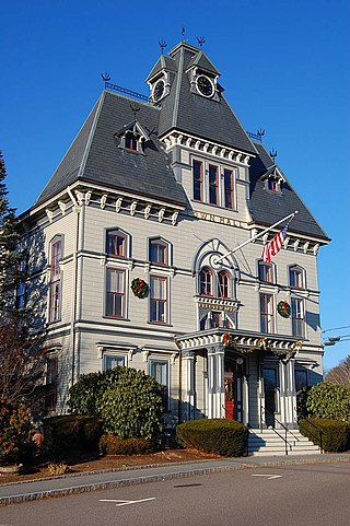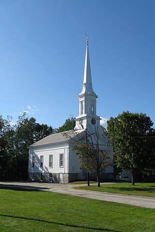
Middleton is a town in Essex County, Massachusetts, United States. The population was 9,779 at the 2020 census.

Boxford is a town in Essex County, Massachusetts, United States. According to the U.S. Census Bureau, the town's population was 8,203 in 2020.

Topsfield is a town in Essex County, Massachusetts, United States. The population was 6,569 at the 2020 census. Topsfield is located in the North Shore region of Massachusetts. Part of the town comprises the census-designated place of Topsfield.

Massachusetts's 6th congressional district is located in northeastern Massachusetts. It contains most of Essex County, including the North Shore and Cape Ann, as well as part of Middlesex County. It is represented by Seth Moulton, who has represented the district since January 2015. The shape of the district went through minor changes effective from the elections of 2012 after Massachusetts congressional redistricting to reflect the 2010 census. The towns of Tewksbury and Billerica were added, along with a small portion of the town of Andover.

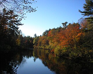
Ipswich River is a small river in northeastern Massachusetts, United States. It held significant importance in early colonial migrations inland from the ocean port of Ipswich. The river provided safe harborage at offshore Plum Island Sound to early Massachusetts subsistence farmers, who were also fishermen. A part of the river forms town boundaries and divides Essex County, Massachusetts on the coast from the more inland Middlesex County. It is 35 miles (56 km) long, and its watershed is approximately 155 square miles (401 km2), with an estimated population in the area of 160,000 people.

Route 97 is a south–north highway in Essex County in northeastern Massachusetts, United States. It connects the cities of Beverly and Haverhill before continuing into Salem, New Hampshire as New Hampshire Route 97.

The Holyoke–French House is a historical house at Elm Street and Topsfield Road in Boxford, Massachusetts. It is a 2+1⁄2-story wood-frame structure, with a side-gable gambrel roof, twin interior chimneys, clapboard siding, and a stone foundation. The center entrance is flanked by pilasters and is topped by a transom window and a gabled pediment.

Farnumsville Historic District is a historic district encompassing a historic mill village in Grafton, Massachusetts. It is located on the eastern bank of the Blackstone River, extending along Providence and Main Streets, roughly between Cross and Depot Streets, and radiating along those roads and adjacent streets. This area was one of Grafton's 19th century industrial mill villages, which was centered on the Farnum Mill, which first began operating in the second decade of the 19th century. The main mill building that survives dates to 1844, and the housing stock in the village is in a diversity of styles, built roughly between the 1820s and 1920s.

Royalston Common Historic District is a historic district encompassing the historic village center of Royalston, Massachusetts. Centered on a long town common laid out in 1752, it is one of the best surviving examples of an 18th-century town center in the state. The district was listed on the National Register of Historic Places in 1976. The common was named as one of the 1,000 places to visit in Massachusetts by the Great Places in Massachusetts Commission.

The Elm–Maple–South Streets Historic District is a historic district encompassing part of the historic downtown of Stockbridge, Massachusetts. The most prominent parts of Stockbridge lie within the Main Street Historic District, which abuts this district to the north. The southern boundary of this district is the railroad tracks that run parallel to the Housatonic River. The eastern boundary of the district is Laurel Hill, a wooded park overlooking the town, and the western boundary is a terraced shelf in the plains of the river. The district includes properties on Depot, Elm, Maple, and South Streets, and Laurel Lane. Unlike Main Street, this district consists of more densely place residences, and narrower roads containing businesses just off Main Street. Its buildings were mostly constructed during the late 19th and early 20th centuries, and partially reflect Elm Street's function as an industrial part of the town. The district was added to the National Register of Historic Places in 2004.

The Bradstreet Historic District encompasses the rural 19th-century village of Bradstreet in Hatfield, Massachusetts. It is centered at the junction of Depot Road and Main Street, and includes properties lining those two streets and Old Farm Road. Most of the buildings in the area date to the second half of the 19th century, featuring architectural styles typical of the period, including Queen Anne, Second Empire, Italianate, and Colonial Revival. The village grew on land that was originally granted to colonial governor Simon Bradstreet and divided in 1682, and has remained largely agricultural since then. The district was listed on the National Register of Historic Places in 1997.

The Russell Center Historic District is a historic district encompassing the historic village center of Russell, Massachusetts. It is centered at the junction of Main Street and Lincoln Avenue, and is bordered by the Westfield River to the east, and the rising foothills of The Berkshires to the west. The village's 19th century development was spurred by the railroad and sustained by local papermaking businesses. It was listed on the National Register of Historic Places in 1996, and was named as one of the 1,000 places to visit in Massachusetts by the Great Places in Massachusetts Commission.

The Phineas Foster House is a historic First Period house in Boxford, Massachusetts. Like many First Period houses it was built in stages. The first portion, built c. 1725, was a single cell to the right of what is now the central chimney. It was extended with a matching section on the left side of the chimney later in the First Period, and acquired a two-story kitchen ell late in the 18th century, giving the house an L shape. The front porch entry is a Federal period addition, and the central chimney has been rebuilt. The house is named for the owner of the property in 1799.

The Zaccheus Gould House is a historic First Period house in Topsfield, Massachusetts. The oldest part of the house was built c. 1670, probably for Zaccheus Gould by John Gould, one of the founders of Topsfield. The house is a 2+1⁄2-story five-bay wood-frame structure. The older portion of the house is on the right of the central chimney; the portion on the left is estimated to have been added c. 1700. The workmanship on the exposed framing elements inside the house suggests that the same workman also worked on the Stephen Foster House.

The Stanley Lake House is a historic First Period house in Topsfield, Massachusetts. It is a 2+1⁄2-story wood-frame house that was built in stages by Mathew Stanley or his heirs between c. 1675 and 1693 and subsequently enlarged by the Lake family. It illustrates a host of building practices over the 17th and 18th centuries. The first Matthew Stanley house was said by Dow to be located northwest of this building. The first portion of this building is the section from the chimney westward. An easterly room was added after and a further addition to the east by the Lakes c. 1750. Matthew Stanley's heirs having removed to the Attleborough Falls area, sold the 70 acre farm property 1710- 1718 to Eleazer Lake. The property also includes a rare First Period barn. It was listed on the National Register of Historic Places in 1990. In 2005 it was named a contributing property to the River Road-Cross Street Historic District.

The Howe Village Historic District is a historic district in Boxford, Massachusetts. It encompasses an area in and around Massachusetts Route 97, just east of Interstate 95 and south of the junction of those two roads, and includes most of the properties on Ipswich Road and a few on adjacent roads. This area was among the first to be settled in what is now Boxford, and consists of a rural cluster of houses built between about 1750 and 1850. The district was listed on the National Register of Historic Places in 1973.

The River Road–Cross Street Historic District is a rural agricultural historic district in Topsfield, Massachusetts. It is representative of Topsfield's development first as an agricultural community, and later as place for rural retreats. The district, which was listed on the National Register of Historic Places in 2005, is roughly bounded by River Road, Rowley Bridge Road, Cross Street, Hill Street, and Salem Road, and also includes properties facing Prospect Street and Bradstreet Lane. Much of the district was consolidated under the ownership of William Appleton Coolidge in the 20th century, and bequeathed to the Massachusetts Institute of Technology with restrictions to preserve its rural character. MIT sold the donated properties in 2000.

Canaan is a village and census-designated place (CDP) within the town of North Canaan in Litchfield County, Connecticut, United States. Formerly known as Canaan Depot, the village is more commonly known as Canaan Village to distinguish it from the town of Canaan located to the south of North Canaan. The Canaan Village Historic District is listed on the National Register of Historic Places. As of the 2010 census, the CDP had a population of 1,212, out of a total population of 3,315 in the town of North Canaan.

Massachusetts House of Representatives' 18th Essex district in the United States is one of 160 legislative districts included in the lower house of the Massachusetts General Court. It covers parts of Essex County and Middlesex County. Democrat Tram Nguyen of Andover has represented the district since 2019. She is running for reelection in the 2020 Massachusetts general election.


