Brethour, Ontario

Last updated
Brethour
Township of Brethour
Brethour ON.JPG
Canada Ontario location map 2.svg
Red pog.svg
Brethour
Coordinates: 47°40′N79°34′W / 47.667°N 79.567°W / 47.667; -79.567
CountryFlag of Canada (Pantone).svg  Canada
ProvinceFlag of Ontario.svg  Ontario
District Timiskaming
Government
  TypeTownship
  MayorDavid White
  Federal riding Nipissing—Timiskaming
  Prov. riding Timiskaming—Cochrane
Area
[1]
  Land82.08 km2 (31.69 sq mi)
Population
 (2016) [1]
  Total97
  Density1.2/km2 (3/sq mi)
Time zone UTC-5 (EST)
  Summer (DST) UTC-4 (EDT)
Area code(s) 705

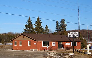
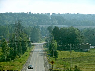
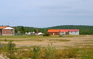
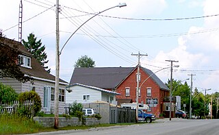
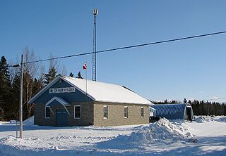
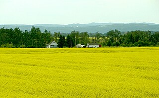
Brethour is a township in the Canadian province of Ontario, located within the Timiskaming District.

The term township generally means the district or area associated with a town. However, in some systems, no town needs to be involved. The specific use of the term to describe political subdivisions has varied by country, usually to describe a local rural or semi-rural government within the country itself.

Canada Country in North America

Canada is a country in the northern part of North America. Its ten provinces and three territories extend from the Atlantic to the Pacific and northward into the Arctic Ocean, covering 9.98 million square kilometres, making it the world's second-largest country by total area. Its southern border with the United States, stretching some 8,891 kilometres (5,525 mi), is the world's longest bi-national land border. Canada's capital is Ottawa, and its three largest metropolitan areas are Toronto, Montreal, and Vancouver.

Ontario Province of Canada

Ontario is one of the 13 provinces and territories of Canada. Located in Central Canada, it is Canada's most populous province accounting for 38.3 percent of the country's population, and is the second-largest province in total area. Ontario is fourth-largest jurisdiction in total area when the territories of the Northwest Territories and Nunavut are included. It is home to the nation's capital city, Ottawa, and the nation's most populous city, Toronto, which is also Ontario's provincial capital.

Contents

The township had a population of 97 in the Canada 2016 Census. [1]

History

Brethour Township was surveyed in 1887. It was then later officially incorporated on October 17, 1917. The township's title was derived from the name of a prominent business man from Brantford, Ontario: H.W. Brethour.

Located in the District of Temiskaming, Brethour sits on the Ontario/Quebec provincial border. The first people to settle in the area were Edmond and Philomene Robert. Other mentionable early-settler family names include Schmidt, Cooke, Armstrong, Doonan, Broderick, and Goddard; many of which have living descendants still residing within the community. Most notably, Mr. Leonard Broderick continues to own and reside at the farm in which his great-grandfather William Broderick settled in 1903. Although the Brodericks are the only family to have remained on the same original land, many other original settler families have living descendants that have taken up residence on other lots within the township.

Demographics

Brethour, Ontario
Historical populations
YearPop.±%
1991179    
1996 181+1.1%
2001 157−13.3%
2006 117−25.5%
2011 129+10.3%
2016 97−24.8%
[2] [3] [1]

Private dwellings occupied by usual residents: 36 (total dwellings: 38) [1]

Mother tongue (2006): [4]

See also

Related Research Articles

Erin, Ontario Town in Ontario, Canada

Erin is a town in Wellington County, approximately 80 kilometres (50 mi) northwest of Toronto, Ontario, Canada. Erin is bordered by the Town of Caledon, Ontario to the east, the Town of Halton Hills to the south, the Township of Guelph/Eramosa to the west and the Township of East Garafraxa to the north.

Adjala–Tosorontio Township in Ontario, Canada

Adjala–Tosorontio is a township in south-central Ontario, Canada, in the County of Simcoe.

Central Frontenac Township in Ontario, Canada

Central Frontenac is a township in eastern Ontario, Canada in the County of Frontenac.

Nobleton, Ontario Unincorporated community in Ontario, Canada

Nobleton is an unincorporated community in southwestern King, Ontario, Canada. It is the third-largest community in the township, after King City and Schomberg. Located south of the Oak Ridges Moraine, Nobleton is surrounded by hills and forests. Many horse farms are found on Nobleton's eastern periphery.

Whitestone, Ontario Municipality in Ontario, Canada

Whitestone is a township in the Canadian province of Ontario, as well as the name of a community within the township.

Armour, Ontario Township in Ontario, Canada

Armour is a township in the Canadian province of Ontario.

Strong, Ontario Township in Ontario, Canada

Strong is a township in the Canadian province of Ontario, as well as the name of a community within the township. Located in the Almaguin Highlands region of Parry Sound District, the township surrounds but does not include the village of Sundridge.

Perry, Ontario Township in Ontario, Canada

Perry is a township in the Canadian province of Ontario, located in the Almaguin Highlands region of Parry Sound District.

Ryerson, Ontario Township in Ontario, Canada

Ryerson is an incorporated township in the Almaguin Highlands region of Parry Sound District in northeastern Ontario, Canada. It had a population of 648 in the 2016 Canadian census. It was named after Egerton Ryerson, the Chief Superintendent of Education for Ontario from 1844 to 1876.

Joly, Ontario Township in Ontario, Canada

Joly is a township in the Almaguin Highlands region of Parry Sound District of the Canadian province of Ontario.

McKellar, Ontario Township in Ontario, Canada

McKellar is a township and census subdivision in Parry Sound District, Ontario, Canada. Per the 2016 Census, it has a population of 1111.

McMurrich/Monteith Township in Ontario, Canada

McMurrich/Monteith is a municipality and census subdivision in the Almaguin Highlands region of Parry Sound District, Ontario, Canada.

Gauthier, Ontario Township in Ontario, Canada

Gauthier is a township in the Canadian province of Ontario, located in the Timiskaming District east of Kirkland Lake. The township had a population of 123 in the Canada 2011 Census. Its main population centre is Dobie, located just north of Highway 66.

Frontenac Islands Township in Ontario, Canada

Frontenac Islands is a township located in Frontenac County, Ontario, Canada, that encompasses a number of islands at the beginning of the Saint Lawrence River near the outlet of Lake Ontario, including: Arabella, Bayfield, Black Ant, Garden, Goose, Hickory, Horseshoe, Howe, Wolfe and Simcoe.

Algonquin Highlands Township in Ontario, Canada

Algonquin Highlands is a township located in Haliburton County, Ontario, Canada. It has a population of 2,351. The northeastern section of the township is included in Algonquin Provincial Park.

Harris, Ontario Township in Ontario, Canada

Harris is a township in the Timiskaming District in the Canadian province of Ontario.

Harley, Ontario Township in Ontario, Canada

Harley is a township in the Canadian province of Ontario. Located within the Timiskaming District, Harley is located directly north of the city of Temiskaming Shores.

Hilliard, Ontario Township in Ontario, Canada

Hilliard is a township in the Canadian province of Ontario, located within the Timiskaming District. Its main community is Hilliardton, located along Secondary Highway 569. The smaller communities of Couttsville and Whitewood Grove are also located within the township.

Casey, Ontario Township in Ontario, Canada

Casey is a township in the Canadian province of Ontario, located within the Timiskaming District.

Gordon/Barrie Island Municipality in Ontario, Canada

The Municipality of Gordon/Barrie Island is a township in Manitoulin District in north central Ontario, Canada. It was formed on January 1, 2009, upon the amalgamation of the townships of Gordon and Barrie Island.

References

  1. 1 2 3 4 5 "Census Profile, 2016 Census: Brethour, Township". Statistics Canada. Retrieved July 19, 2019.
  2. Statistics Canada: 1996, 2001, 2006, 2011 census
  3. 2011 Census Profile
  4. "2006 Community Profile".

Coordinates: 47°40′N79°34′W / 47.667°N 79.567°W / 47.667; -79.567

Geographic coordinate system Coordinate system

A geographic coordinate system is a coordinate system that enables every location on Earth to be specified by a set of numbers, letters or symbols. The coordinates are often chosen such that one of the numbers represents a vertical position and two or three of the numbers represent a horizontal position; alternatively, a geographic position may be expressed in a combined three-dimensional Cartesian vector. A common choice of coordinates is latitude, longitude and elevation. To specify a location on a plane requires a map projection.