Kenogami Lake, Ontario

Last updated
Kenogami Lake
Kenogami Lake ON.JPG
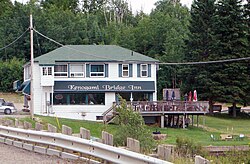
Kenogami Bridge Inn, on the shore of Kenogami Lake
Canada Ontario location map 2.svg
Red pog.svg
Kenogami Lake
Location of Kenogami Lake in Ontario
Coordinates: 48°06′15″N80°12′02″W / 48.10417°N 80.20056°W / 48.10417; -80.20056 Coordinates: 48°06′15″N80°12′02″W / 48.10417°N 80.20056°W / 48.10417; -80.20056
CountryCanada
ProvinceOntario
RegionNortheastern Ontario
District Timiskaming
Part Timiskaming, Unorganized, West
Elevation
304 m (997 ft)
Time zone UTC-5 (Eastern Time Zone)
  Summer (DST) UTC-4 (Eastern Time Zone)
Postal code FSA
P0K
Area codes 705, 249

Kenogami Lake is an unincorporated place and community in the Unorganized West Part of Timiskaming District in northeastern Ontario, Canada. [1] [2] It is located on Kenogami Lake on the Blanche River in the Saint Lawrence River drainage basin.

Contents

Transportation

The community is located on Ontario Highway 11 (at this point part of the Trans-Canada Highway), at the junction with Ontario Highway 568, that heads 2.4 kilometres (1.5 mi) east to Kenogami Lake Station, and just north of the junction with Ontario Highway 66.

The nearby Kenogami Lake Station is on the Ontario Northland Railway main line, between Goldthorpe to the north and Swastika to the east.

Related Research Articles

Sables-Spanish Rivers Township in Ontario, Canada

Sables-Spanish Rivers is a township in Ontario, Canada, on the north shore of Georgian Bay. It is located in the Sudbury District, approximately 70 kilometres (43 mi) west of Sudbury.

Kenogami River

The Kenogami River is a river in the James Bay drainage basin in Thunder Bay and Cochrane districts in Northern Ontario, Canada, which flows north from Long Lake near Longlac to empty into the Albany River. The river is 320 kilometres (199 mi) in length and its name means "long water" in the Cree language. A portion of the river's headwaters have been diverted into the Lake Superior drainage basin.

Albany River

The Albany River is a river in Northern Ontario, Canada, which flows northeast from Lake St. Joseph in Northwestern Ontario and empties into James Bay. It is 982 kilometres (610 mi) long to the head of the Cat River, tying it with the Severn River for the title of longest river in Ontario. Major tributaries include the Kenogami River and Ogoki River.

Nipissing, Ontario Township in Ontario, Canada

Nipissing is an incorporated (political) township in Parry Sound District in Central Ontario, Canada. It is on Lake Nipissing and is part of the Almaguin Highlands region. Nipissing was surveyed between 1874 and 1881, and was incorporated in 1888. Among the first settlers in the area were the Chapman and Beatty families. Nipissing Township annexed Gurd Township in 1970. The township also contains a community named Nipissing, which is located on the South River near Chapman's Landing, on the South Bay of Lake Nipissing. The township administrative offices are located in Nipissing.

Unorganized North Algoma District Unorganized area in Ontario, Canada

Unorganized North Algoma District is an unorganized area in northeastern Ontario, Canada, comprising all areas in Algoma District, north of the Sault Ste. Marie to Elliot Lake corridor, which are not part of an incorporated municipality or a First Nation. It covers 44,077.03 km2 (17,018.24 sq mi) of land, and had a population of 5739 in 2016.

King's Highway 66, commonly referred to as Highway 66, is a provincially-maintained highway in the Canadian province of Ontario. Located in the Timiskaming District, the highway begins at Matachewan near a junction with Highway 65. It extends eastward for 107.0 kilometres (66.5 mi) to the Quebec boundary just east of Kearns. At the provincial boundary, the highway continues eastward as Route 117. From Highway 11 at Kenogami Lake eastwards to the Quebec boundary, Highway 66 is designated as part of the Trans-Canada Highway.

Highway 2 is a provincial highway in the Canadian province of Saskatchewan. It is the longest highway in Saskatchewan at 809 km (503 mi). The highway is partially divided and undivided. However, only about 18 kilometres (11 mi) near Moose Jaw, 11 kilometres (7 mi) near Chamberlain, and 21 kilometres (13 mi) near Prince Albert are divided highway. Highway 2 is a major north-south route beginning at the Canada–US border at the Port of West Poplar River and Opheim, Montana customs checkpoints. Montana Highway 24 continues south. It passes through the major cities of Moose Jaw in the south and Prince Albert in the north. Highway 2 overlaps Highway 11 between the towns of Chamberlain and Findlater. This 11 kilometres (7 mi) section of road is a wrong-way concurrency. The highway ends at La Ronge, where it becomes Highway 102.

Gauthier, Ontario Township municipality in Ontario, Canada

Gauthier is a township municipality in Timiskaming District the Northeastern Ontario, Canada. The township had a population of 138 in the Canada 2016 Census. Its main population centre is Dobie, located just north of Ontario Highway 66, 18.5 kilometres (11.5 mi) east of Kirkland Lake. The township has just one other named place, Northlands Park, 3.7 kilometres (2.3 mi) west of Dobie on Ontario Highway 672 just north of Highway 66.

Constance Lake First Nation Place

Constance Lake First Nation is an Oji-Cree First Nations band government located on the shores of Constance Lake near Hearst, Cochrane District in northeastern Ontario, Canada. It is directly north of the community of Calstock along a continuation of Ontario Highway 663. Constance Lake First Nation is home to close to 1605 members of Cree and Ojibway ancestry with approximately 820 living on reserve. It may also be known as "Home of Sonny Sutherland". The reserves, Constance Lake 92 and English River 66, total 7,686 acres (3,110 ha) in size.

Departure Lake, Ontario Dispersed rural community in Ontario, Canada

Departure Lake is a dispersed rural community and unincorporated place in geographic Haggart Township, Cochrane District in Northeastern Ontario, Canada. It is located on Ontario Highway 11 between the communities of Strickland to the west and Smooth Rock Falls to the east.

Kabinakagami River

The Kabinakagami River is a river in Cochrane and Algoma Districts in northeastern Ontario, Canada. It is part of the James Bay drainage basin and is a right tributary of the Kenogami River.

Summit Lake (Kabinakagami River)

Summit Lake is a lake in the James Bay drainage basin in the Unorganized North Part of Algoma District in northeastern Ontario, Canada. It is the source of the Kabinakagami River, which flows via the Kenogami River and Albany River to James Bay. The lake is about 1.0 kilometre (0.6 mi) long and 0.2 kilometres (0.1 mi) wide, lies at an elevation of 442 metres (1,450 ft), and there are no significant inflows.

Kenogami Lake Station Unincorporated place in Ontario, Canada

Kenogami Lake Station is an unincorporated place and railway point in the Unorganized West Part of Timiskaming District in northwestern Ontario, Canada. It is located on the Blanche River in the Saint Lawrence River drainage basin.

Blanche River (Lake Timiskaming)

The Blanche River is a river in the Saint Lawrence River drainage basin in Timiskaming District in northeastern Ontario, Canada. The river is a tributary of Lake Timiskaming and its name is from the French for the colour "white".

Mammamattawa, Ontario Dispersed rural community in Ontario, Canada

Mammamattawa is a dispersed rural community and unincorporated place in the Unorganized North Part of Cochrane District in northeastern Ontario, Canada. It is located at the mouth of the Kabinakagami River at the Kenogami River, just 2 kilometres (1.2 mi) downstream of the mouth of the Nagagami River at the Kenogami, in the James Bay drainage basin.

Pagwa, Ontario Place in Ontario, Canada

Pagwa is an unincorporated place and railway point in geographic Bicknell Township in Unorganized North Cochrane District in northeastern Ontario, Canada. It is named for the Pagwachuan River.

Jobrin, Ontario Place in Ontario, Canada

Jobrin is an unincorporated place and community in the Unorganized North Part of Cochrane District in northeastern Ontario, Canada.

References

  1. "Kenogami Lake". Geographical Names Data Base . Natural Resources Canada . Retrieved 2011-08-18.
  2. Map 15 (PDF) (Map). 1 : 1,600,000. Official road map of Ontario. Ministry of Transportation of Ontario. 2010-01-01. Retrieved 2011-08-18.