New Iberia is the largest city in and parish seat of Iberia Parish in the U.S. state of Louisiana. The city of New Iberia is located approximately 21 miles southeast of Lafayette, and forms part of the Lafayette metropolitan statistical area in the region of Acadiana. The 2020 United States census tabulated a population of 28,555. New Iberia is served by a major four lane highway, being U.S. 90, and has its own general aviation airfield, Acadiana Regional Airport. Scheduled passenger and cargo airline service is available via the nearby Lafayette Regional Airport located adjacent to U.S. 90 in Lafayette.

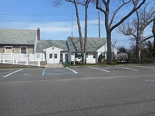
Brightwaters is an incorporated village in the southwestern part of the Town of Islip in Suffolk County, on Long Island, in New York, United States. The population was 3,103 at the time of the 2010 census.

The City of Lake Macquarie is a local government area in the Hunter Region in New South Wales, Australia. It was proclaimed a city from 7 September 1984. The city is situated adjacent to the city of Newcastle and is widely considered as a part of the Greater Newcastle area. The city is approximately 150 km (93 mi) north of Sydney. One of its major tourist attractions is its lake, also named Lake Macquarie.

Port Macquarie, locally nicknamed Port, is a coastal city the local government area of Port Macquarie-Hastings. It is located on the Mid North Coast of New South Wales, Australia, about 390 km (242 mi) north of Sydney, and 570 km (354 mi) south of Brisbane. The city is located on the Tasman Sea coast, at the mouth of the Hastings River, and at the eastern end of the Oxley Highway (B56). The city with its suburbs had a population of 47,973 in June 2018 and an estimated population of 50,307 in June 2023.

Brightwater is a town 20 kilometres (12 mi) southwest of Nelson in Tasman district in the South Island of New Zealand. It stands on the banks of the Wairoa River. Brightwater was first named Spring Grove. Alfred Saunders, the owner of a local flax mill situated on the banks of the Wairoa River and a prominent temperance activist, renamed it Brightwater because of the clarity of the water in Wairoa River. The settlement was named in 1855, but the area was settled as early as 1843.

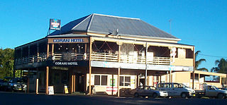
Coraki is a small town that sits on the confluence of the Richmond and Wilsons Rivers in northern New South Wales, Australia in Richmond Valley Shire. At the 2016 census, Coraki had a population of 1,277 people.
Charlestown is a suburb of the City of Lake Macquarie, New South Wales, Australia, and the largest suburb in Lake Macquarie and in the Greater Newcastle area. It is approximately 10 kilometres (6 mi) west-south-west of the central business district of Newcastle.

Belmont is a suburb in the City of Lake Macquarie New South Wales, Australia, located 20 kilometres (12 mi) from Newcastle's central business district on the eastern side of Lake Macquarie.

Cardiff is a small town in the Lake Macquarie LGA of New South Wales, Australia.

North Parramatta is a suburb of the City of Parramatta, in the state of New South Wales, Australia 24 kilometres north-west of the Sydney central business district in the local government area of the City of Parramatta.

Dora Creek is a small rural suburb of the City of Lake Macquarie in New South Wales, Australia, located west of Lake Macquarie in New South Wales and north of the town of Morisset.

Lake Cathie is a town in New South Wales, Australia about 15 minutes drive south of Port Macquarie. At the 2021 census, it had a population of 4,296.
Speers Point is a suburb of Greater Newcastle, and the location of the council seat of the City of Lake Macquarie local government area in New South Wales, Australia. It is 17 kilometres (10.6 mi) west-southwest of the city of Newcastle on the northern shore of Lake Macquarie, in Cockle and Warners Bays, between the suburbs of Cardiff and Warners Bay.

Boambee is a suburb in the city of Coffs Harbour on the Mid North Coast of New South Wales, Australia. Boambee is west of Sawtell on the Pacific Highway. It is divided into two sections: semi-rural Boambee (2450) and the more suburban Boambee East (2452). These suburbs are divided by the Pacific Highway. In 2011, Boambee had a population of 1,545 people, while Boambee East had a population of 5,446 people.
Gwandalan is a suburb of the Central Coast region of New South Wales, Australia, located on a peninsula extending northwards into Lake Macquarie. It is part of the Central Coast Council local government area.
Bonnells Bay is a suburb of the City of Lake Macquarie in New South Wales, Australia on a peninsula east of the town of Morisset on the western side of Lake Macquarie.
Argenton is a suburb of the city of Lake Macquarie, Greater Newcastle in New South Wales, Australia 16 kilometres (10 mi) west of the Newcastle's central business district in Lake Macquarie's West Ward.

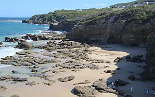
Caves Beach is a locality on the Swansea peninsula between Lake Macquarie and the Pacific Ocean in Greater Newcastle, New South Wales, Australia. It is part of the City of Lake Macquarie local government area. The locality is named for the large number of caves on the nearby coastline. It has a surfing beach which is popular with the local surfers. It is highly popular for spearfishing, with the premier target species being the elusive red morwong. The traditional custodians of the land were the Awabakal people.
Croudace Bay is a suburb of the City of Lake Macquarie in New South Wales, Australia, located 19 kilometres (12 mi) southwest of Newcastle's central business district on the eastern side of Lake Macquarie.
Belmont North is a suburb of Greater Newcastle, City of Lake Macquarie in New South Wales, Australia, located 18 kilometres (11 mi) southwest of Newcastle's central business district on the eastern side of Lake Macquarie.


