
The City of Lake Macquarie is a local government area in the Hunter Region in New South Wales, Australia. It was proclaimed a city from 7 September 1984. The city is situated adjacent to the city of Newcastle and is widely considered as a part of the Greater Newcastle area. The city is approximately 150 km (93 mi) north of Sydney. One of its major tourist attractions is its lake, also named Lake Macquarie.
Morisset is a commercial centre and suburb of the City of Lake Macquarie local government area in the Hunter region in New South Wales, Australia. Morisset is a part of the Greater Newcastle area, it is located west of the lake of Lake Macquarie just off the M1 Pacific Motorway. It is also located approximately halfway between Gosford and the Newcastle CBD. The count at the 2016 Census was 3,213 for the gazetted suburb of Morisset. The estimated urban population of the Morisset area, including Cooranbong, was 25,662 as at June 2019. The area has experienced moderate growth over the five years to 2019 with an average year-on-year rate of 1.79 percent.

Avondale University is an Australian tertiary education provider affiliated with the Seventh-day Adventist Church. It is a part of the Seventh-day Adventist education system, the world’s second largest Christian school system.
Cooranbong is a town in a suburb of the City of Lake Macquarie, Greater Newcastle in New South Wales, Australia, west of the town of Morisset off the M1 Pacific Motorway. Cooranbong is surrounded by the Watagans National Park.
Charlestown is a suburb of the City of Lake Macquarie, New South Wales, Australia, and the largest suburb in Lake Macquarie and in the Greater Newcastle area. It is approximately 10 kilometres (6 mi) west-south-west of the central business district of Newcastle.

Cardiff is a small town in the Lake Macquarie LGA of New South Wales, Australia.

Dora Creek is a small rural suburb of the City of Lake Macquarie in New South Wales, Australia, located west of Lake Macquarie in New South Wales and north of the town of Morisset.

Boolaroo is a suburb of Greater Newcastle, city of Lake Macquarie, New South Wales, Australia, located 19 kilometres (12 mi) west of Newcastle's central business district in Lake Macquarie's West Ward.
Speers Point is a suburb of Greater Newcastle, and the location of the council seat of the City of Lake Macquarie local government area in New South Wales, Australia. It is 17 kilometres (10.6 mi) west-southwest of the city of Newcastle on the northern shore of Lake Macquarie, in Cockle and Warners Bays, between the suburbs of Cardiff and Warners Bay.
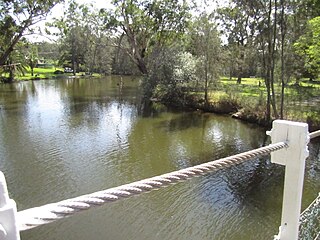
Dora River is a watercourse that is located in Greater Newcastle in the Hunter region of New South Wales, Australia.
Lake Macquarie Airport is an airfield located in the Lake Macquarie suburb of Marks Point, 15 km (9.3 mi) south of Newcastle, New South Wales, Australia. The airport is located on a narrow peninsula between the Pacific Highway and a shallow tidal inlet that forms the entrance to Lake Macquarie.
Mandalong is a small rural town in the City of Lake Macquarie in New South Wales, Australia, located near the town of Morisset and west of Lake Macquarie.
Blackalls Park is a suburb of the City of Lake Macquarie, Greater Newcastle in New South Wales, Australia to the immediate north-west of the town of Toronto on a bay west of Lake Macquarie.
Argenton is a suburb of the city of Lake Macquarie, Greater Newcastle in New South Wales, Australia 16 kilometres (10 mi) west of the Newcastle's central business district in Lake Macquarie's West Ward.
Barnsley is a township in New South Wales, Australia, 21 kilometres (13 mi) west of Newcastle's central business district. It is a suburb of the City of Lake Macquarie local government area.

Dudley is a southern coastal suburb of Newcastle, New South Wales, Australia, 13 kilometres (8 mi) southwest of Newcastle's central business district on the eastern side of Lake Macquarie. It is part of the City of Lake Macquarie local government area.
Teralba is a town and suburb of Greater Newcastle, City of Lake Macquarie in New South Wales, Australia, between the towns of Speers Point and Booragul on the northern shoreline of Lake Macquarie. The town first came into being with the construction of the Homebush to Waratah Railway in the early 1880s.
Freemans Waterhole is a small town west of Lake Macquarie in New South Wales, Australia, located along State Route 82 between Cooranbong and Mulbring. It is part of the West Ward of the City of Lake Macquarie local government area. The suburb is mostly bushland; however, it contains several farms and two petrol stations.
Ryhope is a small rural locality in the City of Lake Macquarie in New South Wales, Australia, located approximately eight kilometres west of the town of Toronto and west of Lake Macquarie.
