Brockton, Montana

Last updated
Brockton, Montana
Brockton Montana Panorama.jpg
Panorama of Brockton
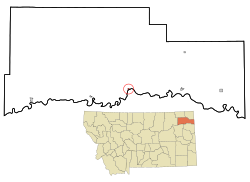
Roosevelt County Montana Incorporated and Unincorporated areas Brockton Highlighted.svg
Location of Brockton, Montana
Coordinates: 48°8′58″N104°54′59″W / 48.14944°N 104.91639°W / 48.14944; -104.91639 Coordinates: 48°8′58″N104°54′59″W / 48.14944°N 104.91639°W / 48.14944; -104.91639
Country United States
State Montana
County Roosevelt
Area
[1]
  Total1.10 sq mi (2.84 km2)
  Land0.99 sq mi (2.56 km2)
  Water0.11 sq mi (0.28 km2)
Elevation
1,985 ft (605 m)
Population
 (2020)
  Total358
  Density361.62/sq mi (139.64/km2)
Time zone UTC-7 (Mountain (MST))
  Summer (DST) UTC-6 (MDT)
ZIP code
59213
Area code 406
FIPS code 30-10000
GNIS feature ID0769244

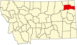
Brockton is a town in Roosevelt County, Montana, United States. The population was 358 at the 2020 census. [2]

Contents

Brockton's first post office was established in 1904. [3] Fort Peck Indian Reservation was opened to non-Native settlers in 1913 and the town boomed. [4] It was incorporated in 1952. [4]

Geography

Brockton is located at 48°8′58″N104°54′59″W / 48.14944°N 104.91639°W / 48.14944; -104.91639 (48.149531, -104.916383). [5]

According to the United States Census Bureau, the town has a total area of 0.23 square miles (0.60 km2), all land. [6]

Demographics

Historical population
CensusPop.Note
1960 367
1970 4019.3%
1980 374−6.7%
1990 365−2.4%
2000 245−32.9%
2010 2554.1%
2020 35840.4%
U.S. Decennial Census [2]

2010 census

As of the census [7] of 2010, there were 255 people, 70 households, and 61 families residing in the town. The population density was 1,108.7 inhabitants per square mile (428.1/km2). There were 77 housing units at an average density of 334.8 per square mile (129.3/km2). The racial makeup of the town was 3.9% White and 96.1% Native American. Hispanic or Latino of any race were 1.2% of the population.

There were 70 households, of which 65.7% had children under the age of 18 living with them, 28.6% were married couples living together, 42.9% had a female householder with no husband present, 15.7% had a male householder with no wife present, and 12.9% were non-families. 11.4% of all households were made up of individuals, and 2.9% had someone living alone who was 65 years of age or older. The average household size was 3.64 and the average family size was 3.84.

The median age in the town was 22.4 years. 39.2% of residents were under the age of 18; 15.7% were between the ages of 18 and 24; 18.4% were from 25 to 44; 20.4% were from 45 to 64; and 6.3% were 65 years of age or older. The gender makeup of the town was 49.0% male and 51.0% female.

2000 census

As of the census [8] of 2000, there were 245 people, 67 households, and 59 families residing in the town. The population density was 1,285.7 inhabitants per square mile (496.4/km2). There were 72 housing units at an average density of 377.8 per square mile (145.9/km2). The racial makeup of the town was 13.06% White, 84.90% Native American, 0.41% Pacific Islander, and 1.63% from two or more races. Hispanic or Latino of any race were 1.22% of the population.

There were 67 households, out of which 47.8% had children under the age of 18 living with them, 37.3% were married couples living together, 37.3% had a female householder with no husband present, and 11.9% were non-families. 9.0% of all households were made up of individuals, and 1.5% had someone living alone who was 65 years of age or older. The average household size was 3.66 and the average family size was 3.85.

In the town, the population was spread out, with 42.0% under the age of 18, 7.8% from 18 to 24, 25.3% from 25 to 44, 19.2% from 45 to 64, and 5.7% who were 65 years of age or older. The median age was 25 years. For every 100 females, there were 91.4 males. For every 100 females age 18 and over, there were 94.5 males.

The median income for a household in the town was $19,167, and the median income for a family was $19,167. Males had a median income of $30,625 versus $25,625 for females. The per capita income for the town was $8,231. About 43.5% of families and 50.8% of the population were below the poverty line, including 53.3% of those under the age of eighteen and 85.7% of those 65 or over.

Education

Brockton School District educates students from kindergarten through 12th grade. [9] The team name for Brockton High School is the Warriors. [10]

Related Research Articles

<span class="mw-page-title-main">New Brockton, Alabama</span> Town in Alabama, United States

New Brockton is a town in Coffee County, Alabama, United States. At the 2020 census, the population was 1,428. The community was named for Huey E. Brock, a settler who came to the region in 1871.

<span class="mw-page-title-main">Taft Mosswood, California</span> Census-designated place in California, United States

Taft Mosswood is a census-designated place (CDP) in San Joaquin County, California, United States. The population was 1,530 at the 2010 census, up from 1,388 at the 2000 census. It comprises an unincorporated "island" within the City of Stockton.

<span class="mw-page-title-main">Ekalaka, Montana</span> Town in Montana, United States

Ekalaka is a town in and the county seat of Carter County, Montana, United States. The population was 399 at the 2020 census.

<span class="mw-page-title-main">Belt, Montana</span> Town in Montana, United States

Belt is a town in Cascade County, Montana, United States. The population was 510 according to the 2020 census. It is part of the Great Falls, Montana metropolitan area.

<span class="mw-page-title-main">Ismay, Montana</span> Town in Montana, United States

Ismay is a town in Custer County, Montana, United States. The population was 17 at the 2020 census. The town is the least-populous incorporated municipality in the state of Montana.

<span class="mw-page-title-main">Victor, Montana</span> Census-designated place in Montana, United States

Victor is a census-designated place (CDP) in Ravalli County, Montana, United States. The population was 745 at the 2010 census.

<span class="mw-page-title-main">Fairview, Montana</span> Town in Montana, United States

Fairview is a town in Richland County, Montana, United States. The population was 896 at the 2020 census. The town is directly on the North Dakota border. Fairview incorporated in 1913.

<span class="mw-page-title-main">Bainville, Montana</span> Town in Montana, United States

Bainville is a town in Roosevelt County, Montana, United States. The population was 271 at the 2020 census. It is named for Charles M. Bain, an early resident and the town's first postmaster. Bainville celebrated its centennial on July 4, 2006.

<span class="mw-page-title-main">Froid, Montana</span> Town in Montana, United States

Froid is a town in Roosevelt County, Montana, United States. The population was 195 at the 2020 census. Froid was named for the French word for "cold".

<span class="mw-page-title-main">Medicine Lake, Montana</span> Town in Montana, United States

Medicine Lake is a town in Sheridan County, Montana, United States. The population was 244 at the 2020 census.

<span class="mw-page-title-main">Outlook, Montana</span> Town in Montana, United States

Outlook is a small rural village in Sheridan County, Montana, United States. The population was 84 at the 2020 census. The village includes a post office which services Outlook and the hamlet of Raymond, as well as the surrounding countryside.

<span class="mw-page-title-main">Westby, Montana</span> Town in Montana, United States

Westby is a town in Sheridan County, Montana, United States. The population was 167 at the 2020 census.

<span class="mw-page-title-main">Plevna, Montana</span> Town in Montana, United States

Plevna is a town in Fallon County, Montana, United States. The population was 179 at the 2020 census.

<span class="mw-page-title-main">Snow Shoe Township, Centre County, Pennsylvania</span> Township in Pennsylvania, United States

Snow Shoe Township is a township in Centre County, Pennsylvania, United States. It is part of the State College, Pennsylvania Metropolitan Statistical Area. The population was 1,638 at the 2020 census.

<span class="mw-page-title-main">Union Township, Centre County, Pennsylvania</span> Township in Pennsylvania, United States

Union Township is a township in Centre County, Pennsylvania, United States. It is part of the State College, Pennsylvania Metropolitan Statistical Area. The population was 1,380 at the 2020 census, a decline the figure of 1,383 tabulated in 2010.

<span class="mw-page-title-main">Barree Township, Huntingdon County, Pennsylvania</span> Township in Pennsylvania, United States

Barree Township is a township in Huntingdon County, Pennsylvania, United States. The population was 436 at the 2020 census.

<span class="mw-page-title-main">Summit Township, Potter County, Pennsylvania</span> Township in Pennsylvania, United States

Summit Township is a township in Potter County, Pennsylvania, United States. The population was 134 at the 2020 census. Two of the smallest Pennsylvania state parks, Prouty Place State Park and Patterson State Park are in Summit Township.

<span class="mw-page-title-main">Heidelberg Township, York County, Pennsylvania</span> Township in Pennsylvania, United States

Heidelberg Township is a township in York County, Pennsylvania, United States. The township was erected in 1750 and encompassed the land grant known as "Digges' Choice". The township consisted of 9,030 acres and extended as far west as the borough (town) of McSherrystown. The township included the borough (town) of Hanover until Hanover was made a borough in 1815. When Adams County was formed from western York County in 1800, the portion of Heidelberg Township that was included in York County was subsequently renamed Conewago Township. In 1860, the western half of Heidelberg Township was split off to form Penn Township. Although residents of this township have a Hanover address, the children attend Spring Grove School District.

<span class="mw-page-title-main">Jackson Township, York County, Pennsylvania</span> Township in Pennsylvania, United States

Jackson Township is a township in York County, Pennsylvania, United States. The population was 8,737 at the 2020 census. It was founded in 1853 from parts of Paradise Township. Jackson Township education is served by the Spring Grove Area School District. Police Coverage is provided by Northern York County Regional Police Department, and EMS is provided by Spring Grove Area Ambulance. The township is home to York Airport.

<span class="mw-page-title-main">Williams Creek, Indiana</span> Town in Indiana, United States

Williams Creek is a town in Washington Township, Marion County, Indiana, United States. It is located about 9 miles (14 km) north of downtown Indianapolis. The population was 430 at the 2020 census. It has existed as an "included town" since 1970, when it was incorporated into Indianapolis as part of Unigov. It is part of Indianapolis, but retains a functioning town government under IC 36-3-1-11.

References

  1. "ArcGIS REST Services Directory". United States Census Bureau. Retrieved September 5, 2022.
  2. 1 2 "U.S. Census website". United States Census Bureau . Retrieved November 2, 2021.
  3. Carkeek Cheney, Roberta (1983). Names on the Face of Montana. Missoula, Montana: Mountain Press Publishing Company. ISBN   0-87842-150-5.
  4. 1 2 "Montana Place Names Companion". Montana Historical Society. Retrieved 29 July 2017.
  5. "US Gazetteer files: 2010, 2000, and 1990". United States Census Bureau. 2011-02-12. Retrieved 2011-04-23.
  6. "US Gazetteer files 2010". United States Census Bureau. Archived from the original on 2012-01-25. Retrieved 2012-12-18.
  7. "U.S. Census website". United States Census Bureau . Retrieved 2012-12-18.
  8. "U.S. Census website". United States Census Bureau . Retrieved 2008-01-31.
  9. "Brockton School District". Brockton School District. Retrieved 19 April 2021.
  10. "Member Schools". Montana High School Association. Retrieved 19 April 2021.