Brookview, Maryland

Last updated

Brookview, Maryland
Dorchester County Maryland Incorporated and Unincorporated areas Brookview Highlighted.svg
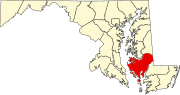
Location of Brookview, Maryland
Coordinates: 38°34′31″N75°47′42″W / 38.57528°N 75.79500°W / 38.57528; -75.79500
Country Flag of the United States.svg United States
State Flag of Maryland.svg  Maryland
County Flag of Dochester County, Maryland.png Dorchester
Incorporated1953 [1]
Government
  TypeTown council [1]
  MayorClint Falduto [2]
Area
[3]
  Total0.04 sq mi (0.11 km2)
  Land0.04 sq mi (0.11 km2)
  Water0.00 sq mi (0.00 km2)
Elevation
20 ft (6 m)
Population
 (2020)
  Total48
  Density1,116.28/sq mi (427.74/km2)
Time zone UTC-5 (Eastern (EST))
  Summer (DST) UTC-4 (EDT)
ZIP code
21659
Area code(s) 410, 443, and 667
FIPS code 24-10575
GNIS feature ID0589830
Website Town charter

Brookview is a town in Dorchester County, Maryland, United States. The population was 48 at the 2020 census. Brookview was incorporated in 1953. [1] Brookview is governed by a three-person town council. [1] Each member of the town council is elected by voters to a three-year term in office. [1] The now deceased Richard E. Sullivan had previously served as mayor of the town since 1996 and was recognized at the 2017 Annual Maryland Municipal League Summer Conference as a long-serving mayor of over 25 years. The 2018 council consisted of Mayor J.D. Hurley, Commissioner Clint Falduto, Commissioner Shelly Hurley. The present 2021 council consists of Mayor Clint Falduto, Commissioner Mary Falduto, Commissioner Shelly Hurley. [2]

Contents

Geography

Brookview is located at 38°34′31″N75°47′42″W / 38.57528°N 75.79500°W / 38.57528; -75.79500 (38.575406, -75.795132). [4]

According to the United States Census Bureau, the town has a total area of 0.04 square miles (0.10 km2), all land. [5]

Demographics

Historical population
CensusPop.Note
1960 83
1970 9514.5%
1980 78−17.9%
1990 64−17.9%
2000 651.6%
2010 60−7.7%
2020 48−20.0%
U.S. Decennial Census [6]

2010 census

As of the census [7] of 2010, there were 60 people, 23 households, and 15 families residing in the town. The population density was 1,500.0 inhabitants per square mile (579.2/km2). There were 31 housing units at an average density of 775.0 per square mile (299.2/km2). The racial makeup of the town was 93.3% White and 6.7% African American. Hispanic or Latino of any race were 11.7% of the population.

There were 23 households, of which 21.7% had children under the age of 18 living with them, 30.4% were married couples living together, 13.0% had a female householder with no husband present, 21.7% had a male householder with no wife present, and 34.8% were non-families. 26.1% of all households were made up of individuals, and 17.4% had someone living alone who was 65 years of age or older. The average household size was 2.61 and the average family size was 3.27.

The median age in the town was 42 years. 16.7% of residents were under the age of 18; 11.6% were between the ages of 18 and 24; 23.3% were from 25 to 44; 23.3% were from 45 to 64; and 25% were 65 years of age or older. The gender makeup of the town was 58.3% male and 41.7% female.

2000 census

As of the census [8] of 2000, there were 65 people, 26 households, and 17 families residing in the town. The population density was 1,597.4 inhabitants per square mile (616.8/km2). There were 27 housing units at an average density of 663.5 per square mile (256.2/km2). The racial makeup of the town was 100.00% White.

There were 26 households, out of which 23.1% had children under the age of 18 living with them, 57.7% were married couples living together, 3.8% had a female householder with no husband present, and 34.6% were non-families. 34.6% of all households were made up of individuals, and 19.2% had someone living alone who was 65 years of age or older. The average household size was 2.50 and the average family size was 3.24.

In the town, the population was spread out, with 23.1% under the age of 18, 6.2% from 18 to 24, 26.2% from 25 to 44, 23.1% from 45 to 64, and 21.5% who were 65 years of age or older. The median age was 41 years. For every 100 females, there were 71.1 males. For every 100 females age 18 and over, there were 72.4 males.

The median income for a household in the town was $51,719, and the median income for a family was $51,250. Males had a median income of $28,125 versus $31,875 for females. The per capita income for the town was $14,288. There were 8.3% of families and 14.0% of the population living below the poverty line, including 12.1% of under eighteens and none of those over 64.

Related Research Articles

<span class="mw-page-title-main">Millport, Alabama</span> Town in Alabama, United States

Millport is a town in Lamar County, Alabama, United States. It incorporated in 1887. At the 2010 census the population was 1,049, down from 1,160 in 2000. After its incorporation from 1890 to 1900, it was the largest town in Lamar County, losing the distinction to Sulligent. Since 1940, it has been the 3rd largest town.

<span class="mw-page-title-main">Fayetteville, Illinois</span> Village in Illinois, United States

Fayetteville is a village on the Kaskaskia River in St. Clair County, Illinois, United States. The population was 384 at the 2000 census.

<span class="mw-page-title-main">New Canada, Maine</span> Town in the state of Maine, United States

New Canada is a town in Aroostook County, Maine, United States. The population was 310 at the 2020 census.

<span class="mw-page-title-main">Midland, Maryland</span> Town in Maryland, United States

Midland is a town in Allegany County, Maryland, United States, along the Georges Creek Valley. It is part of the Cumberland, MD-WV Metropolitan Statistical Area. The population was 446 at the 2010 census. Midland was founded in 1850 as a coal-mining community, though today only some strip mining remains.

<span class="mw-page-title-main">Highland Beach, Maryland</span> Town in Maryland, United States

Highland Beach is a town in Anne Arundel County, Maryland, United States. Per the 2020 census, the population was 118. The town was founded late in the 19th century by affluent African Americans from Washington, D.C., and Baltimore, looking for a summer retreat on the Chesapeake Bay. The town's incorporated status gave it a unique standing in empowering it to maintain its own police force. Celebrities with homes there have included historian and author Alex Haley, actor and comedian Bill Cosby, and tennis champion Arthur Ashe. Street names in the town include Crummell, Dunbar, Henson, Augusta, Douglass, Langston, and Washington, which were chosen to honor leading African Americans.

<span class="mw-page-title-main">Goldsboro, Maryland</span> Town in Maryland

Goldsboro is a town in Caroline County, Maryland, United States. William James Yeager is the current mayor. The population was 246 at the 2010 United States Census. The zip code is 21636. First known as Oldtown, it was renamed in 1870 for the prominent Goldsborough family who owned land in the area. Castle Hall was listed on the National Register of Historic Places in 1975.

<span class="mw-page-title-main">Rising Sun, Maryland</span> Town in Maryland, United States

Rising Sun is a town in Cecil County, Maryland, United States. The population was 2,781 at the 2010 census.

<span class="mw-page-title-main">Galestown, Maryland</span> Town in Maryland, United States

Galestown is a town in Dorchester County, Maryland, United States. The population was 138 at the 2010 census.

<span class="mw-page-title-main">Woodsboro, Maryland</span> Town in Maryland

Woodsboro is a town in Frederick County, Maryland, United States that was granted to Joseph Wood in 1693. The population was 1,092 at the 2020 census.

<span class="mw-page-title-main">Barnesville, Maryland</span> Town in Maryland, United States

Barnesville is a town in Montgomery County, Maryland, United States. It was incorporated in 1888. The population was 144 at the 2020 census.

<span class="mw-page-title-main">Hancock, Maryland</span> Town in Maryland, United States

Hancock is a town in Washington County, Maryland, United States. The population was 1,557 at the 2020 census. The Western Maryland community is notable for being located at the narrowest part of the state. The north–south distance from the Pennsylvania state line to the West Virginia state line is only 1.8 miles (2.9 km) at Hancock.

<span class="mw-page-title-main">Mardela Springs, Maryland</span> Town in Maryland, United States

Mardela Springs is a town in Wicomico County, Maryland, United States. The population was 357 at the 2010 census. It is included in the Salisbury, Maryland-Delaware Metropolitan Statistical Area.

<span class="mw-page-title-main">Hurley, New Mexico</span> Town in New Mexico, United States

Hurley is a town in Grant County, New Mexico, United States. The population was 1,297 at the 2010 census, down from 1,464 in 2000.

<span class="mw-page-title-main">Huntsville, Ohio</span> Village in Ohio, United States

Huntsville is a village in Logan County, Ohio, United States. The population was 408 at the 2020 census.

<span class="mw-page-title-main">Hurley, South Dakota</span> City in South Dakota, United States

Hurley is a city in Turner County, South Dakota, United States. The population was 379 at the 2020 census.

<span class="mw-page-title-main">Alto, Wisconsin</span> Town in Wisconsin, United States

Alto is a town in Fond du Lac County, Wisconsin, United States. The population was 1,055 at the 2020 census. The unincorporated community of Alto is located in the town.

<span class="mw-page-title-main">Beetown, Wisconsin</span> Town in Wisconsin, United States

The Town of Beetown is located in Grant County, Wisconsin, United States. The population was 734 at the 2000 census. The unincorporated communities of Beetown, Diamond Grove, Five Points, Flora Fountain, Hurricane, and North Andover are located in the town. The former community of Pleasant Ridge was also located in the town.

<span class="mw-page-title-main">Eleva, Wisconsin</span> Village in Wisconsin, United States

Eleva is a village within the Town of Albion in Trempealeau County, Wisconsin, along the Buffalo River. The population was 670 at the 2010 Census and reached 685 in the 2020 Census.

<span class="mw-page-title-main">Tennessee Ridge, Tennessee</span> Town in Tennessee, United States

Tennessee Ridge is a town in Houston county in the U.S. state of Tennessee. The population was 1,332 at the 2020 census and 1,368 at the 2010 census.

Andover is a village located in the town of Andover in Allegany County, New York, United States. The population was 1,042 at the 2010 census. The name is derived from Andover, Vermont.

References

  1. 1 2 3 4 5 "Brookview". Maryland Manual On-line. Maryland State Archives. Retrieved December 23, 2016.
  2. 1 2 "Mayors of Brookview". Maryland Manual On-line. Maryland State Archives. Retrieved 2019.
  3. "2020 U.S. Gazetteer Files". United States Census Bureau. Retrieved April 26, 2022.
  4. "US Gazetteer files: 2010, 2000, and 1990". United States Census Bureau. February 12, 2011. Retrieved April 23, 2011.
  5. "US Gazetteer files 2010". United States Census Bureau. Archived from the original on July 2, 2012. Retrieved January 25, 2013.
  6. "Census of Population and Housing". Census.gov. Retrieved June 4, 2015.
  7. "U.S. Census website". United States Census Bureau . Retrieved January 25, 2013.
  8. "U.S. Census website". United States Census Bureau . Retrieved January 31, 2008.