Nottinghamshire is a landlocked county in the East Midlands region of England, bordering South Yorkshire to the north-west, Lincolnshire to the east, Leicestershire to the south, and Derbyshire to the west. The traditional county town is Nottingham, though the county council is based at County Hall in West Bridgford in the borough of Rushcliffe, at a site facing Nottingham over the River Trent.

Eastwood is a former coal mining town in the Broxtowe district of Nottinghamshire, England, 8 miles (13 km) northwest of Nottingham and 10 miles (16 km) northeast of Derby on the border between Nottinghamshire and Derbyshire. Mentioned in Domesday Book, it expanded rapidly during the Industrial Revolution. The Midland Railway was formed here and it is the birthplace of D. H. Lawrence. The distinctive dialect of East Midlands English is extensively spoken, in which the name of the town is pronounced.

Broxtowe is a local government district with borough status in Nottinghamshire, England, west of the City of Nottingham. The population of the district as taken at the 2011 Census was 109,487. It is part of the Nottingham Urban Area. Broxtowe's neighbour to the west is the borough of Erewash, which is in Derbyshire.

Sutton-in-Ashfield is a market town in Nottinghamshire, England, with a population of 48,527 in 2019. It is the largest town in the district of Ashfield, four miles west of Mansfield, two miles from the Derbyshire border and 12 miles north of Nottingham.

The Robin Hood Line is a railway line running from Nottingham to Worksop, Nottinghamshire, in the United Kingdom. The stations between Shirebrook and Whitwell (inclusive) are in Derbyshire.

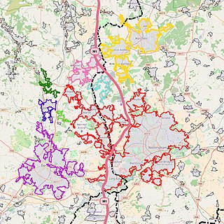
The Nottingham Built-up Area (BUA), Nottingham Urban Area, or Greater Nottingham is an area of land defined by the Office for National Statistics as which is built upon, with nearby areas linked if within 200 metres - see the List of urban areas in the United Kingdom article for a broader definition. It consists of the city of Nottingham and the adjoining urban areas of Nottinghamshire and Derbyshire, in the East Midlands of England. It had a total population of 729,977 at the time of the 2011 census. This was an increase of almost 10% since the 2001 census recorded population of 666,358, due to population increases, reductions and several new sub-divisions.

Broxtowe is a parliamentary constituency in Nottinghamshire, England, represented in the House of Commons of the UK Parliament since 2019 by Darren Henry, a Conservative.

Nottinghamshire Police is the territorial police force responsible for policing the shire county of Nottinghamshire and the unitary authority of Nottingham in the East Midlands of England. The area has a population of just over 1 million.

Brinsley is a village and civil parish in Nottinghamshire, England. The church of St James was built in 1837–38 from Mansfield stone, the chancel being added in 1877. The village is split into two sections, Old Brinsley which is within Broxtowe and New Brinsley which is in Ashfield. At the 2011 Census the population of the parish was 2,327.

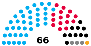
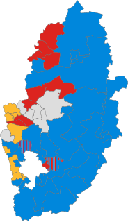
Nottinghamshire County Council is the upper-tier local authority for the non-metropolitan county of Nottinghamshire in England. It consists of 66 county councillors, elected from 56 electoral divisions every four years. The most recent election was held in 2021.

Prior to its uniform adoption of proportional representation in 1999, the United Kingdom used first-past-the-post for the European elections in England, Scotland and Wales. The European Parliament constituencies used under that system were smaller than the later regional constituencies and only had one Member of the European Parliament each, of which the constituency of Nottingham was one.

Elections to Nottinghamshire County Council took place on 4 June 2009, having been delayed from 7 May, in order to coincide with elections to the European Parliament.

Mansfield is a market town and the administrative centre of Mansfield District in Nottinghamshire, England. It is the largest town in the wider Mansfield Urban Area. It gained the Royal Charter of a market town in 1227. The town lies in the Maun Valley, 12 miles (19 km) north of Nottingham and near Sutton-in-Ashfield. Most of the 106,556 population live in the town itself, with Warsop as a secondary centre. Mansfield is the one local authority in Nottinghamshire with a publicly elected mayor.

The Nottingham and Derby Green Belt is a green belt environmental and planning policy for the cities of Derby and Nottingham in the East Midlands region of England. It includes designated parts of several districts in the surrounding counties of Derbyshire and Nottinghamshire. Management is mainly performed by the local planning authority on guidance from central government.
Broxtowe refers to a number of geographic entities, current and historic, in Nottinghamshire, England:

The Ashfield Independents are a political party in the Ashfield District in Nottinghamshire, England.


