
West Bridgford is a town and the administrative centre of the Borough of Rushcliffe, part of the city of Nottingham, in the county of Nottinghamshire, England. It lies south of Nottingham city centre, east of Wilford,north of Ruddington and west of Radcliffe-on-Trent. It is southwest of Colwick and southeast of Beeston which are on the opposite bank of the River Trent. The town is part of the Nottingham Urban Area and had a population of 36,487 in a 2021-census.
Chilwell is a suburban area and former civil parish in the borough of Broxtowe in Nottinghamshire, England. It lies on the west side of the town of Beeston and is 4 miles (6.4 km) south-west of the centre of Nottingham.

Radford is an inner-city area of Nottingham and former civil parish in the Nottingham district, in the ceremonial county of Nottinghamshire, England, located just outside the city centre. The appropriate ward of the City of Nottingham Council is Radford and Park which, in 2011, had a population of 21,414. It is bounded to the south by Lenton and to the east by Nottingham city centre, and comprises around 600 acres (240 ha) of land.
Dunkirk is a residential area of Nottingham, England which is located to the south-east of the University of Nottingham and the Queen's Medical Centre. It is in the electoral ward of 'Dunkirk and Lenton', part of the Nottingham South constituency, with a population of 10,920 in the 2011 census.

Wollaton is a suburb and former civil parish in the western part of Nottingham, in the Nottingham district, in the ceremonial county of Nottinghamshire, England. Wollaton has two wards in the City of Nottingham, with a total population of 24,693 at the 2011 census. It is home to Wollaton Hall, with its museum, deer park, lake, walks and golf course.
Bramcote is a suburban village and former civil parish in the Broxtowe district of Nottinghamshire, England, between Stapleford and Beeston. It is in Broxtowe parliamentary constituency. The main Nottingham–Derby road today is the A52, Brian Clough Way. Nearby are Beeston, Wollaton, Chilwell and Stapleford. One of the main roads between Nottingham and Derby used to pass through the village centre, entering a cutting that formed a blind bend. A country house to the north of the village became publicly owned and was demolished in 1968. Its grounds became a public area of park and hillside, now known as Bramcote Hills Park.
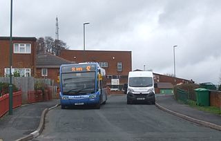
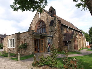
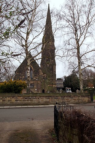
St Ann's is a large district of the city of Nottingham, in the English ceremonial county of Nottinghamshire. The population of the district at the time of the United Kingdom census, 2011 was 19,316.

Bulwell is a market town and former civil parish in the Nottingham district, in the ceremonial county of Nottinghamshire, England. It is 3 miles (5 km) south-west of Hucknall and 4.5 miles (7 km) to the north-west of Nottingham. The United Kingdom Census 2011 recorded the population of Bulwell at 29,771 which amounted to over 10 per cent of Nottingham city's population. The 2011 census gave a population of 16,157 for the Bulwell ward of Nottingham City Council. There is an adjacent ward, Bulwell Forest, which includes Highbury Vale, Rise Park and the west of Top Valley, its population at the same census being 13,614.

Strelley is a village and former civil parish in the Borough of Broxtowe and City of Nottingham in Nottinghamshire, England. It is to the west of Nottingham. The population of the civil parish taken at the 2011 census was 653, and 496 at the 2021 census. It is also the name of the nearby post war council housing estate. The village lies mainly in the Broxtowe district with a small portion crossing over into the city administrative area, whilst the estate is fully contained in the city of Nottingham. The village is separated from the housing estate by the A6002 road.

Aspley is a council estate and a ward of the city of Nottingham, Nottinghamshire, England. It is located within the boundaries of Nottingham City Council. The ward is located 3 miles (4.8 km) west of Nottingham City Centre and is located only 1.6 miles west of Junction 26 of the M1. It lies south of Bulwell, west of Basford and is north of Bilborough. The principal road in the ward is the A610. At the 2001 Census the ward had a population of 15,689, increasing to 17,622 at the 2011 census.

Nottingham City Transport (NCT) is the major bus operator of the city of Nottingham, England. NCT operates extensively within Nottingham as well beyond the city boundaries into Nottinghamshire county. Publicly-owned, it is today the second largest municipal bus company in the United Kingdom after Lothian Buses in Edinburgh, Scotland.

Bluecoat Aspley Academy is a Church of England secondary school and sixth form located in the Aspley area of Nottingham, England, dating back to 1706. In 2007, the school had 1550 students aged six to eighteen, including 250 Sixth form students. Prior to receiving Academy status in January 2012, the school was titled The Nottingham Bluecoat School and Technology College.

Lenton Abbey is a large housing estate, forming a neighbourhood in Nottingham, close to Wollaton, Beeston and the University of Nottingham.

Strelley Estate is a post war housing estate located in the Bilborough ward in the City of Nottingham. The estate is located around 3.5 miles (6 km) from the city centre and lies west of the Broxtowe Estate, south of Nuthall, east of the Strelley Village and north of Bilborough. At the 2001 census, the estate had a population of 2,561.

Bestwood Estate is a large council estate located to the north of the city of Nottingham, England. Based on the 2011 census, its population is 4,719. There is also a ward of the City of Nottingham called Bestwood, which at the time of the 2011 census had a population of 16,753.

Broxtowe is a council estate in the City of Nottingham which is part of the Aspley ward. The estate is located 3 miles (5 km) from the City Centre and lies west of Aspley and Cinderhill, south of Bulwell, east of Strelley and north of Bilborough. At the 2001 census, the estate had a population of 4,847.

Highbury Vale is an area located in the city of Nottingham, and is located in the Bulwell Forest ward. The area is located roughly 5.4 miles (8.7 km) from the City Centre, and about 1 mile (2 km) from Bulwell. Surrounding areas include Bulwell towards the North, Bestwood to the east, Hempshill Vale to the west and Cinderhill and Basford towards the south. Highbury Vale and Hempshill Vale are classed as a part of Bulwell. At the 2001 census, the area had a population of 4,530.

Beechdale is suburban area in the City of Nottingham. The area is located roughly 2.2 miles (3.5 km) from the City Centre and surrounding areas include Bilborough to the west, Aspley to the north, Radford to the east and Wollaton to the south. At the 2001 Census, the area had a population of 5,537.

Cinderhill is an area in the City of Nottingham. It is located roughly 3.1 miles (5.0 km) from the City Centre, and surrounding areas include Bulwell to the north, Aspley and Broxtowe to the south, Basford to the east and Nuthall to the west.


