Forest Fields

Last updated

Forest Fields
Myrtle Avenue, Forest Fields - geograph.org.uk - 1408869.jpg
Myrtle Avenue in October 2006
Nottinghamshire UK location map.svg
Red pog.svg
Forest Fields
Location within Nottinghamshire
Population6,577  [1]
OS grid reference SK5620541655
District
Shire county
Region
Country England
Sovereign state United Kingdom
Post town NOTTINGHAM
Postcode district NG7
Dialling code 0115
Police Nottinghamshire
Fire Nottinghamshire
Ambulance East Midlands
UK Parliament
List of places
UK
England
Nottinghamshire
52°58′08″N1°09′47″W / 52.969°N 1.163°W / 52.969; -1.163

Forest Fields is an inner-city area of the City of Nottingham, in the county of Nottinghamshire, England.

Contents

Geography

Forest Fields is slightly north of the city centre, just past the Forest Recreation Ground. The area includes 31 streets from Noel Street (Asda) to Nottingham Road (NCN Claredon, Sherwood Rise practitioners, Djanogly Sixth Form) and from Gregory Boulevard to Gladstone Street (Basford factories). The areas that surround Forest Fields are New Basford, Sherwood Rise, Hyson Green, and Radford.

Local attractions

Berridge Road in Forest Fields is one of the main streets in Nottinghamshire for Asian shopping. The main shops on Berridge Road include the Seehra Saree Centre, Eastern Fashions, Adnans Sweet Centre, a grocery store, and the vegan/vegetarian bakery the Screaming Carrot. Previous well-known shops included Kashif Videos, the Gift Shop, Georges Fish bar, and Mizan Bookstore

The area is also home to the Djanogly City Academy, on the site of the former Forest Comprehensive School. Nearby is NCN Clarendon, run by New College Nottingham. There are also several primary schools, including Scotholme Primary and Forest Fields Primary School. It used to be Forest Fields Grammar School, and before 1954 it was High Pavement Grammar School.

Along Noel Street is a charitable organisation called Asian Women's Project. On Gladstone Street is the Sumac Centre, a co-operatively owned, non-hierarchical social centre.

Community groups

There are a number of community groups in Forest Fields, including a residents' group, Forest Fields Improvement Association, [2] NG7 Food bank, [3] and, since 2012, the Nottingham Solidarity Network. [4] Past groups include a transition initiative called Transition Forest Fields. [5]

The Sumac Centre is home to a number of groups, [6] including the Forest Fields Social Club and Veggies Catering Campaign. [7] The centre also has a weekly people's kitchen, a bike repair shop, a free shop, a library, and a book shop, [8] as well as being the base for the Sumac Youth Club, [9] a group formed by the Robin Hood Solidarity Group [10] to work with 7- to 15-year-olds in the local area.

Demographics

Forest Fields is an ethnically diverse community, with significant black and South Asian communities.

History

Nearby churches include St Stephen With St Paul's Church. [11]

A number of early releases by Tindersticks were recorded in Forest Fields.

Although mainly set in the Radford part of the city, many of Alan Sillitoe's books mention streets in Forest Fields.

Related Research Articles

<span class="mw-page-title-main">Nottingham</span> City and council area in Nottinghamshire, England

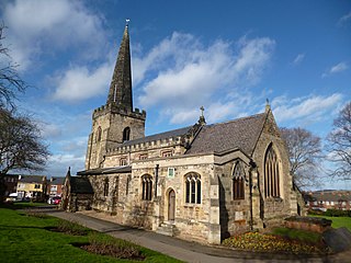
Nottingham is a city and unitary authority area in Nottinghamshire, East Midlands, England. It is located 110 miles (180 km) north-west of London, 33 miles (53 km) south-east of Sheffield and 45 miles (72 km) north-east of Birmingham. Nottingham is the legendary home of Robin Hood and to the lace-making, bicycle and tobacco industries. The city is also the county town of Nottinghamshire and the settlement was granted its city charter in 1897, as part of Queen Victoria's Diamond Jubilee celebrations. Nottingham is a tourist destination; in 2018, the city received the second-highest number of overnight visitors in the Midlands and the highest number in the East Midlands.

<span class="mw-page-title-main">Nottingham East (UK Parliament constituency)</span> Parliamentary constituency in the United Kingdom, 1885–1955 and 1974 onwards

Nottingham East is a constituency represented in the House of Commons of the UK Parliament since 2019 by Nadia Whittome of the Labour Party.

<span class="mw-page-title-main">Stapleford, Nottinghamshire</span> Town and civil parish in Nottinghamshire, England

Stapleford is a town and civil parish in the Borough of Broxtowe, Nottinghamshire, England, 6 miles (9.7 km) west of Nottingham. The population of the civil parish at the 2001 census was 14,991, at the 2011 census it was 15,241, and 15,453 at the 2021 census.

<span class="mw-page-title-main">Hyson Green</span> Human settlement in England

Hyson Green is a neighbourhood in Nottingham, England. It is home to a variety of cultures with a thriving local economy. Hyson Green has the largest ethnic minority population in the city. Since 2006 Hyson Green has seen a larger rise in development and direct international investment than any other area of Nottingham.

Sherwood is a large district and ward of the city of Nottingham, England, 1.5 miles (2.4 km) north of the city centre. The population at the 2011 census was 15,414. It is bordered by Woodthorpe to the northeast, Mapperley to the east, Carrington to the south, New Basford and Basford to the west, and Daybrook and Bestwood to the north.

<span class="mw-page-title-main">Bulwell</span> Human settlement in England

Bulwell is a market town and former civil parish in the Nottingham district, in the ceremonial county of Nottinghamshire, England. It is 3 miles (5 km) south-west of Hucknall and 4.5 miles (7 km) to the north-west of Nottingham. The United Kingdom Census 2011 recorded the population of Bulwell at 29,771 which amounted to over 10 per cent of Nottingham city's population. The 2011 census gave a population of 16,157 for the Bulwell ward of Nottingham City Council. There is an adjacent ward, Bulwell Forest, which includes Highbury Vale, Rise Park and the west of Top Valley, its population at the same census being 13,614.

<span class="mw-page-title-main">Basford, Nottingham</span> Northerly suburb of Nottingham, England

Basford is a northerly suburb of Nottingham, England, incorporated into the city in 1877. It gave its name to Basford Rural District, which existed from 1894 to 1974. The ward population at the 2011 census was 16,207, estimated at 16,779 in 2019. Next to Old Basford is New Basford, which is mainly Victorian. Basford lies close to the River Leen, a tributary of the River Trent. It is linked to Nottingham City Centre to the south and Hucknall and Bulwell to the north by the Nottingham Express Transit tram service.

Nottingham College is one of the largest further education and higher education colleges in the United Kingdom. Based in the city of Nottingham in England, it provides education and training from pre-entry through to university-degree level at its 10 centres in the city and around Nottinghamshire.

<span class="mw-page-title-main">Sumac Centre</span>

The Sumac Centre is a self-managed social centre in Nottingham, UK. It provides resources, meeting spaces and workshops for groups and individuals, and supports campaigning for human rights, animal rights, the environment, and peace. It is part of the UK Social Centre Network and the radical catering group Veggies is based at the centre. It receives no regular funding, the core groups each pay rent that goes toward the mortgage and running costs. Some of the groups are run by volunteers. Its origins can to traced to the Rainbow Centre, which was established in 1984.

<span class="mw-page-title-main">Mapperley</span> Area of north-eastern Nottingham, England

Mapperley is a residential and commercial area of north-eastern Nottingham, England. The area is bounded by Sherwood to the north-west, Thorneywood to the south and Gedling to the east.

<span class="mw-page-title-main">Veggies of Nottingham</span> Vegan catering campaign and worker co-operative in Nottingham, England

Veggies of Nottingham, also known as Veggies Catering Campaign, is a company and a campaigning group based in Nottingham, England, promoting ethical alternatives to mainstream fast food. It does this by hosting events such as the annual East Midlands Vegan Festival, publishing books and leaflets, and maintaining an extensive website, including a Contacts Directory of groups with similar aims. As a non-profit worker co-operative it also provides affordable, wholesome, minimally-packaged vegan catering at a wide range of events and protests using fair trade, organic and/or locally sourced ingredients.

Carrington is a small suburb of Nottingham, England, located approximately 1.3 miles (2.1 km) north of Nottingham city centre. It lies next to the areas of Sherwood, Mapperley, Forest Fields, Basford, Sherwood Rise and the Forest Recreation Ground.

Richard Charles Sutton was an architect based in Nottingham. He was born 1834 and died on 18 October 1915.

<span class="mw-page-title-main">Killisick</span> Area of the town of Arnold, Nottinghamshire, England

Killisick is an area of the market town of Arnold in the ceremonial county of Nottinghamshire in the East Midlands of England. It also used to be a local government ward area of Gedling borough until 2015. The population of the ward as it stood at the 2011 census was 2,595. The area is currently contained within the newly created Coppice ward.

Sherwood Rise is a residential area in the north of the city of Nottingham in the United Kingdom. It is bordered by Carrington, Basford, Forest Fields and Sherwood.

Education in Nottingham is governed by the unitary authority of Nottingham, overseen by its Nottingham City Council.

<span class="mw-page-title-main">Highbury Vale</span> Human settlement in England

Highbury Vale is an area located in the city of Nottingham, and is located in the Bulwell Forest ward. The area is located roughly 5.4 miles (8.7 km) from the City Centre, and about 1 mile (2 km) from Bulwell. Surrounding areas include Bulwell towards the North, Bestwood to the east, Hempshill Vale to the west and Cinderhill and Basford towards the south. Highbury Vale and Hempshill Vale are classed as a part of Bulwell. At the 2001 census, the area had a population of 4,530.

<span class="mw-page-title-main">Herbert Walker (architect)</span> British architect, surveyor and civil engineer

Lieut-Colonel Herbert Walker FRIBA, M Inst CE, FSI, was an architect, surveyor and civil engineer based in Nottingham from 1870 to 1923.

References

  1. http://www.nottinghaminsight.org.uk/d/64025
  2. "FFIA homepage". FFIA. Retrieved 21 March 2014.,
  3. "Spotlight on... the NG7 Food Bank". Nottingham CVS. Archived from the original on 4 March 2016. Retrieved 21 March 2014.
  4. "NSN homepage". NSN. Retrieved 21 March 2014.
  5. "Transition Forest Fields homepage". TransitionFF. Archived from the original on 25 October 2011. Retrieved 21 March 2014.
  6. "Sumac Centre Groups" . Retrieved 19 April 2018.
  7. "Veggies Catering Campaign" . Retrieved 19 April 2018.
  8. "Sumac Centre | A volunteer-run social and community centre based in Forest Fields in Nottingham". Archived from the original on 23 December 2014. Retrieved 31 August 2014.
  9. "Sumac Youth Club" . Retrieved 19 April 2018.
  10. "Robin Hood Solidary Group" . Retrieved 19 April 2018.
  11. "St Stephen With St Paul's Church" . Retrieved 19 April 2018.