Interstate 45 (I-45) is a major Interstate Highway located entirely within the US state of Texas. While most Interstate routes which have numbers ending in "5" are cross-country north–south routes, I-45 is comparatively short, with the entire route located in Texas. Additionally, it has the shortest length of all the interstates that end in a "5." It connects the cities of Dallas and Houston, continuing southeast from Houston to Galveston over the Galveston Causeway to the Gulf of Mexico.

River Oaks is a residential community located in the center of Houston, Texas, United States. Located within the 610 Loop and between Downtown and Uptown, the community spans 1,100 acres (450 ha). Established in the 1920s by brothers Will Hogg and Michael Hogg, the community became a well-publicized national model for community planning. Real estate values in the community range from $1 million to over $20 million. River Oaks was also named the most expensive neighborhood in Houston in 2013. The community is home to River Oaks Country Club, which includes a golf course designed by architect Donald Ross and redesigned in 2015 by Tom Fazio.
Uptown is a business district in Houston, located 6.2 miles (10.0 km) west of Downtown and is centered along Post Oak Boulevard and Westheimer Road. The Uptown District is roughly bounded by Woodway Drive to the north, the I-610 to the east, Richmond Avenue to the south, and Yorktown Street to the west. It covers 1,010 acres (410 ha).

Montrose is an area located in west-central Houston, Texas, United States and is one of the city's major cultural areas. Montrose is a 7.5 square miles (19 km2) area roughly bounded by Interstate 69/U.S. Highway 59 to the south, Allen Parkway to the north, South Shepherd Drive to the west, and Taft to Fairview to Bagby to Highway 59 to Main to the east. Montrose neighborhoods include Cherryhurst, Courtlandt Place, Hyde Park, Montrose, Vermont Commons, North and East Montrose, Mandell Place and Winlow Place. Montrose is also less well known by the moniker Neartown, encompassing Superneighborhood #24.
The Hardy Toll Road is a toll road in the Greater Houston area of the U.S. state of Texas, maintained by the Harris County Toll Road Authority. The route runs from Interstate 610 near central Houston to Interstate 45 just south of the Harris–Montgomery county line. The road generally parallels Interstate 45. The portion from I-610 to Crosstimbers Road was designated on September 26, 1984 as Spur 548, although this is unsigned.

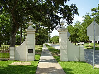
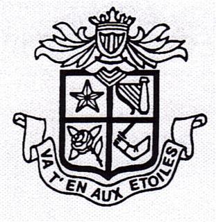
Lamar High School is a comprehensive public secondary school located in Houston, Texas, United States. It is a part of the Houston Independent School District (HISD). Lamar High School, was established in 1936 in memory of Mirabeau B. Lamar (1798–1859), a leader in the Texas Revolution and the second President of the Republic of Texas. Lamar has a four-year program, serving grades 9 through 12.

The Westpark Tollway, also Fort Bend Westpark Tollway, is a limited-access toll road in Texas, serving western Houston and Harris County, and northeastern Fort Bend County. Construction on the facility began in 2001 and portions of the road were opened to traffic in May 2004. Construction of the roadway was completed in August 2005. The Westpark Tollway begins on Westpark Drive just past the South Rice Avenue intersection in the Uptown District of Houston and runs approximately 22 miles (35 km) west to Farm to Market Road 1093 just past Farm to Market Road 723 in Fulshear, Texas. It runs roughly parallel and to the south of Westheimer Road in Harris County and concurrently with FM 1093 in Fort Bend County.

Montrose is a neighborhood located in west-central Houston, Texas, United States. Montrose is a 7.5-square-mile (19 km2) area roughly bounded by Interstate 69/U.S. Highway 59 to the south, Allen Parkway to the north, South Shepherd Drive to the west, and Taft to Fairview to Bagby to Highway 59 to Main to the east. The area is also referred to as Neartown or Neartown / Montrose.

Addicks is an area of Houston that was formerly its own community.
Memorial Drive is an arterial road in the western half of Houston, Texas, United States. It runs from Interstate 45 west to State Highway 6, a distance of approximately 20 miles (32 km). A 1-mile (1.6 km) section goes through several predominantly higher-income residential neighborhoods in the cities of Houston, Bunker Hill Village, Piney Point Village, and Hunters Creek Village, in addition to Memorial Park. Memorial Drive was named in the memory of the men who served in Camp Logan.

Allen Parkway is an arterial road west of Downtown Houston, Texas. It has a distance of approximately 2.3 miles (3.7 km), running from Interstate 45 west to Shepherd Drive, where it becomes Kirby Drive. Originally known as Buffalo Parkway, it was later named after John Kirby Allen and Augustus Chapman Allen, the founders of Houston.
Briargrove Park (BGP) is a subdivision in western Houston, Texas, United States. It has about 1,480 houses. It is bounded by Beltway 8, the Buffalo Bayou, Gessner Road, and Westheimer Road.

Westheimer Road is an arterial east–west road in Houston, Texas, United States. It runs from Bagby Street in Downtown and terminates at the Westpark Tollway on the southern edge of George Bush Park, stretching about 19 miles (31 km) long. The street was named after Michael Louis Westheimer, a German immigrant and flour salesman.

The Energy Corridor is a business district in Houston, Texas, located on the west side of the metropolitan area between Beltway 8 and the Grand Parkway. The district straddles a 7-mile (11 km) stretch of Interstate 10 from Kirkwood Road westward to Barker Cypress Road and extends south along Eldridge Parkway to Briar Forest Drive. Parts of the district overlap with the Memorial area of Houston. The district is located north of Westchase, another major business district of Houston, and east of Greater Katy.
The University Line is a planned 25 mi (40 km) bus rapid transit route that would be operated by Metro in Houston, Texas, United States. It replaces a former METRORail light rail line that was proposed in the 2000s and 2010s. The University Line is scheduled to begin construction in 2025 and would be built in five sections between Westchase Park and Ride, Uptown, the University of Houston, and Tidwell Transit Center.

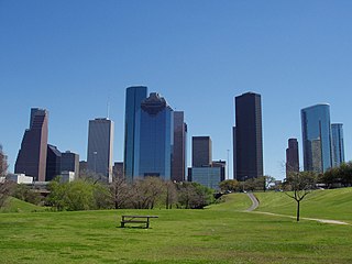
Eleanor Tinsley Park is a section of Buffalo Bayou Park in Houston, Texas. It was designated on April 20, 1998 in honor of Eleanor Tinsley, who served as a member of the Houston City Council At-Large for 16 years.

Briarhills is a subdivision in western Houston, Texas. The Briarhills Property Owners Association (POA) and the Briarhills Home Owners Association (HOA) serve Briarhills, Meadowbriar, and Oaks of Parkway.

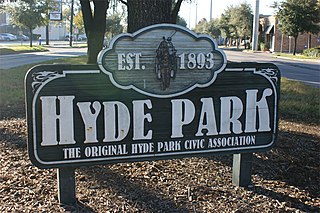
Hyde Park is a historic community located in the Montrose neighborhood of Houston, Texas. Its southeast boundary is the intersection Montrose Boulevard and Westheimer. The neighborhood was established in the late 1800s on the summer farm of the second President of the Republic of Texas, Mirabeau Lamar. In the 1970s, Hyde Park became a central part of the Gay Rights Movement in Houston. Like much of Montrose, the neighborhood is now experiencing significant gentrification, and is home to an abundance of restaurants, including Mexican, Italian, Greek, American, Lebanese, coffee houses, and numerous bars.


