Bukeerere

Last updated
Bukeerere
Uganda location map.svg
Red pog.svg
Bukeerere
Map of Uganda showing the location of Bukeerere.
Coordinates: 00°24′27″N32°42′07″E / 0.40750°N 32.70194°E / 0.40750; 32.70194
CountryFlag of Uganda.svg  Uganda
District Mukono District
Elevation
1,121 m (3,678 ft)
Time zone UTC+3 (EAT)

Bukeerere, sometimes wrongly spelled as Bukerere, is a township in the Central Region of Uganda. The correct phonetic spelling is with two 'e's after the 'k'. [1]

Contents

Location

Bukeerere is in Mukono District, 11 kilometres (6.8 mi), by road, northwest of Mukono, the headquarters of the district. [2] This is approximately 19 kilometres (12 mi), by road, northeast of Kampala, Uganda's capital and largest city. [3] The coordinates of Bukeerere are 0°24'27.0"N, 32°42'07.0"E (Latitude:0.407498; Longitude:32.701953). [4] The average elevation of Bukeerere is approximately 1,121 metres (3,678 ft) above sea level. [5]

Overview

The town of Bukeerere is the headquarters of Bukeerere parish, in Goma sub-county, Kyaggwe county. [6] The Bukerere Road leads from Seeta on the Kampala–Jinja Highway through Bukeerere to join the Mukono-Kalagi Road at Kasaayi. [7]

All the land in Bukerere, approximately 1 square mile (640 acres), is mailo land that is owned by the descendants of Stanslaus Mugwanya, one of the three regents during the reign of Daudi Cwa II of Buganda. Settlers on this land are sitting tenants without land titles. They are expected to pay annual lease payments to the respective and owners. [8]

Related Research Articles

<span class="mw-page-title-main">Mukono Town</span> Urban centre in Uganda

Mukono Town is a municipality in Mukono District in the Central Region of Uganda. The town is administered by the Mukono Town Council. The district headquarters are located in this town.

The Kampala–Jinja Highway is a road in Uganda, connecting the cities of Kampala and Jinja. Sometimes referred to as Kampala–Jinja Road, it is a busy road, with several towns, trading centers and other points of interest along the way. As of October 2016, a new, wider, four-lane dual carriageway expressway, the Kampala–Jinja Expressway, is proposed to be constructed south of the present highway to relieve traffic and complement existing transport infrastructure between Kampala and Jinja.

Kapeeka is a town in Nakaseke District of the Central Region of Uganda.

Kijura is a town in Kabarole District, in the Western Region of Uganda.

Ngogwe is a municipality in Buikwe District in the Central Region of Uganda.

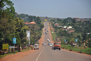
Kasawo is an urban centre in the Mukono District, Central Region of Uganda.

Maddu is a town in Gomba District in the Central Region of Uganda.

Musita is a town in Mayuge District, in the Eastern Region of Uganda.

Karuma is a settlement in the Western Region of Uganda.

Mukono–Kayunga–Njeru Road is a road in the Central Region of Uganda, connecting the city of Mukono to the town of Njeru at the Nalubaale Power Station.

Mukono Health Centre IV (MHC4), commonly known as Mukono Mini Hospital is an outpatient health facility in Mukono Town in Uganda.

<span class="mw-page-title-main">Kampala–Entebbe Road</span> Road in Uganda

The Kampala–Entebbe Road, also known as the Entebbe–Kampala Road or the Entebbe Road, is a road in the Central Region of Uganda, connecting the capital city of Kampala and Entebbe International Airport.

Kabojja is a neighborhood in Wakiso District, in the Central Region of Uganda.

Kisubi is a neighborhood in the Central Region of Uganda.

Mbalala, is an urban center in the Central Region of Uganda.

Rubanda is a town in the extreme southwest of the Western Region of Uganda. It serves as the commercial, political and administrative center of Rubanda District.

Mparo is a town in the Western Region of Uganda and the political and administrative center of Rukiga District. However, the largest town in the district and its major commercial center is Muhanga.

Mbalwa is a neighborhood in Kyaliwajjala Parish, Kira Municipality, Wakiso District in the Central Region of Uganda.

Kijabijo is a neighborhood in Kira Town, in Wakiso District in the Buganda Region of Uganda.

References

  1. "Oluguudo lwe'Bukeerere lukolebwa ddi? (When will Bukerere Road be improved?)". Bukedde Newspaper Online (in Ganda). Kampala. 8 July 2011. Archived from the original on 28 June 2017. Retrieved 10 January 2016.
  2. GFC (10 January 2016). "Distance between Bukerere Health Center II, Mukono, Central Region, Uganda and Mukono, Central Region, Uganda". Globefeed.com (GFC). Retrieved 10 January 2016.
  3. GFC (10 January 2016). "Distance between Kampala, Central Region, Uganda and Bukerere Health Center II, Mukono, Central Region, Uganda". Globefeed.com (GFC). Retrieved 10 January 2016.
  4. Google (10 January 2016). "Location of Bukeerere, Uganda" (Map). Google Maps . Google. Retrieved 10 January 2016.
  5. GVI (10 January 2016). "Bukerere populated place, Uganda". Geoview.info (GVI). Retrieved 10 January 2016.
  6. Lcmt (10 January 2016). "Villages in Bukerere Parish". Lcmt.org. Retrieved 10 January 2016.
  7. Okedi, Joseph (23 July 2011). "Alarm Bells: Ministry should tamarck Bukerere Road". Daily Monitor . Kampala. Retrieved 10 January 2016.
  8. Paul Murungi (27 March 2019). "Bukerere, the virgin area with investment potential". Daily Monitor . Kampala. Retrieved 27 March 2019.

00°24′27″N32°42′07″E / 0.40750°N 32.70194°E / 0.40750; 32.70194