Kalagi, Mukono | |
|---|---|
| Coordinates: 00°30′18″N32°45′00″E / 0.50500°N 32.75000°E | |
| Country | |
| District | Mukono District |
| Elevation | 3,840 ft (1,170 m) |
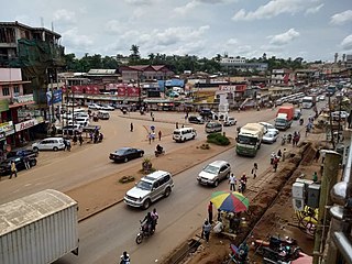
Kalagi is a town in Mukono District in the Central Region of Uganda.
Kalagi, Mukono | |
|---|---|
| Coordinates: 00°30′18″N32°45′00″E / 0.50500°N 32.75000°E | |
| Country | |
| District | Mukono District |
| Elevation | 3,840 ft (1,170 m) |
Kalagi is a town in Mukono District in the Central Region of Uganda.
The town is approximately 10 miles (16 km) north of Mukono, the district headquarters, on an all weather tarmac road. In Kalagi, the road from Mukono forms a T-junction with the road from Kasangati to Kayunga. The coordinates of Kalagi are 0°30'18.0"N, 32°45'00.0"E (Latitude:0.5050; Longitude:32.7500). [1] [2]
The following additional points of interest lie within the town or near its edges:

Mukono is one of the districts in the Central Region of Uganda. The town of Mukono serves as the district headquarters and is home to the district's main commercial center.
Kisoga is a town in Mukono District in Central Uganda.

Mukono Town is a municipality in Mukono District in the Central Region of Uganda. The town is administered by the Mukono Town Council. The district headquarters are located in this town.
Kalagi is a settlement in Mubende District in Central Uganda.

Lugazi is a town in the Buikwe District of the Central Region of Uganda. The town is also called "Kawolo", and the two names are interchangeably used by the local inhabitants.

The Kampala–Jinja Highway is a road in Uganda, connecting the cities of Kampala and Jinja. Sometimes referred to as Kampala–Jinja Road, it is a busy road, with several towns, trading centers and other points of interest along the way. As of October 2016, a new, wider, four-lane dual carriageway expressway, the Kampala–Jinja Expressway, is proposed to be constructed south of the present highway to relieve traffic and complement existing transport infrastructure between Kampala and Jinja.
Nakifuma is a town in the Central Region of Uganda.
Opportunity Bank Uganda Limited (OBUL), is a Tier II credit institution in Uganda. It was previously registered as a commercial bank by the Bank of Uganda, the central bank and national banking regulator. The institution received a commercial banking license on 25 September 2019.
Nagalama, whose correct phonetic spelling is Naggalama is a town in Uganda's Central Region.

Namanve is an area in the Central Region of Uganda. The larger portion of Namanve lies in Kira Municipality, in Wakiso District with portions located in Mukono Municipality, in Mukono District.

Koome is an island in Lake Victoria, Uganda.

Katosi is a town in the Mukono District of the Central Region of Uganda. The town is an urban center under Mukono District Administration.
Namataba is a town in Mukono District, Central Uganda. The town is an urban center under Mukono District Administration.
Kyetume is a township in Mukono District in the Central Region of Uganda.
Bukeerere, sometimes wrongly spelled as Bukerere, is a township in the Central Region of Uganda. The correct phonetic spelling is with two 'e's after the 'k'.
Mukono–Kayunga–Njeru Road is a road in the Central Region of Uganda, connecting the city of Mukono to the town of Njeru at the Nalubaale Power Station.
Mbalala, is an urban center in the Central Region of Uganda.
Kijabijo is a neighborhood in Kira Town, in Wakiso District in the Buganda Region of Uganda.
Nagojje is a town in the Buganda Region of Uganda. It is a municipality in Mukono District.
Saints Andrew and Philip Cathedral, Mukono is an Anglican cathedral in Mukono District, in the Central Region of Uganda.The current Diocesan is The Rt. Rev. James Ssebaggala.