
Kayunga District is a district in Central Uganda. Like most other Ugandan districts, it is named after its 'chief town', Kayunga.
Luweero District is a district in the Central Region of Uganda. Luweero is the site of the district headquarters.

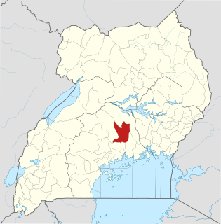
Mukono is one of the districts in the Central Region of Uganda. The town of Mukono home to the district's main commercial center and district headquarters.

Wakiso District is a district in the Central Region of Uganda that partly encircles Kampala, Uganda's capital city. The town of Wakiso is the site of the district headquarters. Kira, the country's second largest city and suburb of Kampala, is in the district.

Kayunga is a town in the Central Region of Uganda. It is the main municipal, administrative, and commercial center of Kayunga District.
The Kampala–Jinja Highway is a road in Uganda, connecting the cities of Kampala and Jinja. Sometimes referred to as Kampala–Jinja Road, it is a busy road, with several towns, trading centers and other points of interest along the way. As of October 2016, a new, wider, four-lane dual carriageway expressway, the Kampala–Jinja Expressway, is proposed to be constructed south of the present highway to relieve traffic and complement existing transport infrastructure between Kampala and Jinja.

Ggaba is a neighborhood within the city of Kampala in the Central Region of Uganda.
Nkokonjeru is a town council in Buikwe District in the Central Region of Uganda with villages such as: Namaliiri, Kigulu, Mulajje, Naziwanga, Ndolwa, Buira, Bukasa, Wabiduuku, Nsuube and Nkokonjeru Central. The town's name means "White Chicken" in English.
Gayaza is a town in Wakiso District in the Buganda Region of Uganda.
Namilyango is a hill in Mukono District in south-central Uganda. The hill rises 1,220 metres (4,000 ft) above sea level. The name "Namilyango" is also applied to the village that occupies the hill and the schools and churches that are located there.
Nsasa is a neighborhood in Kira Municipality, Kyaddondo County, Wakiso District, in the Central Region of Uganda.
Nakifuma is a town in the Central Region of Uganda.
Naggalama Hospital, whose full name is St. Francis Hospital, Naggalama, is a hospital in Naggalama, Mukono District, in the Central Region of Uganda. It is a private, non-profit, faith-based community hospital, owned by the Roman Catholic Diocese of Lugazi.
Kasawo is an urban centre in the Mukono District, Central Region of Uganda.
Namataba is a town in Mukono District, Central Uganda. The town is an urban center under Mukono District Administration.
Bukeerere, sometimes wrongly spelled as Bukerere, is a township in the Central Region of Uganda. The correct phonetic spelling is with two 'e's after the 'k'.
Mukono–Kayunga–Njeru Road is a road in the Central Region of Uganda, connecting the city of Mukono to the town of Njeru at the Nalubaale Power Station.
Kayunga Hospital, is a public hospital in Uganda.
Kijabijo is a neighborhood in Kira Town, in Wakiso District in the Buganda Region of Uganda.
Nagojje is a town in the Buganda Region of Uganda. It is a municipality in Mukono District.

