Seeta | |
|---|---|
 Seeta | |
| Coordinates: 00°22′00″N32°42′45″E / 0.36667°N 32.71250°E | |
| Country | |
| District | Mukono District |
| Elevation | 1,180 m (3,870 ft) |
| Time zone | UTC+3 (EAT) |

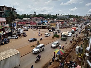
Seeta, sometimes wrongly spelled as Seta, is a township in Uganda.
Seeta | |
|---|---|
 Seeta | |
| Coordinates: 00°22′00″N32°42′45″E / 0.36667°N 32.71250°E | |
| Country | |
| District | Mukono District |
| Elevation | 1,180 m (3,870 ft) |
| Time zone | UTC+3 (EAT) |

Seeta, sometimes wrongly spelled as Seta, is a township in Uganda.

Seeta is located inside Mukono Town and is situated on the main highway (A-109) between Kampala and Jinja, on the Kampala-Jinja Highway. It is approximately 18 kilometres (11 mi) east from Kampala by road, which is Uganda's capital and largest city. [1] This location is in Mukono District, Central Region of Uganda.

The following points of interest lie within the township or close to its borders:

Mukono is one of the districts in the Central Region of Uganda. The town of Mukono serves as the district headquarters and is home to the district's main commercial center.
Namilyango College is a boys-only boarding secondary school located in Mukono District in the Central Region of Uganda, whose history and excellence in sports and academics have made it one of the most prestigious schools in Uganda. It is Uganda's oldest secondary school, founded in 1902 by the Catholic Mill Hill Fathers.

Mukono Town is a municipality in Mukono District in the Central Region of Uganda. The town is administered by the Mukono Town Council. The district headquarters are located in this town.

Lugazi is a town in the Buikwe District of the Central Region of Uganda. The town is also called "Kawolo", and the two names are interchangeably used by the local inhabitants.

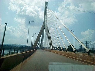
The Kampala–Jinja Highway is a road in Uganda, connecting the cities of Kampala and Jinja. Sometimes referred to as Kampala–Jinja Road, it is a busy road, with several towns, trading centers and other points of interest along the way. As of October 2016, a new, wider, four-lane dual carriageway expressway, the Kampala–Jinja Expressway, is proposed to be constructed south of the present highway to relieve traffic and complement existing transport infrastructure between Kampala and Jinja.

Bweyogerere is one of the six townships or wards that constitute Kira Municipality in Wakiso District in southern central Uganda. The other five wards are Kimwaanyi, Kira, Kireka, Kirinnya and Kyaliwajjala.
Namilyango is a hill in Mukono District in south-central Uganda. The hill rises 1,220 metres (4,000 ft) above sea level. The name "Namilyango" is also applied to the village that occupies the hill and the schools and churches that are located there.
Mt. St. Mary's College Namagunga is an all-girl boarding secondary school located in Mukono District in Uganda. The school is affiliated with the Roman Catholic Diocese of Lugazi.
United Bank for Africa Uganda Limited, also UBA Uganda, is a commercial bank in Uganda. It is licensed by the Bank of Uganda, the central bank and national banking regulator. UBA Uganda is a subsidiary of the United Bank for Africa, headquartered in Lagos, Nigeria, with a presence in twenty African countries, the United Kingdom, France, and the United States. The stock of UBA Transnational trades on the Nigeria Stock Exchange under the symbol UBA.

Naalya is a township in Kira Municipality, in Kyaddondo County, Wakiso District, in Uganda.

Namanve is an area in the Central Region of Uganda. The larger portion of Namanve lies in Kira Municipality, in Wakiso District with portions located in Mukono Municipality, in Mukono District.
Namanve Power Station is a 50 MW heavy fuel oil-fired thermal power plant in Uganda. Sometimes the power station is referred to as Kiwanga Power Station.
The Kampala Industrial and Business Park(KIBP), also referred to as Kampala Business and Industrial Park or Kampala Industrial Park, is an industrial and business park in Uganda. The park was developed by the Uganda Investment Authority (UIA) as a central place where investors can locate factories, warehouses, distribution centers, and other business offices.
The Kampala–Jinja Expressway, also known as the Jinja–Kampala Expressway, is a proposed four-lane toll highway in Uganda, linking Kampala, the capital and largest city of Uganda, with the city of Jinja in the Eastern Region of Uganda.
The Mukono–Kyetume–Katosi–Nyenga Road is a road in the Central Region of Uganda, connecting the towns of Mukono, Kyetume and Katosi in Mukono District to Nkokonjeru and Nyenga in Buikwe District.
Bukeerere, sometimes wrongly spelled as Bukerere, is a township in the Central Region of Uganda. The correct phonetic spelling is with two 'e's after the 'k'.
The Kampala Outer Beltway, also known as the Kampala Outer Ring Road, is a planned road in Uganda. It will form a full circle around Kampala, Uganda's capital and largest city.

Sonde, also Ssonde, is a settlement in Mukono District, in Uganda's Central Region.
East African Medical Vitals Limited, commonly referred to as East African Medical Vitals (EAMV), is a manufacturer of consumable medical supplies in Uganda. It is reported to be the first company in Africa, that manufactures powder-free latex, medical gloves.