Katosi

Last updated
Katosi
Morning breeze at katoosi.jpg
Uganda location map.svg
Red pog.svg
Katosi
Location in Uganda
Coordinates: 00°09′10″N32°48′05″E / 0.15278°N 32.80139°E / 0.15278; 32.80139
Country Flag of Uganda.svg Uganda
Region Central Region
District Mukono District
Elevation
3,717 ft (1,133 m)
Population
 (2015 Estimate)
  Total16,442

Katosi is a town in the Mukono District of the Central Region of Uganda. The town is an urban center under Mukono District Administration. [1]

Contents

Location

Katosi is located approximately 29 kilometres (18 mi), by road, south-east of Mukono, the location of the district headquarters. [2] This location is along the northern shore of Lake Victoria, approximately 52 kilometres (32 mi), by road, southeast of Kampala, the capital and largest city of Uganda. [3]

The geographical coordinates of Katosi are 0°09'10.0"N, 32°48'05.0"E (Latitude:0.152778; Longitude:32.801389). [4] The town's average elevation is approximately 1,133 metres (3,717 ft) above sea level. [5]

Overview

Traditionally, Katosi was a fishing village and a landing site for water craft transporting people and merchandise between Koome Island in Mukono District and the Buvuma Islands in neighboring Buvuma District and the mainland. [6] [7] During the last decade of the 20th century and in the first decade of the 21st century, Katosi became a major fishing center, with the majority of the catch exported to Europe and the Middle East.[ citation needed ] As the fishing village has increased in economic importance, the human population has increased as well.

Katosi has a high population of AIDS orphans and widows. [8]

Recent developments

In 2011, the National Water and Sewerage Corporation (NWSC), the government parastatal responsible for water supply and sanitation, announced plans to build a water treatment plant in Katosi, capable of supplying 120,000 cubic meters (120,000,000 L) of purified water daily. The new water plant will cost approximately US$306 million and will supply mainly the rapidly growing towns of Mukono and Kira Town. [9] [10]

Population

As of January 2015, the estimated population of Katosi was 16,442. [5]

Points of interest

The following points of interest lie within or near Katosi:

See also

Related Research Articles

<span class="mw-page-title-main">Masindi</span> Place in Western Region of Uganda, Uganda

Masindi is a town in the Western Region of Uganda. It is on the road between Kampala and the Murchison Falls National Park. It is the site of the headquarters of the Masindi District.

Kanungu is a town in the Western Region of Uganda. It is the location of the district headquarters for Kanungu District.

Kisoga is a town in Mukono District in Central Uganda.

<span class="mw-page-title-main">Mukono Town</span> Urban centre in Uganda

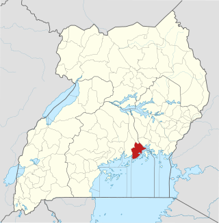
Mukono Town is a municipality in Mukono District in the Central Region of Uganda. The town is administered by the Mukono Town Council. The district headquarters are located in this town.

Lugazi is a town in the Buikwe District of the Central Region of Uganda. The town is also called "Kawolo", and the two names are interchangeably used by the local inhabitants.

The Kampala–Jinja Highway is a road in Uganda, connecting the cities of Kampala and Jinja. Sometimes referred to as Kampala–Jinja Road, it is a busy road, with several towns, trading centers and other points of interest along the way. As of October 2016, a new, wider, four-lane dual carriageway expressway, the Kampala–Jinja Expressway, is proposed to be constructed south of the present highway to relieve traffic and complement existing transport infrastructure between Kampala and Jinja.

Ggaba is a neighborhood within the city of Kampala in the Central Region of Uganda.

The National Water and Sewerage Corporation (NWSC) is a water supply and sanitation company in Uganda. It is wholly owned by the government of Uganda.

Nkokonjeru is a town council in Buikwe District in the Central Region of Uganda with villages such as: Namaliiri, Kigulu, Mulajje, Naziwanga, Ndolwa, Buira, Bukasa, Wabiduuku, Nsuube and Nkokonjeru Central. The town's name means "White Chicken" in English.

Nakifuma is a town in the Central Region of Uganda.

<span class="mw-page-title-main">Namanve</span> Place in Wakiso District, Uganda

Namanve is an area in the Central Region of Uganda. The larger portion of Namanve lies in Kira Municipality, in Wakiso District with portions located in Mukono Municipality, in Mukono District.

Ngogwe is a municipality in Buikwe District in the Central Region of Uganda.

Kitukutwe is a neighborhood in Kira Municipality, Kyaddondo County, Wakiso District, in Central Uganda.

Namataba is a town in Mukono District, Central Uganda. The town is an urban center under Mukono District Administration.

The Mukono–Kyetume–Katosi–Nyenga Road is a road in the Central Region of Uganda, connecting the towns of Mukono, Kyetume and Katosi in Mukono District to Nkokonjeru and Nyenga in Buikwe District.

Kyetume is a township in Mukono District in the Central Region of Uganda.

Kayunga Hospital, is a public hospital in Uganda.

Kawolo General Hospital, also Kawolo Hospital, is a hospital in Buikwe District in the Central Region of Uganda.

<span class="mw-page-title-main">Sonde, Uganda</span> Place in Mukono District, Uganda

Sonde, also Ssonde, is a settlement in Mukono District, in Uganda's Central Region.

Katosi Water Works (KWW), also Katosi Water Treatment Plant is a water purification and distribution project in Uganda.

References

  1. Daily Monitor (19 October 2017). "Government considers scrapping new towns in Mukono". Daily Monitor . Kampala. Retrieved 8 June 2021.
  2. Google (8 June 2021). "Road Distance Between Mukono Town And Katosi Trading Centre, Mukono District, Uganda" (Map). Google Maps . Google. Retrieved 8 June 2021.
  3. Google (8 June 2021). "Road Distance Between Kampala City Centre And Katosi Trading Centre, Mukono District, Uganda" (Map). Google Maps . Google. Retrieved 8 June 2021.
  4. Google (8 June 2021). "Location of Katosi Town, Mukono District, Central Region, Uganda" (Map). Google Maps . Google. Retrieved 8 June 2021.
  5. 1 2 "Estimated Human Population of Katosi In 2015". GetAMap.net. Retrieved 23 January 2015.
  6. "Fishing in Uganda". classicuganda.com. Retrieved 2020-05-24.
  7. "Children and fishing, in Katosi community – Jai Jagat 2020" . Retrieved 2020-05-26.
  8. Mugalu, Moses (7 June 2012). "Feature: Religions United Against HIV In Katosi". The Observer (Uganda) . Retrieved 23 January 2015.
  9. "Uganda To Build US$306 Million Water Treatment Plant in Katosi". Water-technology.net. 18 April 2011. Retrieved 23 January 2015.
  10. Athumani, Halima (17 March 2011). "New Water Purification System For Kampala City". Uganda Radio Network. Retrieved 23 January 2015.

00°09′10″N32°48′05″E / 0.15278°N 32.80139°E / 0.15278; 32.80139