The Union Station building is located at 1 Main Street in Burlington, Vermont. The building, last used by the Rutland Railroad as a railroad station in 1953, is owned by Main Street Landing Company, and houses offices and art studios.

The steamboat Ticonderoga is one of two remaining side-paddle-wheel passenger steamers with a vertical beam engine of the type that provided freight and passenger service on America's bays, lakes and rivers from the early 19th to the mid-20th centuries. Commissioned by the Champlain Transportation Company, Ticonderoga was built in 1906 at the Shelburne Shipyard in Shelburne, Vermont on Lake Champlain.

The Harbor Beach Lighthouse is a "sparkplug lighthouse" located at the end of the north breakwall entrance to the harbor of refuge on Lake Huron. The breakwall and light were created by the United States Army Corps of Engineers to protect the harbor of Harbor Beach, Michigan, which is the largest man-made freshwater harbor in the world. Harbor Beach is located on the eastern edge of the Thumb of Huron County, in the state of Michigan.

The National Harbor of Refuge and Delaware Breakwater Historic District encompasses a series of seacoast breakwaters behind Cape Henlopen, Delaware, built between 1828 and 1898 to establish a shipping haven on a coastline that lacked safe harbors. The Harbor of Refuge is at the mouth of the Delaware Bay estuary where it opens into the Atlantic Ocean, at Lewes.

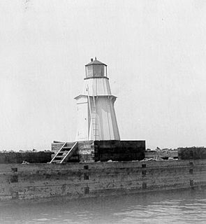
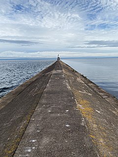
The Burlington Breakwater Lights were originally established in 1857 to mark the ends of a low, detached, two piece breakwater 2⁄3-nautical-mile long which protects the Burlington, Vermont harbor from Lake Champlain. The breakwater is on the National Register of Historic Places, but the lights, being replicas, are not. The two lights were replaced and rebuilt several times as fire and ice took their toll. In the middle of the 20th century, the wood towers were replaced by steel skeleton towers. The City of Burlington arranged for Federal funding for replicas of the original towers which were activated on September 12, 2003.

The Ontonagon Harbor Piers Historic District is historic shipping structure located on the Ontonagon River at Lake Superior in Ontonagon, Michigan. It was listed on the National Register of Historic Places in 2001.

The Winooski Falls Mill District is located along the Winooski River in the cities of Winooski and Burlington, Vermont, in the United States of America. It encompasses a major industrial area that developed around two sets of falls on the river in the 19th century.

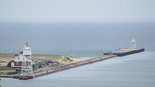
The Grand Marais Harbor of Refuge Inner and Outer Lights are a pair of lighthouses located on the west pier at the entry to Grand Marais Harbor of Refuge, in Grand Marais, Michigan. They were listed on the National Register of Historic Places in 2012.

The Navigation Structures at Pentwater Harbor are navigational structures located at the west end of Lowell Street in Pentwater, Michigan. They were listed on the National Register of Historic Places in 2001.

The Navigation Structures at Frankfort Harbor are a collection of breakwaters, piers, and other structures in Lake Michigan located at the foot of Second Street in Frankfort, Michigan. They were listed on the National Register of Historic Places in 1997.

The Swallow Boathouse is a historic boathouse on Lake Winnipesaukee in central New Hampshire, United States. It is located in a cove on the west side of Moultonborough Neck, in the town of Moultonborough. Built in 1908-10, it is one of the state's most architecturally elaborate boathouses, exhibiting elements of the Tudor Revival and Shingle style. Now used exclusively by the association owners, it was listed on the National Register of Historic Places in 1980.

The Burlington Bay Horse Ferry is a shipwreck in Lake Champlain off Burlington, Vermont, United States. It is the only known example of a turntable horse ferry, a ship type that was common on United States waterways in the mid-19th century. The wreck is a Vermont State Historic Site, and was listed on the National Register of Historic Places in 1993. Its location is marked by buoys in Burlington Bay between the northern end of the Burlington Breakwater and Lone Rock Point, and it is visitable by certified divers.

The General Butler was a schooner-rigged sailing canal boat that plied the waters of Lake Champlain and the Champlain Canal in the United States states of Vermont and New York. Built in 1862 and named for American Civil War General Benjamin Franklin Butler, she sank after striking the Burlington Breakwater in 1876, while carrying a load of marble. Her virtually intact wreck, discovered in 1980, is a Vermont State Historic Site and a popular dive site; it was listed on the National Register of Historic Places in 1998.

The O.J. Walker was a cargo schooner that plied the waters of Lake Champlain between New York and Vermont. Built in 1862 in Burlington, Vermont, she hauled freight until sinking off the Burlington coast in a storm in 1895, while carrying a load of brick and tile. The shipwreck, located west of the Burlington Breakwater, is a Vermont State Historic Site, and is accessible to registered divers. It is one of the best-preserved examples of the 1862 class of sailing canal schooners, and was listed on the National Register of Historic Places in 1998.

The Phoenix was a sidewheel paddle steamer operating on Lake Champlain between the United States states of New York and Vermont and the British province of Lower Canada. Built in 1815, she grounded, burned and sank in 1819 off the shore of Colchester, Vermont. Her surviving wreckage is the oldest known example of a sidewheel steamer anywhere in the world. The wreck site is a Vermont State Historic Site, which may be visited by registered and qualified divers. It was listed on the National Register of Historic Places in 1998.

The Keweenaw Waterway Lower Entrance Light, also known as the Portage Entry Light, is a lighthouse located at the south end of breakwater at mouth of the Portage River in Torch Lake Township. It was listed on the National Register of Historic Places in 2014.

The Navigation Structures at Saugatuck Harbor consist of two piers flanking the mouth of the Kalamazoo River on the shore of Lake Michigan near Saugatuck, Michigan. The structures were listed on the National Register of Historic Places in 2001.

The Manistee Harbor, South Breakwater is a navigational structure located at the mouth of the Manistee River, in Manistee, Michigan. It was listed on the National Register of Historic Places in 1995. The breakwater is significant due to its construction, which represents a final stage in the United States Army Corps of Engineers's use of timber crib substructures in pier and breakwater construction.

The Piers and Revetments at Grand Haven, Michigan are navigational structures located at the mouth of the Grand River in Grand Haven, Michigan. The structures were listed on the National Register of Historic Places in 1995.

The Navigation Structures at Harbor Beach Harbor are a series of breakwaters located in Lake Huron, on North Lakeshore Drive in Harbor Beach, Michigan. They were listed on the National Register of Historic Places in 1997.


