
The Five Corners Historic District is a historic district encompassing the central district of the village of South Williamstown, Massachusetts. It is centered at the junction of Cold Spring, Green River, New Ashford. The junction has been a prominent center in the area since 1760. Prominent buildings in the district include the South Center School, the Store at Five Corners, and the Second Congregational Church. The district was listed on the National Register of Historic Places in 1993.

The Boston Post Road Historic District encompasses a portion of the historic roadway known as the Boston Post Road, which ran Boston, Massachusetts to Albany, New York. The surviving alignment in Weston, Massachusetts extends along the entire length of United States Route 20, except for a bypassed section that passes through the town's village center. The 3.5 miles (5.6 km) of roadway retains much of the generally rural appearance it had during the late colonial period, and the town center retains significant elements of historic character as well. The district was added to the National Register of Historic Places in 1983.

The Canaan Street Historic District encompasses the historic original town center of Canaan, New Hampshire. It is a basically linear district, running along Canaan Street roughly from Prospect Hill Road in the north to Moss Flower Lane in the south. The town flourished first as a stagecoach stop, and then as a resort colony in the late 19th century. The historic district was listed on the National Register of Historic Places in 1973. It included 60 contributing buildings.

The Rockingham Village Historic District encompasses the traditional village center of the town of Rockingham, Vermont. Settled in the 18th century, the district, located mainly on Meeting House Road off Vermont Route 103, includes a variety of 18th and 19th-century houses, and has been little altered since a fire in 1908. It notably includes the 18th-century National Historic Landmark Rockingham Meeting House. The district was listed on the National Register of Historic Places in 2008.

Shaftsbury Center is an unincorporated village in the town of Shaftsbury in Bennington County, Vermont, United States. Located on Vermont Route 7A at West Mountain and Tunic Roads, near the town's geographic center, it was the town's main civic center through the middle of the 19th century. It is now a modest village with agricultural and tourist-oriented economic interests. Most of the village is listed on the National Register of Historic Places as the Center Shaftsbury Historic District.

Benson Village is the village center of the rural town of Benson, Vermont. The central portion of the village, stretching along Stage Road from Lake Road to Hulett Hill Road, is a historic district listed on the National Register of Historic Places as a well-preserved 19th-century village center.
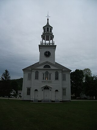
The East Poultney Historic District encompasses the historic center of the rural village of East Poultney, Vermont. The district is centered on the triangular green at the center of the village, and was developed mainly from the late 18th through mid-19th centuries, producing a village with strong Federal and Greek Revival architecture. It was listed on the National Register of Historic Places in 1978.
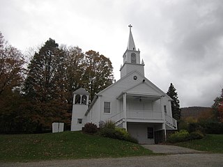
The Tinmouth Historic District encompasses a cluster of residential and civic buildings that form the center of the village Tinmouth Center in Tinmouth, Vermont. The district contains a collection of well-preserved buildings, that are reflective of life in a rural 19th-century village. The district was listed on the National Register of Historic Places in 1980.
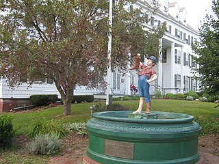
The Wallingford Main Street Historic District encompasses the historic portions of the village of Wallingford, Vermont. An essentially linear district extending along Main Street on either side of School Street, it has a well-preserved array of 19th and early-20th century residential, commercial, and civic buildings. It was listed on the National Register of Historic Places in 1984.

The Randolph Center Historic District encompasses the historic early town center of Randolph, Vermont. Established in 1783, it was later eclipsed by Randolph Village, which developed around the town's main railroad depot. The village now has a distinguished array of late 18th and early 19th-century architecture, and is home to an academic campus now housing the Vermont Technical College. It was listed on the National Register of Historic Places in 1974.

The South Newbury Village Historic District encompasses the surviving elements of a small industrial village in southern Newbury, Vermont. It includes five residences and several outbuildings, most of which are agricultural in character, representing the area's shift in use in the 20th century. The district was listed on the National Register of Historic Places in 1983.
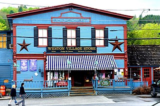
The Weston Village Historic District encompasses the town center and principal village of Weston, Vermont. Centered on Farrar Park, which serves as the town green, it includes a diversity of architectural styles from the late 18th century to about 1935, and includes residential, civic, commercial, industrial and religious buildings. It was listed on the National Register of Historic Places in 1985.

The Thetford Center Historic District encompasses the village of Thetford Center in Thetford, Vermont. The village contains a well-preserved collection of early to mid-19th century architecture, a legacy of its period of greatest prosperity as an agricultural and industrial center. It was listed on the National Register of Historic Places in 1998.

The Kents Corner Historic District encompasses a well-preserved 19th-century crossroads hamlet in Calais, Vermont. Centered on the junction of Kent Hill Road, Old West Church Road, and Robinson Cemetery Road, it developed as a stagecoach stop with a small industrial presence. It was listed on the National Register of Historic Places in 1973, and substantially enlarged in 2006.
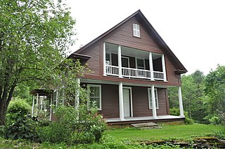
The North Calais Village Historic District encompasses a linear 19th-century mill village in Calais, Vermont. It extends mainly along North Calais Road, paralleling Pekin Brook below Mirror Lake, where ruins of its former industrial past are still evident. It was listed on the National Register of Historic Places in 2010.

The Tavern on Mutton Hill, also known locally as the 1812 Tavern, is a historic former public accommodation on Church Hill Road in Charlotte, Vermont. Built in 1813, it is a prominent local example of Federal period architecture, and the town's only documented 19th-century tavern house built out of brick. It was listed on the National Register of Historic Places in 1982.

The Williston Village Historic District encompasses the village center of Williston, Vermont. The predominantly rural community is home to a well-preserved array of Federal and Greek Revival buildings, constructed mainly in the first half of the 19th century. The district was listed on the National Register of Historic Places in 1979, with a minor enlargement in 1992.
The Moscow Village Historic District encompasses a former 19th-century industrial village in southern Stowe, Vermont. Centered on the Little River at its Moscow Road crossing, the village prospered into the early 20th century as a woodworking center. It was listed on the National Register of Historic Places in 2008.

The Stowe Village Historic District encompasses most of the village center of Stowe, Vermont. The village has since the 19th century been one of Vermont's major resort centers, and its center is architecturally reflective of this history, It was listed on the National Register of Historic Places in 1978.

The Peacham Corner Historic District encompasses much of the historic village center of Peacham, Vermont. The village's period of greatest growth and importance between the town's founding as a hill town in the late 18th century, and 1860, when significant development effectively ended. As a result, the village lacks Victorian features often found in other rural communities. The district was listed on the National Register of Historic Places in 2003.


