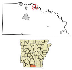
Calion, Arkansas | |
---|---|
Coordinates: 33°19′43″N92°32′24″W / 33.32861°N 92.54000°W | |
Country | United States |
State | Arkansas |
County | Union |
Area | |
• Total | 1.30 sq mi (3.38 km2) |
• Land | 1.07 sq mi (2.78 km2) |
• Water | 0.23 sq mi (0.60 km2) |
Elevation | 95 ft (29 m) |
Population (2020) | |
• Total | 429 |
• Density | 400.19/sq mi (154.49/km2) |
Time zone | UTC-6 (Central (CST)) |
• Summer (DST) | UTC-5 (CDT) |
ZIP code | 71724 |
Area code | 870 |
FIPS code | 05-10600 |
GNIS feature ID | 2403970 [2] |
Calion is a second-class city [3] in Union County, Arkansas, United States. The population was 494 at the 2010 census.
The town grew around the Ouachita River Lock and Dam, completed by the U.S. Army Corps of Engineers in 1916. It was incorporated in 1921 and named Calion after the first three letters of Calhoun County and the final three letters of Union County. [4]
According to the United States Census Bureau, the city has a total area of 1.3 square miles (3.4 km2), of which 1.0 square mile (2.6 km2) is land and 0.3 square miles (0.78 km2) (20.77%) is water.
Census | Pop. | Note | %± |
---|---|---|---|
1930 | 924 | — | |
1940 | 712 | −22.9% | |
1950 | 536 | −24.7% | |
1960 | 544 | 1.5% | |
1970 | 535 | −1.7% | |
1980 | 638 | 19.3% | |
1990 | 558 | −12.5% | |
2000 | 516 | −7.5% | |
2010 | 494 | −4.3% | |
2020 | 429 | −13.2% | |
U.S. Decennial Census [5] 2018 Estimate [6] |
As of the census [7] of 2000, there were 516 people, 219 households, and 146 families residing in the city. The population density was 500.3 inhabitants per square mile (193.2/km2). There were 274 housing units at an average density of 265.7 per square mile (102.6/km2). The racial makeup of the city was 65.70% White, 33.33% Black or African American, 0.58% Native American, and 0.39% from two or more races. 1.55% of the population were Hispanic or Latino of any race.
There were 219 households, out of which 26.5% had children under the age of 18 living with them, 44.7% were married couples living together, 17.4% had a female householder with no husband present, and 33.3% were non-families. 29.7% of all households were made up of individuals, and 14.2% had someone living alone who was 65 years of age or older. The average household size was 2.36 and the average family size was 2.89.
In the city, the population was spread out, with 24.6% under the age of 18, 7.2% from 18 to 24, 24.6% from 25 to 44, 26.0% from 45 to 64, and 17.6% who were 65 years of age or older. The median age was 40 years. For every 100 females, there were 89.7 males. For every 100 females age 18 and over, there were 80.1 males.
The median income for a household in the city was $25,268, and the median income for a family was $26,042. Males had a median income of $28,750 versus $20,000 for females. The per capita income for the city was $13,860. About 25.5% of families and 25.6% of the population were below the poverty line, including 33.9% of those under age 18 and 17.2% of those age 65 or over.
The climate in this area is characterized by hot, humid summers and generally mild to cool winters. According to the Köppen Climate Classification system, Calion has a humid subtropical climate, abbreviated "Cfa" on climate maps. [8]
Calion is within the Smackover-Norphlet School District which operates Smackover High School. It was previously in the Norphlet School District, [9] which operated Norphlet Elementary School (PreK-6) and Norphlet High School (grades 7-12). On May 8, 2014, the Arkansas Board of Education (ABE) approved the merger of the Norphlet School District into the Smackover School District. [10]
Union County is a county located on the central southern border of the U.S. state of Arkansas. As of the 2020 census, the population was 39,054. The county seat is El Dorado. The county was formed on November 2, 1829, and named in recognition of the citizens' petition for a new county, which said that they were petitioning "in the spirit of Union and Unity." The county is directly adjacent to the south to Union Parish in the state of Louisiana.
Columbia County is a county located in the U.S. state of Arkansas. As of the 2020 census, the population was 22,801. The county seat is Magnolia. The county was formed on December 17, 1852, and was named for Christopher Columbus. The Magnolia, AR Micropolitan Statistical Area includes all of Columbia County.
Hamburg is a city and county seat of Ashley County, Arkansas, United States. The population was 2,857 at the 2010 census. It is the home town of NBA player Scottie Pippen.
Diamond City is a city in northeast Boone County, Arkansas, United States. The population was 782 at the 2010 census. It is part of the Harrison Micropolitan Statistical Area.
Thornton is a city in Calhoun County, Arkansas, United States. The population was 407 as of the 2010 census, down from 517 in 2000. It is part of the Camden, Arkansas micropolitan area.
Dermott is a city in Chicot County, Arkansas, United States. The population was 2,316 at the 2010 census. Dermott was incorporated in 1890.
Eudora is a city in Chicot County, Arkansas, United States. The population was 2,269 at the 2010 census, down from 2,819 in 2000.
McNeil is a town in Columbia County, Arkansas, United States. The population was 516 at the 2010 census, down from 662 in 2000. The community was named after William B. McNeil, founder of the College Hill Academy.
Mountainburg is a town in Crawford County, Arkansas, United States. It is part of the Fort Smith, Arkansas-Oklahoma Metropolitan Statistical Area. As of the 2010 census the population was 631.
Tuckerman is a city in Jackson County, Arkansas, United States. The population was 1,862 at the 2010 census.
Lewisville is a city in Lafayette County, Arkansas, United States. The population was 1,280 at the 2010 census. It is the county seat of Lafayette County.
Walnut Ridge is a city in and the county seat of Lawrence County, Arkansas, United States. The population was 5,098 at the United States Census's 2019 estimate. Walnut Ridge lies immediately north of Hoxie. The two towns form a contiguous urban area with approximately 8,000 residents. Williams Baptist University is in College City, a formerly separate community that merged into Walnut Ridge in 2017.
Keo is a town in southwest Lonoke County, Arkansas, United States. The population was 256 at the 2010 census. It is part of the Little Rock–North Little Rock–Conway Metropolitan Statistical Area.
Chidester is a city in Ouachita County, Arkansas, United States. The population was 253 at the 2020 census. It is part of the Camden Micropolitan Statistical Area. It was founded in 1880 and incorporated on February 14th, 1906.
Louann is a town in Ouachita County, Arkansas, United States. The population was 195 at the 2000 census, which fell to 164 in the 2010 census. It is part of the Camden Micropolitan Statistical Area.
Benton is a city in and the county seat of Saline County, Arkansas, United States and a suburb of Little Rock. It was established in 1837. At the 2020 census, the city had a population of 35,014, making it the 12th most populous city in Arkansas. It is part of the Little Rock–North Little Rock–Conway Metropolitan Statistical Area. The city of Benton, first settled in 1833 and named after Missouri Senator Thomas Hart Benton, was formally chartered in 1836 when Arkansas became a state.
Waldron is a city in Scott County, Arkansas, United States. Its population was 3,386 at the 2020 census. The city is the county seat of Scott County.
Norphlet is a city in Union County, Arkansas, United States. As of the 2010 census the population stood at 844.
Smackover is a small city in northern Union County, Arkansas, United States. According to the 2010 census, the population was at 1,865. It had a large oil boom in the 1920s, with production continuing for some time.
Syracuse is a city in and the county seat of Hamilton County, Kansas, United States. As of the 2020 census, the population of the city was 1,826. It is located along Highway 50.