Portage la Prairie (North) Airport is a registered aerodrome located adjacent to Portage la Prairie, Manitoba, Canada.

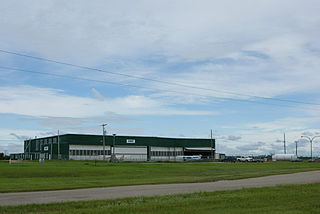
Portage la Prairie/Southport Airport is located adjacent to Portage la Prairie, Manitoba, Canada. It is operated by Southport Aerospace Centre Inc., a commercial-industrial centre. It was formerly Canadian Forces Base Portage la Prairie. It has been commercially operated since 1992.
Thicket Portage Airport is located 0.8 nautical miles west southwest of Thicket Portage, Manitoba, Canada.
Arcola Airport is located adjacent to Arcola, Saskatchewan, Canada. Burton Ag Air Ltd. operates a fixed base at the airport.
Cudworth Municipal Airport is located adjacent to Cudworth, Saskatchewan, Canada.
Key Lake Airport is a regional airport near the Key Lake mine in Saskatchewan, Canada.
Points North Landing Airport is a regional airport adjacent to Points North Landing in Saskatchewan, Canada.

Stony Rapids Airport is located adjacent to Stony Rapids, Saskatchewan, Canada.
Yorkton Municipal Airport is located 2.8 nautical miles north of Yorkton, Saskatchewan, Canada.
Wilkie is a town in the Canadian province of Saskatchewan, located at Section 5, Township 40, Range 19, west of the 3rd Meridian. The town is at the junctions of Highways 14, 29, and 784.
Highway 995, also known as Welcome Street, is a provincial highway in the far north region of the Canadian province of Saskatchewan. It is one of the few highways in Saskatchewan that is completely isolated from the other highways. Seasonal access is provided to Highway 905 by way of the Wollaston Lake Barge.
Highway 954 is a provincial highway in the Canadian province of Saskatchewan. It runs from Highway 26 on the north side of Goodsoil to a dead end at Northern Cross Resort on Lac des Îles within Meadow Lake Provincial Park. At the eastern end of the highway is the Goodsoil Airport. It is about 12.9 kilometres (8.0 mi) long.

The Rural Municipality of Arborfield No. 456 is a rural municipality (RM) in the Canadian province of Saskatchewan within Census Division No. 14 and SARM Division No. 4.
Highway 999 is a provincial highway in the far north region of the Canadian province of Saskatchewan. It is split in two sections and serves the small settlement of Camsell Portage and Charlot River Airport on the north side of Lake Athabasca. The western section of the highway is about 2 kilometres (1.2 mi) long and serves Camsell Portage, which is the northern-most settlement in Saskatchewan, and Camsell Portage Airport. The eastern section is about 12.3 kilometres (7.6 mi) long and runs from Charlot River Airport on the shore of Lake Athabasca east to Dam Lake. The highway provides access to the three Athabasca System Hydroelectric Stations.
Camsell Portage is a northern settlement of 5 people, located on the north-central shore of Lake Athabasca. The northern settlement is an unincorporated community in the Northern Saskatchewan Administration District.
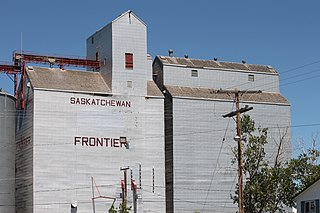
Frontier is a village in the Canadian province of Saskatchewan within the Rural Municipality of Frontier No. 19 and Census Division No. 4. Frontier is on Highway 18 and is served by the Frontier Airport located (3.7 km) south of the village.
Canadian Forces Base Portage la Prairie is a former military airport of the Royal Canadian Air Force (RCAF) located adjacent to Portage la Prairie, Manitoba, Canada. Today the airport is operated as Portage la Prairie/Southport Airport.
Cumberland Island, also known as Pine Island, is a small island in the Saskatchewan River Delta in the east-central region of the Canadian province of Saskatchewan. The Saskatchewan River Delta is one of the largest active inland deltas in North America. Cumberland Island is situated between Cumberland Lake to the north and the Saskatchewan River to the south. The Tearing River runs along the eastern edge of the island and Bigstone River along the western edge. The Bigstone River separates Cumberland Island from Spruce Island to the west. The island is in the Mid-Boreal Lowland region, which consists of mixed coniferous and deciduous forests of white and black spruce, jack pine, tamarack, trembling aspen, balsam poplar, and balsam fir.

