Cap-Saint-Jacques Nature Park

Last updated

Cap-Saint-Jacques Nature Park
Cap-Saint-Jacques.JPG
A path in the park
Montreal-blank.png
Red pog.svg
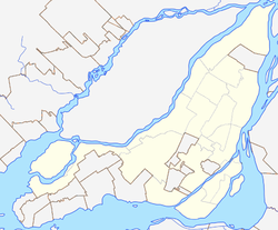
Location within Montreal
Type Nature park
Location Pierrefonds-Roxboro, Montreal, Quebec, Canada
Coordinates 45°27′58″N73°55′52″W / 45.4661°N 73.9311°W / 45.4661; -73.9311 [1]
Area302 hectares (750 acres)
Operated by City of Montreal
Opensunrise to sunset
StatusOpen all year
Public transit access STM Bus: 68
Website Official website

Cap-Saint-Jacques Nature Park is a large nature park in the Pierrefonds-Roxboro borough of Montreal, Quebec, Canada.

Contents

It is located in the West Island at the junction of the Lake of Two Mountains and the Rivière des Prairies. Situated on a peninsula, three quarters of the park is bordered by water. At 330 ha (820 acres), [2] it is the largest park in Montreal.

The land for the park was purchased by the City of Montreal on 15 February 1980 from the Congregation des Soeurs des Saints Noms de Jesus et de Marie. [3]

The park features a natural sand beach and an organic farm, which raises animals and grows organic produce. Farm activities are offered by the non profit D-Trois-Pierres. [4]

The park's bays are home to a variety of animals, including the map turtle. Environmental science activities are offered by the Groupe uni des éducateurs-naturalistes et professionnels en environnement (GUEPE). The park includes stands of silver birch and sugar maple, with a sugar shack where visitors can watch the production of maple syrup, in season. The park has 26 km (16 mi) of hiking trails and 32 km (20 mi) of trails for cross country skiing. [5]

The name "Cap St. Jacques" was written on maps as early as 1744. The land mass south of the (cape) of Cap St. Jacques is the Jacques Cartier electoral district. The French Wikipedia article conjectures the name comes from Jacques Bizard, but both Jacques Cartier and Jacques Bizard have not been named Saints. There is a street named "St. Jacques" in the city of Montreal dated 1672. There is also a land area called the Saint-Jacques Escarpment on the island of Montreal.

Plans

As of 2020, the City of Montreal has a plan to include the park into the future Grand Parc de l'Ouest. [6]

Related Research Articles

<span class="mw-page-title-main">Island of Montreal</span> Island in Quebec, Canada

The Island of Montreal is a large island in southwestern Quebec, Canada, that is the site of a number of municipalities, including most of the city of Montreal, and is the most populous island in Canada. It is the main island of the Hochelaga Archipelago at the confluence of the Saint Lawrence and Ottawa rivers.

<span class="mw-page-title-main">Trois-Rivières</span> City in Quebec, Canada

Trois-Rivières is a city in the Mauricie administrative region of Quebec, Canada, at the confluence of the Saint-Maurice and Saint Lawrence rivers, on the north shore of the Saint Lawrence River across from the city of Bécancour. It is part of the densely populated Quebec City–Windsor Corridor and is approximately halfway between Montreal and Quebec City. Trois-Rivières is the economic and cultural hub of the Mauricie region. The settlement was founded by French colonists on July 4, 1634, as the second permanent settlement in New France, after Quebec City in 1608.

<span class="mw-page-title-main">West Island</span> Settlements in Quebec, Canada

The West Island is the unofficial name given to the city, towns and boroughs at the western end of the Island of Montreal, in Quebec, Canada. It is generally considered to consist of the Lakeshore municipalities of Dorval, Pointe-Claire, and Beaconsfield, the municipalities of Kirkland, Dollard-des-Ormeaux, Baie-D'Urfé, Sainte-Anne-de-Bellevue, the village of Senneville, and two North Shore boroughs of the city of Montreal: Pierrefonds-Roxboro and L'Île-Bizard–Sainte-Geneviève.

<span class="mw-page-title-main">Île Bizard</span> Island in Montreal, Quebec, Canada

Île Bizard is an island near the Island of Montreal in the Hochelaga Archipelago region. It is one of the three populated islands within the city of Montreal, along with the Island of Montreal and Nuns' Island. The island is served by buses 207 and 407.

<span class="mw-page-title-main">L'Île-Bizard, Quebec</span> Former city in Quebec, Canada

L'Île-Bizard is a former municipality current borough located on Île Bizard, an island northwest of the Island of Montreal. It was originally incorporated as a municipality on 1 July 1855 as Paroisse de Saint-Raphael-de l'Ile-Bizard.

The 2000–2006 municipal reorganization in Quebec resulted in large-scale amalgamation of smaller municipalities in Quebec into larger cities. It was undertaken by one administration, and modified and partially undone by its successor.

<span class="mw-page-title-main">L'Île-Bizard–Sainte-Geneviève</span> Borough of Montreal in Quebec, Canada

L'Île-Bizard–Sainte-Geneviève is a borough (arrondissement) of the city of Montreal.

<span class="mw-page-title-main">Pierrefonds-Roxboro</span> Borough of Montreal in Quebec, Canada

Pierrefonds-Roxboro is a borough of the city of Montreal. It was created January 1, 2006, following the demerger of parts of the city.

This is a list of landmarks of Montreal.

<span class="mw-page-title-main">Jacques-Cartier National Park</span>

Jacques-Cartier National Park is a provincial park located 50 kilometres (31 mi) north of Quebec City. The park aims to protect wildlife in the Laurentian massif. It lies within the Eastern forest-boreal transition ecoregion.

<span class="mw-page-title-main">Mont-Saint-Bruno National Park</span>

Mont-Saint-Bruno Provincial Park is a small national park of Quebec located near the municipality of Saint-Bruno-de-Montarville, 15 kilometres (9.3 mi) to the east of Montréal on the south shore of the Saint Lawrence River. The park, with an area of 8.84 square kilometres (3.41 sq mi), notably includes Mont Saint-Bruno, one of the Monteregian Hills which peaks at 218 metres (715 ft). The mountain is shared with the Ski Mont Saint-Bruno ski resort, a quarry and a small Canadian Forces training camp. Despite its relatively small size, the mountain is known for its rich fauna and flora. Situated at the heart of the old signory of Montarville, its many lakes have permitted the construction and exploitation of many water mills, contributing to the region's economical success. A building from one of those mills, the "Vieux Moulin", still stands to this day and is used as a rest area for skiers and hikers in different seasons.

<span class="mw-page-title-main">Rapides du Cheval Blanc</span> Rapids in Laval, Quebec, Canada

The Rapides du Cheval Blanc, or White Horse Rapids, flow between the Island of Montreal, Pierrefonds-Roxboro and Sainte-Dorothée, Laval on the Rivière des Prairies in Quebec. The Rapides du Cheval Blanc also include a protected wooded area, a public city park adjacent to the rapids, and to a fault line underneath the area.

<span class="mw-page-title-main">Laurentides Wildlife Reserve</span> Wildlife reserve in Quebec, Canada

Réserve faunique des Laurentides, also known by its former name of parc des Laurentides, is a wildlife reserve in Quebec, Canada, located between Quebec City and the Saguenay–Lac-Saint-Jean region. This reserve is part of the network of wildlife reserves of Quebec (Canada) managed by the Ministry of Energy and Natural Resources (Quebec) and the Société des établissements de plein air du Québec. It is located halfway between Saguenay and Quebec.

<span class="mw-page-title-main">Saint Henri Square</span> Town square in Montreal, Canada

Saint Henri Square, known officially as Saint Henri Park ) is a town square in Montreal, Quebec, Canada. It is centrally located in the Saint Henri neighbourhood of the Le Sud-Ouest borough. The square is bordered by Saint Antoine Street West to the north, Agnes Street to the west, Place Guay to the south and Laporte Avenue to the east.

<span class="mw-page-title-main">Bois-de-l'Île-Bizard Nature Park</span> Large nature park in Montreal, Canada

Bois-de-l'Île-Bizard Nature Park is a large nature park in the L'Île-Bizard–Sainte-Geneviève borough of Montreal, Quebec, Canada.

Grand Parc de l'Ouest is a planned park along the north shore of the western part of Montreal, Quebec, Canada.

References

  1. "Parc régional du Cap-Saint-Jacques". Commission de toponymie du Québec. Retrieved 21 November 2020.
  2. "Parc-nature du Cap-Saint-Jacques" (in French). City of Montreal. Retrieved 16 November 2020.
  3. The North Shore News (14 February 1980). "MUC moving ahead on regional park purchases" . Retrieved 16 November 2020.
  4. "Cap-Saint-Jacques Natural Park Ecological Farm". D Trois Pierres. Retrieved 16 November 2020.
  5. "Montreal Seen: Cap Saint Jacques". Out There. Retrieved 16 November 2020.
  6. "Grand parc de l'Ouest". City of Montreal - Making Montreal. Retrieved 7 December 2020.