Casas Grandes | |
---|---|
Municipio libre (municipality) | |
Municipio de Casas Grandes | |
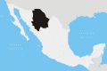
location within the state of Chihuahua | |
Coordinates(municipal seat): 30°22′31″N107°56′54″W / 30.37528°N 107.94833°W Coordinates: 30°22′31″N107°56′54″W / 30.37528°N 107.94833°W | |
Country | Mexico |
State | Chihuahua |
Settlement founded | 1661 |
Municipality created | 1820 |
Founded by | Captain Andrés Gracia |
Cabecera municipal (Municipal seat) | Casas Grandes |
localidades (localities) | Principal localities (2005 population)
|
Government election held July 1, 2007 | |
• Type | H. Ayuntamiento Municipal (municipal government) |
• Presidente Municipal | Dagoberto Quintana Cano (PAN) |
Area | |
• Municipio libre (municipality) | 3,719 km2 (1,436 sq mi) |
• Urban | 3.82 km2 (1.47 sq mi) |
Elevation | 1,480 m (4,860 ft) |
Population (2010) [2] | |
• Municipio libre (municipality) | 10,587 |
• Density | 2.8/km2 (7.4/sq mi) |
Time zone | UTC-7 ( Tiempo de la Montaña (Mountain Time)) |
• Summer (DST) | UTC-6 (Tiempo de la Montaña) |
códigos postales (postal codes) | 31850 through to 31863 |
Area code(s) | 636 |
INEGI state code | 08 |
INEGI municipality code | 013 |
Casas Grandes Municipality is located in the northern Mexican state of Chihuahua. The municipal seat is the town of Casas Grandes, Chihuahua.
The pre-Columbian archaeological zone Casas Grandes and its central site, after which the municipality is named, is located within the municipality's territory. The site of Casas Grandes, alternatively known as Paquimé, is one of the most significant pre-Columbian cultural and archaeological sites in the region of northwestern Mexico and the southwestern United States known in some archaeological contexts as the Oasisamerica culture area.
The municipality of Casas Grandes is situated in the northwestern sector of Chihuahua state, the largest state of Mexico by area. (Pueblo de) Casas Grandes, the municipal capital and its most populous localidad (locality or settlement), is approximately 359 kilometres (223 mi) to the northwest of the state's capital, the city of Chihuahua. Casas Grandes is bounded by the municipalities of Janos to the north, Galeana, Nuevo Casas Grandes and Madera, Chihuahua to the east, and Ignacio Zaragoza to the south. On its western flank Casas Grandes adjoins municipalities within the state of Sonora. [3]
As of 2010, the municipality had a total population of 10,587, [2] up from 8,413 as of 2005.
As of 2010, the town of Casas Grandes had a population of 5,256. [2] Other than the town of Casas Grandes, the municipality had 296 localities, the largest of which (with 2010 populations in parentheses) were: Juan Mata Ortíz (Pearson) (1,182) and Colonia Juárez (1,035), classified as rural. [2]
Asientos is a municipality and town in the Mexican state of Aguascalientes. It stands at 22°14′N102°05′W. The town of Asientos serves as the municipal seat for the surrounding municipality of Asientos.
San Francisco de los Romo is a municipality and city in the Mexican state of Aguascalientes. The city of San Francisco de los Romo serves as the municipal seat for the surrounding municipality of San Francisco de los Romo.
The municipality of Ensenada, with a land area of 52,482.40 km2 (20,263.57 sq mi) prior to San Quintín Municipality's secession from the municipality, is the one of the largest municipality in Mexico by area. The municipality previously took up 72.6% of the land area of Baja California but was home to only 14.7% of the population. It shares borders with Baja California's four other municipalities to the north and northeast as well as with San Quintín Municipality to the south. Its municipal seat is Ensenada, which lies near the northwest corner of the municipality.
Tecate is a municipality in the Mexican state of Baja California. Its municipal seat is located in the city of Tecate. According to the 2020 census, it had a population of 108,440 inhabitants. The municipality has an area of 3,079.0 km².
Playas de Rosarito Municipality is located in the northwestern part of the Mexican state of Baja California comprising part of the Tijuana metropolitan area. It lies just south of the city of Tijuana. Its municipal seat is the city of Rosarito. According to the 2020 census, the municipality had a population of 126,890 inhabitants. Its area is 513.32 km².
Chicomuselo is a municipio (municipality) in the Mexican state of Chiapas, and also the name of the municipality's largest settlement and the seat of the municipal government. The municipality has an area of 1,043 km².
Halachó Municipality is one of the 106 municipalities in the Mexican state of Yucatán containing (671.91 km2) of land and located roughly 68 km southwest of the city of Mérida.
Práxedis Gilberto Guerrero is the municipal seat of the municipality of Práxedis G. Guerrero in the northern Mexican state of Chihuahua.
The Telchac Pueblo Municipality is one of the 106 municipalities of the Mexican state of Yucatán. It is located to the north of the Yucatán Peninsula.
Villaflores Municipality is a municipio (municipality) in the state of Chiapas, southern Mexico, and the name of its largest settlement and seat of the municipal government. Situated in the Sierra Madre de Chiapas range, the municipality has an area of approximately 1232 km2 at an average elevation of 540m above mean sea level.
Práxedis G. Guerrero is one of the 67 municipalities of Chihuahua, in northern Mexico. The municipal seat lies at Práxedis G. Guerrero, Chihuahua. The municipality covers an area of 808.97 km² and stands on the US border close to Ciudad Juárez.
Pabellón de Arteaga is municipality in the Mexican state of Aguascalientes. It stands at 22°09′N102°16′W in the central part of the state. The city of Pabellón de Arteaga serves as its municipal seat. The municipality had a population of 41,862 and an area of 199.33 km². Its largest other town is named Emiliano Zapata.
Jesús María is a municipality in the Mexican state of Aguascalientes. It stands at 21°58′N102°21′W. As of 2010, the municipality had a total population of 99,590.
San Simón Almolongas is a town and municipality in Oaxaca in south-western Mexico. The municipality covers an area of km². It is part of the Miahuatlán District in the south of the Sierra Sur Region.
Tekom Municipality is a municipality in the Mexican state of Yucatán. Tekom is also the name of the municipality's largest settlement and seat of the municipal government. In the XII national census conducted by INEGI in 2000, Tekom municipality recorded a population of 2,660 inhabitants. In the intermediate census count undertaken by INEGI in 2005, the total municipal population was recorded as 2,933 inhabitants, 2,413 of whom spoke one of the recognised indigenous languages of Mexico.
Muna Municipality is one of the 106 municipalities in the Mexican state of Yucatán containing (270.81 km2) of land and is located roughly 50 km south of the city of Mérida.
Sacalum Municipality is one of the 106 municipalities in the Mexican state of Yucatán containing (205.66 km2) of land and is located roughly 75 km south of the city of Mérida.
Calotmul Municipality is one of the 106 municipalities in the Mexican state of Yucatán containing (361.50 km2) of land and is located roughly 185 kilometres (115 mi) east of the city of Mérida.
Cenotillo Municipality is one of the 106 municipalities in the Mexican state of Yucatán containing (614.43 km2) of land and is located roughly 115 kilometres (71 mi) east of the city of Mérida.
Tixcacalcupul Municipality is one of the 106 municipalities in the Mexican state of Yucatán containing (1,164.98 km2) of land and is located roughly 180 kilometres (110 mi) southeast of the city of Mérida.