Janos Municipality

Last updated
Janos
Puerto San Luis - panoramio (1).jpg
Motto(s): 
Primero México, Después México, Siempre México
(First Mexico, Then Mexico, Always Mexico)
Mexico Chihuahua Janos location map.svg
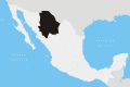
Location of Janos in Chihuahua
Mexico States blank map.svg
Red pog.svg
Janos
Janos
Coordinates: 30°53′16″N108°11′24″W / 30.88778°N 108.19000°W / 30.88778; -108.19000
CountryFlag of Mexico.svg  Mexico
State Chihuahua
Municipality Janos
Mission established1640
Presidio established1686
Municipality created1820
Founded byFranciscan missionaries
Named for Janos people
Government
   Municipal President Leonel Molina García (PRI)
Area
(municipality)
  Total6,930.50 km2 (2,675.88 sq mi)
Elevation
1,369 m (4,491 ft)
Population
 (2010)
  Total10,953
Postal code
31840
Area code 636
DemonymJanosense
Website http://www.janos.gob.mx

Janos is a municipality in the Mexican state of Chihuahua. It is located in the extreme northwest of Chihuahua, on the border with the state of Sonora and the U.S. states of Arizona & New Mexico. As of 2010, the municipality had a total population of 10,953. [1] The municipal seat is the town of Janos, Chihuahua, which shares its name with the municipality.

Contents

The El Berrendo/Antelope Wells border crossing is located in the municipality.

As of 2010, the town of Janos had a population of 2,738. [1] Other than the town of Janos, the municipality had 315 localities, the largest of which (with 2010 populations in parentheses) was: Monte Verde (Altamira) (1,087), classified as rural. [1]

The name "Janos" was given by the Janos people, the indigenous inhabitants of the area upon the arrival of the Spaniards. [2] The Janos were probably a sub-tribe or closely related to the Suma people. Neither the Janos nor the Suma survived contact and are now extinct. Franciscan missionaries originally built a mission in the location in 1640, under the name Soledad de Janos. The mission did not, however, survive a series of revolts by indigenous people and was replaced on 16 October 1686 by a military presidio under Gen. Juan Fernández de la Fuente. The presidio defended the area from attacks from Apache raiders until the municipality was established in 1820.

Towns and villages

The largest localities (cities, towns, and villages) are:

Name2010 Census Population
Janos 2,738
Monte Verde (Altamira)1,087
Fernández Leal885
Pancho Villa (La Morita)812
Tres Álamos670
Casa de Janos399
San Pedro336
Buenos Aires (Campo Uno)275
Altamirano 255
Buenos Aires (Campo Cuatro)213
Total Municipality10,953

Other settlements:

Adjacent municipalities and counties

Sister City

Janos Municipality has one sister city.: [3]

Notes

  1. 1 2 3 "Janos". Catálogo de Localidades. Secretaría de Desarrollo Social (SEDESOL). Retrieved 23 April 2014.
  2. The Janos and Jocomes people of northwestern Chihuahua were probably sub-tribes or closely related to the Suma Indians. Forbes, Jack Douglas (1957). "The Janos, Jocomes, Mansos and Suma Indians". New Mexico Historical Review. 32 (4): 319–334, page 322.
  3. "Archived copy". Archived from the original on 2017-04-15. Retrieved 2017-04-14.{{cite web}}: CS1 maint: archived copy as title (link)

Related Research Articles

<span class="mw-page-title-main">Sonora</span> State of Mexico

Sonora, officially Estado Libre y Soberano de Sonora, is one of the 31 states which, along with Mexico City, comprise the Federal Entities of Mexico. The state is divided into 72 municipalities; the capital city of which being Hermosillo, located in the center of the state. Other large cities include Ciudad Obregón, Nogales, San Luis Río Colorado, and Navojoa.

<span class="mw-page-title-main">Presidio County, Texas</span> County in Texas, United States

Presidio County is a county located in the U.S. state of Texas. As of the 2020 census, its population was 6,131. Its county seat is Marfa. The county was created in 1850 and later organized in 1875. Presidio County is in the Trans-Pecos region of West Texas and is named for the border settlement of Presidio del Norte. It is on the Rio Grande, which forms the Mexican border.

<span class="mw-page-title-main">Pimería Alta</span> Viceroyalty of New Spain area now called Pimeria Alta

The Pimería Alta was an area of the 18th century Sonora y Sinaloa Province in the Viceroyalty of New Spain, that encompassed parts of what are today southern Arizona in the United States and northern Sonora in Mexico.

<span class="mw-page-title-main">Presidio</span> Fort type

A presidio was a fortified base established by the Spanish Empire between the 16th and 18th centuries in areas in of their control or influence. The term is derived from the Latin word praesidium meaning protection or defense.

<span class="mw-page-title-main">Ojinaga Municipality</span> Municipality in the Mexican state of Chihuahua

Ojinaga Municipality is one of the 67 municipalities of Chihuahua, in northern Mexico. The municipal seat lies at Ojinaga, a rural bordertown on the U.S.-Mexico border. The municipality has an area of 9,500.50 km2.

The Opata are an indigenous people in Mexico. Opata territory, the "Opatería" in Spanish, encompasses the mountainous northeast and central part of the state of Sonora, extending to near the border with the United States. Historically, they included several subtribes, including the Eudeve, Teguima, and Jova peoples.

Tepehuanes Municipality is a municipality in the Mexican state of Durango. It is located in the North West of Durango at 25°12'"-26°25'"N 105°23'"-106°40'"W, at an elevation of about 1,830 meters (6000 feet).

<span class="mw-page-title-main">Cananea Municipality</span> Municipality in Sonora, Mexico

Cananea is a municipality in the northern portion of the Mexican state of Sonora, on the U.S. border. Its municipal seat is the city of Cananea, located at 30°58′55″N110°18′02″W.

The Suma were an Indigenous people of Aridoamerica. They had two branches, one living in the northern part of the Mexican state of Chihuahua and the other living near present-day El Paso, Texas. They were semi-nomadic hunter-gatherers who practiced little or no agriculture. The Suma merged with Apache groups and the mestizo population of northern Mexico, and are extinct as a distinct people.

El Berrendo is a town in the Mexican state of Chihuahua, located in Janos Municipality, directly across the U.S. border from Antelope Wells, New Mexico. According to the Population Census and Housing of 2010 from INEGI, there was only 1 inhabitant.

<span class="mw-page-title-main">Casas Grandes Municipality</span> Municipality in the Mexican state of Chihuahua

Casas Grandes Municipality is located in the northern Mexican state of Chihuahua. The municipal seat is the town of Casas Grandes, Chihuahua.

<span class="mw-page-title-main">Ascensión Municipality</span> Municipality in the Mexican state of Chihuahua

Ascensión is one of the 67 municipalities of Chihuahua, in northern Mexico. Ascensión City is the municipal seat. The municipality covers an area of 11,000.1 km2 (4,247.2 sq mi).

<span class="mw-page-title-main">San Francisco de Conchos Municipality</span> Municipality in the Mexican state of Chihuahua

San Francisco de Conchos is one of the 67 municipalities of Chihuahua, in northern Mexico. The municipal seat lies at San Francisco de Conchos. The municipality covers an area of 1,169.1 km².

<span class="mw-page-title-main">Meoqui Municipality</span> Municipality in the Mexican state of Chihuahua

Meoqui is one of the 67 municipalities of Chihuahua, in northern Mexico. The municipal seat lies at Pedro Meoqui. The municipality covers an area of 370 km², making it one of the smallest in the state but one of the most densely populated.

<span class="mw-page-title-main">Práxedis G. Guerrero Municipality</span> Municipality in the Mexican state of Chihuahua

Práxedis G. Guerrero is one of the 67 municipalities of Chihuahua, in northern Mexico. The municipal seat lies at Práxedis G. Guerrero, Chihuahua. The municipality covers an area of 808.97 km² and stands on the US border close to Ciudad Juárez.

<span class="mw-page-title-main">Chihuahua (state)</span> State of Mexico

Chihuahua, officially the Estado Libre y Soberano de Chihuahua, is one of the 31 states which, along with Mexico City, comprise the 32 federal entities of Mexico. It is located in the northwestern part of Mexico and is bordered by the states of Sonora to the west, Sinaloa to the southwest, Durango to the south, and Coahuila to the east. To the north and northeast, it shares an extensive border with the U.S. adjacent to the U.S. states of New Mexico and Texas. Its capital city is Chihuahua City; the largest city is Ciudad Juárez.

<span class="mw-page-title-main">Janos, Chihuahua</span> Town in the Mexican state of Chihuahua

Janos is a town located in the northern Mexican state of Chihuahua. It serves as the municipal seat of government for the surrounding Janos Municipality of the same name. As of 2010, the town of Janos had a population of 2,738. Janos was possibly the site of a Franciscan mission established about 1640 and destroyed by Indian attack in the 1680s. The Spanish established a fort in Janos in 1686 which became a key element in the Spanish attempt to suppress raids and attacks by the Apache people. Several hundred Apaches often lived near the presidio during the late 18th and early 19th centuries.

<span class="mw-page-title-main">History of Sonora</span>

This article details the history of Sonora. The Free and Sovereign State of Sonora is one of 31 states that, with the Federal District, comprise the 32 Federal Entities of Mexico. It is divided into 72 municipalities; the capital city is Hermosillo. Sonora is located in Northwest Mexico, bordered by the states of Chihuahua to the east, Baja California to the northwest and Sinaloa to the south. To the north, it shares the U.S.–Mexico border with the states of Arizona and New Mexico, and on the west has a significant share of the coastline of the Gulf of California.

<span class="mw-page-title-main">Apache–Mexico Wars</span> Conflicts involving Apache Indians in New Spain and Mexican Republic

The Apache–Mexico Wars, or the Mexican Apache Wars, refer to the conflicts between Spanish or Mexican forces and the Apache peoples. The wars began in the 1600s with the arrival of Spanish colonists in present-day New Mexico. War between the Mexicans and the Apache was especially intense from 1831 into the 1850s. Thereafter, Mexican operations against the Apache coincided with the Apache Wars of the United States, such as during the Victorio Campaign. Mexico continued to operate against hostile Apache bands as late as 1915.

<span class="mw-page-title-main">Colonia Díaz</span> Place in Chihuahua, Mexico

Colonia Díaz was the first permanent Mormon colony in Mexico, located along the Casas Grandes River in the northwest of the state of Chihuahua, Mexico. It is now a ghost town bordered on the east by the Sierra Madre Occidental. It was the nearest colony to the Mexico–United States border. By 1900, Díaz had grown to 623 inhabitants. In 1912, during the Mexican revolution, Colonia Díaz was intentionally burned and destroyed. Other neighboring colonies were established after Colonia Díaz in the late 19th century, of which only Colonia Dublán, sixty miles south of Colonia Díaz, and Colonia Juárez, 18 miles southeast of Colonia Dublán, are still inhabited.

References