Castle Pines (unincorporated area), Colorado

Last updated

Castle Pines, Colorado
Douglas County Colorado Incorporated and Unincorporated areas Castle Pines Highlighted.svg
Location in Douglas County and the State of Colorado
Coordinates: 39°27′43″N104°53′40″W / 39.46194°N 104.89444°W / 39.46194; -104.89444 Coordinates: 39°27′43″N104°53′40″W / 39.46194°N 104.89444°W / 39.46194; -104.89444
CountryFlag of the United States.svg  United States
State Flag of Colorado.svg  State of Colorado
County Douglas County
Government
  Type unincorporated community
Area
  Total10.2 sq mi (26.5 km2)
  Land10.2 sq mi (26.5 km2)
  Water0 sq mi (0 km2)
Elevation
[1]
6,558 ft (1,999 m)
Population
 (2010)
  Total3,614
  Density584.1/sq mi (224.8/km2)
Time zone UTC-7 (MST)
  Summer (DST) UTC-6 (MDT)
ZIP code
80108
FIPS code formerly 08-12387
GNIS feature ID formerly 1852840

Castle Pines is a former census-designated place (CDP) in Douglas County, Colorado, United States. The population was 3,614 at the 2010 census. [2]

Contents

On November 6, 2007, the northern portion of the Castle Pines CDP was incorporated as the City of Castle Pines North and the southern portion remained as Castle Pines.

On November 2, 2010, the City of Castle Pines North rename themselves to the City of Castle Pines and the Castle Pines CDP was renamed to Castle Pines Village as a result.

Geography

Castle Pines is located at 39°27′43″N104°53′40″W / 39.462003°N 104.894521°W / 39.462003; -104.894521 . [3]

According to the United States Census Bureau, the CDP had a total area of 10.2 square miles (26 km2), all of it land.

Demographics

Historical population
CensusPop.Note
2000 5,958
2010 3,614−39.3%
U.S. Decennial Census [2]

As of the census of 2000, [4] there were 5,958 people, 2,078 households, and 1,886 families residing in the CDP. The population density was 581.6 inhabitants per square mile (224.6/km2). There were 2,223 housing units at an average density of 217.0 per square mile (83.8/km2). The racial makeup of the CDP was 95.85% White, 0.89% African American, 0.34% Native American, 1.29% Asian, 0.57% from other races, and 1.06% from two or more races. Hispanic or Latino of any race were 3.16% of the population.

There were 2,078 households, out of which 44.0% had children under the age of 18 living with them, 86.5% were married couples living together, 3.0% had a female householder with no husband present, and 9.2% were non-families. 6.8% of all households were made up of individuals, and 1.0% had someone living alone who was 65 years of age or older. The average household size was 2.87 and the average family size was 3.01.

In the CDP, the population was spread out, with 29.5% under the age of 18, 2.9% from 18 to 24, 29.8% from 25 to 44, 33.5% from 45 to 64, and 4.3% who were 65 years of age or older. The median age was 40 years. For every 100 females there were 101.3 males. For every 100 females age 18 and over, there were 99.4 males.

The median income for a household in the CDP was $138,035, and the median income for a family was $140,816. Males had a median income of $93,254 versus $57,054 for females. The per capita income for the CDP was $70,456. About 0.3% of families and 0.3% of the population were below the poverty line, including none of those under the age of eighteen or sixty-five or over.

See also

Related Research Articles

<span class="mw-page-title-main">Douglas County, Colorado</span> County in Colorado, United States

Douglas County is a county located in the U.S. state of Colorado. As of the 2020 census, the population was 357,978. The county’s etymology is derived from the United States Senator Stephen A. Douglas. The county seat is Castle Rock.

<span class="mw-page-title-main">Northglenn, Colorado</span> City in Colorado, United States

The City of Northglenn is a home rule municipality located in Adams and Weld counties, Colorado, United States. Northglenn is a part of the Denver–Aurora–Lakewood, CO Metropolitan Statistical Area. As of the 2010 census the city's population was 35,789. It was built as a master planned community in 1959 by Jordon Perlmutter.

<span class="mw-page-title-main">Todd Creek, Colorado</span> Census Designated Place in Colorado, United States

Todd Creek is an unincorporated community and a census-designated place (CDP) located in and governed by Adams County, Colorado, United States. The CDP is a part of the Denver–Aurora–Lakewood, CO Metropolitan Statistical Area. The population of the Todd Creek CDP was 3,768 at the United States Census 2010. The Todd Creek Village Metropolitan District and the Todd Creek Village Park and Recreation District provide services to the community, which lies in ZIP Code 80602.

<span class="mw-page-title-main">Deer Trail, Colorado</span> Town in Colorado, United States

The Town of Deer Trail is a Statutory Town located in eastern Arapahoe County, Colorado, United States. The town population was 1,068 at the 2020 United States Census, a +95.60% increase since the 2010 United States Census. Deer Trail is a part of the Denver–Aurora–Lakewood, CO Metropolitan Statistical Area and the Front Range Urban Corridor. The town is situated along Interstate 70, approximately 55 miles (89 km) east of Denver.

<span class="mw-page-title-main">Foxfield, Colorado</span> Town in Colorado, United States

The Town of Foxfield is a statutory town located in Arapahoe County, Colorado, United States. The town population was 754 at the 2020 United States Census. Foxfield is a part of the Denver–Aurora–Lakewood, CO Metropolitan Statistical Area and the Front Range Urban Corridor. The town is bordered by the cities of Aurora and Centennial.

<span class="mw-page-title-main">Castle Pines, Colorado</span> City in Colorado, United States

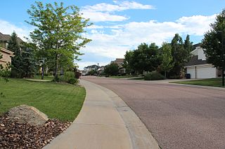
The City of Castle Pines is a home rule municipality located in Douglas County, Colorado, United States. The city population was 11,036 at the 2020 United States Census. Castle Pines is a part of the Denver–Aurora–Lakewood, CO Metropolitan Statistical Area and the Front Range Urban Corridor. The city is located north of the Town of Castle Rock and south of the City of Lone Tree, Colorado.

<span class="mw-page-title-main">Larkspur, Colorado</span> Town in Colorado, United States

Larkspur is a home rule municipality in Douglas County, Colorado, United States. The town population was 183 at the 2010 census, down from 234 at the 2000 census. Each year, on weekends in June, July and August, the Colorado Renaissance Festival is held in the hills just west of the town. The town is served by Larkspur Elementary School, a K-6 school in the Douglas County school district.

<span class="mw-page-title-main">Kiowa, Colorado</span> Town in Colorado, United States

Kiowa is a home rule municipality town and the county seat of Elbert County, Colorado, United States. The town population was 723 at the 2010 United States Census, up from 581 at the 2000 census.

<span class="mw-page-title-main">Dacono, Colorado</span> City in Colorado, United States

Dacono is a home rule municipality located in southwestern Weld County, Colorado, United States. The city population was 6,297 at the 2020 United States Census, an increase of +51.66% since the 2010 United States Census. Dacono is a part of the Greeley, CO Metropolitan Statistical Area and the Front Range Urban Corridor.

<span class="mw-page-title-main">Gilcrest, Colorado</span> Town in Colorado, United States

The Town of Gilcrest is a Statutory Town located in Weld County, Colorado, United States. The town population was 1,029 at the 2020 United States Census. Gilcrest is a part of the Greeley, CO Metropolitan Statistical Area and the Front Range Urban Corridor.

<span class="mw-page-title-main">Grover, Colorado</span> Town in Colorado, United States

The Town of Grover is a Statutory Town located in Weld County, Colorado, United States. The town population was 157 at the 2020 United States Census, a 14.60% increase since the 2010 United States Census. Grover is a part of the Greeley, CO Metropolitan Statistical Area and the Front Range Urban Corridor.

<span class="mw-page-title-main">Keenesburg, Colorado</span> Town in Colorado, United States

The Town of Keenesburg is a Statutory Town in Weld County, Colorado, United States. The population was 1127 at the 2010 United States Census.

<span class="mw-page-title-main">LaSalle, Colorado</span> Town in Colorado, United States

The Town of LaSalle is a Statutory Town in Weld County, Colorado, United States. The town population was 1,955 at the 2010 United States Census.

<span class="mw-page-title-main">Lochbuie, Colorado</span> Town in Colorado, United States

The Town of Lochbuie is a statutory town located in Weld and Adams counties in the U.S. state of Colorado. The town population was 4,726 at the 2010 United States Census.

<span class="mw-page-title-main">Milliken, Colorado</span> Town in Colorado, United States

Milliken is a statutory town in Weld County, Colorado, United States. The town population was 5,610 at the 2010 United States Census.

<span class="mw-page-title-main">Pierce, Colorado</span> Town in Colorado, United States

Pierce is a Statutory Town in Weld County, Colorado, United States. The population was 834 at the 2010 census. The town is a rural agricultural community located on the Colorado Eastern Plains along U.S. Highway 85 north of Greeley.

<span class="mw-page-title-main">Timber Pines, Florida</span> Census-designated place in Florida, United States

Timber Pines is a census-designated place (CDP) in Hernando County, Florida, United States. The population was 5,386 at the 2010 census.

<span class="mw-page-title-main">Pine Castle, Florida</span> Census-designated place in Florida, United States

Pine Castle is a census-designated place and unincorporated area in Orange County, Florida, United States. It is part of the Orlando–Kissimmee–Sanford, Florida Metropolitan Statistical Area.

<span class="mw-page-title-main">Clarks Hill, South Carolina</span> CDP in South Carolina, United States

Clarks Hill is a census-designated place (CDP) in McCormick County, South Carolina, United States. The population was 376 at the 2000 census.

<span class="mw-page-title-main">Castle Pines Village, Colorado</span> Census Designated Place in Colorado, United States

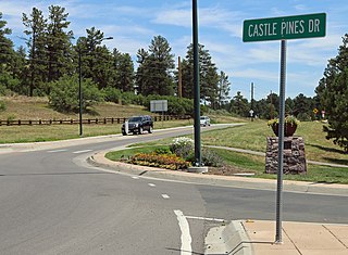
Castle Pines Village, also known as The Village at Castle Pines or The Village, is an unincorporated community and a census-designated place (CDP) located in and governed by Douglas County, Colorado, United States. The CDP is a part of the Denver–Aurora–Lakewood, CO Metropolitan Statistical Area. The population of the Castle Pines Village CDP was 3,614 at the United States Census 2010. Douglas County governs the unincorporated community and the Castle Pines Metropolitan District provides services. The Castle Rock post office serves the area.

References

  1. "US Board on Geographic Names". United States Geological Survey. October 25, 2007. Retrieved January 31, 2008.
  2. 1 2 "Colorado: 2010 Population and Housing Unit Counts" (PDF). United States Census Bureau. August 2012. p. 26 (Table 9). Retrieved January 15, 2021.
  3. "US Gazetteer files: 2010, 2000, and 1990". United States Census Bureau. February 12, 2011. Retrieved April 23, 2011.
  4. "American FactFinder". United States Census Bureau. Archived from the original on September 11, 2013. Retrieved 2008-01-31.