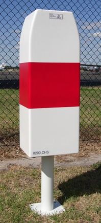
Ceilometer

Last updated
Laser ceilometer Single Lens Ceilometer.JPG
Laser ceilometer

A ceilometer is a device that uses a laser or other light source to determine the height of a cloud ceiling or cloud base. [1] Ceilometers can also be used to measure the aerosol concentration within the atmosphere. [2] A ceilometer that uses laser light is a type of atmospheric lidar (light detection and ranging) instrument. [3] [4]

Contents

Optical drum ceilometer

An optical drum ceilometer uses triangulation to determine the height of a spot of light projected onto the base of the cloud. [5] It consists essentially of a rotating projector, a detector, and a recorder. [6] The projector emits an intense beam of light above into the sky at an angle that varies with the rotation. The detector, which is located at a fixed distance from the projector, uses a photodetector pointing vertically. When it detects the projected light return from the cloud base, the instrument notes the angle and the calculation gives the height of clouds. [7]

Laser ceilometer

A laser ceilometer consists of a vertically pointing laser and a receiver in the same location. A laser pulse with a duration on the order of nanoseconds is sent through the atmosphere. As the beam travels through the atmosphere, tiny fractions of the light are scattered by aerosols. Generally, the size of the particles in question are similar in size to the wavelength of the laser. [8] This situation leads to Mie scattering. [9] A small component of this scattered light is directed back to the lidar receiver. [10] The timing of the received signal can be transformed into a spatial range, z, by using the speed of light. That is,

where c is the light speed in the air.

In this way, each pulse of laser light results in a vertical profile of aerosol concentration within the atmosphere. [11] [12] Generally, many individual profiles will be averaged together in order to increase the signal-to-noise ratio and average profiles are reported on a time scale of seconds. [13] The presence of clouds or water droplets leads to a very strong return signal compared to background levels, which allows for cloud heights to be easily identified. [14]

Since the instrument will note any returns, it is possible to locate any faint layer where it occurs, additionally to the cloud's base, by looking at the whole pattern of returned energy. Furthermore, the rate at which diffusion happens can be noted by the diminishing part returned to the ceilometer in clear air, giving the coefficient of extinction of the light signal. Using these data could give the vertical visibility and the possible concentration of air pollutants. This has been developed in research and could be applied for operational purpose. [15]

In New Zealand, MetService operates a network of laser ceilometers for cloud base measurements at commercial airports. These sensors are also used to map volcanic ash clouds to allow commercial air traffic to avoid damage caused by ash. The movement of volcanic ash has also been tracked from areas such as Iceland. [16] [17] [18]

Examination of the behavior of ceilometers under various cloud-cover conditions has led to the improvement of algorithms to avoid false readings. [19] Accuracy of measurement can be impacted by the limited vertical range and areal extent of a ceilometer's area of observation. [20] [21]

A common use of ceilometers is to monitor the cloud ceiling for airports. [22] [23] A study group from Montreal, Canada in 2013 recommended that ceilometers should be installed "close to the landing threshold" for aerodromes with precision approach runways, but also considered their location "at the middle marker or at an equivalent distance" to be acceptable. [24]

Hazards

Ceilometers that use visible light can sometimes be fatal to birds, as the animals become disoriented by the light beams and suffer exhaustion and collisions with other birds and structures. [25] In the worst recorded ceilometer non-laser light beam incident, approximately 50,000 birds from 53 different species died at Warner Robins Air Force Base in the United States during one night in 1954. [26]

Laser ceilometers use invisible lasers to observe the cloud base. Using optical instruments such as binoculars near ceilometers is not recommended, because lenses in instruments could concentrate the beam and damage one's eyes. [27] [28]

See also

Related Research Articles

<span class="mw-page-title-main">Lidar</span> Method of spatial measurement using laser

Lidar is a method for determining ranges by targeting an object or a surface with a laser and measuring the time for the reflected light to return to the receiver. Lidar may operate in a fixed direction or it may scan multiple directions, in which case it is known as lidar scanning or 3D laser scanning, a special combination of 3-D scanning and laser scanning. Lidar has terrestrial, airborne, and mobile applications.

<span class="mw-page-title-main">Millimeter cloud radar</span> Weather radar tuned to cloud detection

Millimeter-wave cloud radars, also denominated cloud radars, are radar systems designed to monitor clouds with operating frequencies between 24 and 110 GHz. Accordingly, their wavelengths range from 1 mm to 1.11 cm, about ten times shorter than those used in conventional S band radars such as NEXRAD.

<span class="mw-page-title-main">ADM-Aeolus</span> Wind-measuring satellite

Aeolus, or, in full, Atmospheric Dynamics Mission-Aeolus (ADM-Aeolus), was an Earth observation satellite operated by the European Space Agency (ESA). It was built by Airbus Defence and Space, launched on 22 August 2018, and re-entered the atmosphere over Antarctica in a controlled manner and burned up on 28 July 2023. ADM-Aeolus was the first satellite with equipment capable of performing global wind-component-profile observation and provided much-needed information to improve weather forecasting. Aeolus was the first satellite capable of observing what the winds are doing on Earth, from the surface of the planet and into the stratosphere 30 km high.

<span class="mw-page-title-main">Meteorological instrumentation</span> Measuring device used in meteorology

Meteorological instruments, including meteorological sensors, are the equipment used to find the state of the atmosphere at a given time. Each science has its own unique sets of laboratory equipment. Meteorology, however, is a science which does not use much laboratory equipment but relies more on on-site observation and remote sensing equipment. In science, an observation, or observable, is an abstract idea that can be measured and for which data can be taken. Rain was one of the first quantities to be measured historically. Two other accurately measured weather-related variables are wind and humidity. Many attempts had been made prior to the 15th century to construct adequate equipment to measure atmospheric variables.

<span class="mw-page-title-main">Outline of meteorology</span> Overview of and topical guide to meteorology

The following outline is provided as an overview of and topical guide to the field of Meteorology.

<span class="mw-page-title-main">Chesapeake Light</span> Lighthouse in Virginia, United States

Chesapeake Light is an offshore lighthouse marking the entrance to the Chesapeake Bay. The structure was first marked with a lightship in the 1930s, and was later replaced by a "Texas Tower" in 1965. The lighthouse was eventually automated and was used for supporting atmospheric measurement sites for NASA and NOAA. Due to deteriorating structural conditions, the lighthouse was deactivated in 2016. At the time, it was the last remaining "Texas Tower" still in use due to obsolescence.

The CLidar is a scientific instrument used for measuring particulates (aerosols) in the lower atmosphere. CLidar stands for camera lidar, which in turn is a portmanteau of "light" and "radar". It is a form of remote sensing and used for atmospheric physics.

<span class="mw-page-title-main">EarthCARE</span>

EarthCARE is a planned joint European/Japanese satellite, the sixth of ESA's Earth Explorer Programme. The main goal of the mission is the observation and characterization of clouds and aerosols as well as measuring the reflected solar radiation and the infrared radiation emitted from Earth's surface and atmosphere.

ICESat-2, part of NASA's Earth Observing System, is a satellite mission for measuring ice sheet elevation and sea ice thickness, as well as land topography, vegetation characteristics, and clouds. ICESat-2, a follow-on to the ICESat mission, was launched on 15 September 2018 onboard Delta II as the final flight from Vandenberg Air Force Base in California, into a near-circular, near-polar orbit with an altitude of approximately 496 km (308 mi). It was designed to operate for three years and carry enough propellant for seven years. The satellite orbits Earth at a speed of 6.9 kilometers per second (4.3 mi/s).

Ground-based, flight-based, or satellite-based remote sensing instruments can be used to measure properties of the planetary boundary layer, including boundary layer height, aerosols and clouds. Satellite remote sensing of the atmosphere has the advantage of being able to provide global coverage of atmospheric planetary boundary layer properties while simultaneously providing relatively high temporal sampling rates. Advancements in satellite remote sensing have provided greater vertical resolution which enables higher accuracy for planetary boundary layer measurements.

<span class="mw-page-title-main">Cloud Aerosol Transport System</span>

The Cloud Aerosol Transport System (CATS) was a light detection and ranging remote sensing instrument designed to measure the location, composition and distribution of pollution, dust, smoke, aerosols and other particulates in the atmosphere. CATS was installed on the Kibo module of the International Space Station and was expected to run for at least six months, and up to three years.

<span class="mw-page-title-main">Aerosol mass spectrometry</span> Application of mass spectrometry to aerosol particles

Aerosol mass spectrometry is the application of mass spectrometry to the analysis of the composition of aerosol particles. Aerosol particles are defined as solid and liquid particles suspended in a gas (air), with size range of 3 nm to 100 μm in diameter and are produced from natural and anthropogenic sources, through a variety of different processes that include wind-blown suspension and combustion of fossil fuels and biomass. Analysis of these particles is important owing to their major impacts on global climate change, visibility, regional air pollution and human health. Aerosols are very complex in structure, can contain thousands of different chemical compounds within a single particle, and need to be analysed for both size and chemical composition, in real-time or off-line applications.

Atmospheric lidar is a class of instruments that uses laser light to study atmospheric properties from the ground up to the top of the atmosphere. Such instruments have been used to study, among other, atmospheric gases, aerosols, clouds, and temperature.

Global Ecosystem Dynamics Investigation (GEDI, pronounced ) is a NASA mission to measure how deforestation has contributed to atmospheric CO2 concentrations. A full-waveform LIDAR was attached to the International Space Station to provide the first global, high-resolution observations of forest vertical structure. This will allow scientists to map habitats and biomass, particularly in the tropics, providing detail on the Earth's carbon cycle.

<span class="mw-page-title-main">Space-based measurements of carbon dioxide</span> Used to help answer questions about Earths carbon cycle

Space-based measurements of carbon dioxide are used to help answer questions about Earth's carbon cycle. There are a variety of active and planned instruments for measuring carbon dioxide in Earth's atmosphere from space. The first satellite mission designed to measure CO2 was the Interferometric Monitor for Greenhouse Gases (IMG) on board the ADEOS I satellite in 1996. This mission lasted less than a year. Since then, additional space-based measurements have begun, including those from two high-precision satellites. Different instrument designs may reflect different primary missions.

<span class="mw-page-title-main">North Atlantic Aerosols and Marine Ecosystems Study</span>

The North Atlantic Aerosols and Marine Ecosystems Study (NAAMES) was a five-year scientific research program that investigated aspects of phytoplankton dynamics in ocean ecosystems, and how such dynamics influence atmospheric aerosols, clouds, and climate. The study focused on the sub-arctic region of the North Atlantic Ocean, which is the site of one of Earth's largest recurring phytoplankton blooms. The long history of research in this location, as well as relative ease of accessibility, made the North Atlantic an ideal location to test prevailing scientific hypotheses in an effort to better understand the role of phytoplankton aerosol emissions on Earth's energy budget.

<span class="mw-page-title-main">Julia Schmale</span> German atmospheric chemist

Julia Yvonne Schmale is a German environmental scientist. She is a specialist in the micro-physical makeup of the atmosphere, in particular aerosols and their interaction with clouds. She is a professor at EPFL and the head of the Extreme Environments Research Laboratory (EERL). She is a participant in the Multidisciplinary drifting Observatory for the Study of Arctic Climate (MOSAiC) expeditions.

<i>Earth Science Decadal Survey</i> Decadal science surveys

The Earth Science Decadal Survey is a publication of the United States National Research Council that identifies key research priorities in the field of Earth Sciences with a focus on remote sensing. It is written and released at the request of three United States government agencies: the National Aeronautics and Space Administration (NASA), the National Oceanic and Atmospheric Administration (NOAA) and the U.S. Geological Survey (USGS). The survey is produced by the Committee on the Decadal Survey for Earth Science and Applications from Space (ESAS) of the National Academies of Sciences, Engineering and Medicine (NASEM) Space Studies Board, Division on Engineering and Physical Sciences. Agencies like NASA use the recommendations from the decadal survey to prioritize funding for specific types of scientific research projects.

<span class="mw-page-title-main">Delphine Farmer</span> Canadian chemist

Delphine Farmer is a Canadian chemist who is a professor at the Colorado State University. Her research considers the development of scientific instruments for atmospheric science. She was awarded the American Geophysical Union Atmospheric Sciences Ascent Award in 2022.

Hugh Coe is a British atmospheric physicist, currently Head of Atmospheric Sciences and Professor of Atmospheric Composition at the University of Manchester. His research investigates the physics and chemistry of atmospheric aerosols, including their role in climate change and air pollution.

References

  1. National Weather Service Glossary. The National Oceanic and Atmospheric Administration. 16 November 2012. p. 60. ISBN   978-1-300-41402-5 . Retrieved 28 December 2021.
  2. Khare, Neloy (20 August 2021). Understanding Present and Past Arctic Environments: An Integrated Approach from Climate Change Perspectives. Elsevier. p. 459. ISBN   978-0-12-823078-7 . Retrieved 28 December 2021.
  3. Emeis, Stefan (8 September 2010). Surface-Based Remote Sensing of the Atmospheric Boundary Layer. Springer Science & Business Media. ISBN   978-90-481-9340-0 . Retrieved 28 December 2021.
  4. Nadolski, Vickie L., ed. (1998). Automated Surface Observing System (ASOS) User's Guide (PDF). Automated Surface Observing System (ASOS) User’s Guide National Oceanic and Atmospheric Administration, United States Navy.
  5. Lipták, Béla G.; Venczel, Kriszta (25 November 2016). Measurement and Safety: Volume I. CRC Press. p. 1570. ISBN   978-1-4987-2766-2 . Retrieved 28 December 2021.
  6. "15+ Weather Forecast Instruments And Inventions That Helped Define How We Predict the Weather". interestingengineering.com. 23 March 2020. Retrieved 28 December 2021.
  7. "Automated Cloud Base and Visibility Measurement". SKYbrary Aviation Safety. 29 December 2020. Retrieved 28 December 2021.
  8. "Cloudbase sensors". Observator. Retrieved 28 December 2021.
  9. He Junfeng, 何俊峰; Liu Wenqing, 刘文清; Zhang Yujun, 张玉钧; Chen Zhenyi, 陈臻懿; Ruan Jun, 阮俊; Li Sheng, 李胜 (2010). "Design and Test of Mie Scattering Laser Ceilometer Transmitter". Applied Laser. 30 (4): 333–339. doi:10.3788/AL20103004.0333 . Retrieved 28 December 2021.
  10. Young, Stuart A (2007). "INTERPRETATION OF THE MINILIDAR DATA RECORDED AT CAPE GRIM 1998 – 2000". BASELINE ATMOSPHERIC PROGRAM (AUSTRALIA) 2005-2006 (PDF). Australian Bureau of Meteorology and CSIRO Marine and Atmospheric Research. pp. 15–24. Retrieved 28 December 2021.
  11. Madonna, F.; Amato, F.; Vande Hey, J.; Pappalardo, G. (29 May 2015). "Ceilometer aerosol profiling versus Raman lidar in the frame of the INTERACT campaign of ACTRIS" (PDF). Atmospheric Measurement Techniques. 8 (5): 2207–2223. Bibcode:2015AMT.....8.2207M. doi: 10.5194/amt-8-2207-2015 . Retrieved 28 December 2021.
  12. Goldsmith, J. E. M.; Blair, Forest H.; Bisson, Scott E.; Turner, David D. (20 July 1998). "Turn-key Raman lidar for profiling atmospheric water vapor, clouds, and aerosols". Applied Optics. 37 (21): 4979–4990. Bibcode:1998ApOpt..37.4979G. doi:10.1364/AO.37.004979. ISSN   2155-3165. PMID   18285967 . Retrieved 28 December 2021.
  13. Heese, B.; Flentje, H.; Althausen, D.; Ansmann, A.; Frey, S. (20 December 2010). "Ceilometer lidar comparison: backscatter coefficient retrieval and signal-to-noise ratio determination". Atmospheric Measurement Techniques. 3 (6): 1763–1770. Bibcode:2010AMT.....3.1763H. doi: 10.5194/amt-3-1763-2010 . ISSN   1867-1381 . Retrieved 28 December 2021.
  14. Li, Dingdong; Wu, Yonghua; Gross, Barry; Moshary, Fred (11 September 2021). "Capabilities of an Automatic Lidar Ceilometer to Retrieve Aerosol Characteristics within the Planetary Boundary Layer". Remote Sensing. 13 (18): 3626. Bibcode:2021RemS...13.3626L. doi: 10.3390/rs13183626 .
  15. Lee, Junhong; Hong, Je-Woo; Lee, Keunmin; Hong, Jinkyu; Velasco, Erik; Lim, Yong Jae; Lee, Jae Bum; Nam, Kipyo; Park, Jihoon (1 September 2019). "Ceilometer Monitoring of Boundary-Layer Height and Its Application in Evaluating the Dilution Effect on Air Pollution". Boundary-Layer Meteorology. 172 (3): 435–455. Bibcode:2019BoLMe.172..435L. doi: 10.1007/s10546-019-00452-5 . ISSN   1573-1472. S2CID   164390037.
  16. (5 pages) IAVWOPSG.8.WP.024.5.en.docx INTERNATIONAL AIRWAYS VOLCANO WATCH OPERATIONS GROUP (IAVWOPSG) EIGHTH MEETING Melbourne, Australia, 17 to 20 February 2014 (PDF). International Civil Aviation Organization. 2014. Retrieved 28 December 2021.
  17. Flentje, H.; Claude, H.; Elste, T.; Gilge, S.; Köhler, U.; Plass-Dülmer, C.; Steinbrecht, W.; Thomas, W.; Werner, A.; Fricke, W. (26 October 2010). "The Eyjafjallajökull eruption in April 2010 – detection of volcanic plume using in-situ measurements, ozone sondes and lidar-ceilometer profiles". Atmospheric Chemistry and Physics. 10 (20): 10085–10092. Bibcode:2010ACP....1010085F. doi: 10.5194/acp-10-10085-2010 . ISSN   1680-7316 . Retrieved 28 December 2021.
  18. Gasteiger, J.; Groß, S.; Freudenthaler, V.; Wiegner, M. (11 March 2011). "Volcanic ash from Iceland over Munich: mass concentration retrieved from ground-based remote sensing measurements". Atmospheric Chemistry and Physics. 11 (5): 2209–2223. Bibcode:2011ACP....11.2209G. doi: 10.5194/acp-11-2209-2011 . ISSN   1680-7316. S2CID   55043157.
  19. Martucci, Giovanni; Milroy, Conor; O’Dowd, Colin D. (1 February 2010). "Detection of Cloud-Base Height Using Jenoptik CHM15K and Vaisala CL31 Ceilometers". Journal of Atmospheric and Oceanic Technology. 27 (2): 305–318. Bibcode:2010JAtOT..27..305M. doi: 10.1175/2009JTECHA1326.1 . ISSN   0739-0572. S2CID   122654074.
  20. Wagner, Timothy J.; Kleiss, Jessica M. (1 July 2016). "Error Characteristics of Ceilometer-Based Observations of Cloud Amount". Journal of Atmospheric and Oceanic Technology. 33 (7): 1557–1567. Bibcode:2016JAtOT..33.1557W. doi: 10.1175/JTECH-D-15-0258.1 . ISSN   0739-0572.
  21. Maturilli, Marion; Ebell, Kerstin (15 August 2018). "Twenty-five years of cloud base height measurements by ceilometer in Ny-Ålesund, Svalbard". Earth System Science Data. 10 (3): 1451–1456. Bibcode:2018ESSD...10.1451M. doi: 10.5194/essd-10-1451-2018 . ISSN   1866-3508. S2CID   59445246.
  22. "How Cloud Ceilings Are Reported". www.boldmethod.com. Retrieved 28 December 2021.
  23. "AWI Model 8339 Laser Ceilometer Certified by FAA - All Weather Inc". All Weather Inc. Retrieved 28 December 2021.
  24. (3 pages) AMOFSG.10.SN.012.5.en.docx AERODROME METEOROLOGICAL OBSERVATION AND FORECAST STUDY GROUP (AMOFSG) TENTH MEETING Montréal, 17 to 19 June 2013 (PDF). AMOFSG. 2013. Retrieved 28 December 2021.
  25. Allen, Nick (September 15, 2010). "10,000 birds trapped in Twin Towers memorial light". The Telegraph. Retrieved 28 December 2021.
  26. Johnston, D; Haines (1957). "Analysis of Mass Bird Mortality in October, 1954". The Auk. 74 (4): 447. doi: 10.2307/4081744 . JSTOR   4081744.
  27. "Vaisala Ceilometer CL31 User'S Guide" (PDF). www.iag.co.at. Archived from the original (PDF) on 2015-04-02. Retrieved 2015-04-02.
  28. Gaumet, J. L.; Heinrich, J. C.; Cluzeau, M.; Pierrard, P.; Prieur, J. (1 February 1998). "Cloud-Base Height Measurements with a Single-Pulse Erbium-Glass Laser Ceilometer". Journal of Atmospheric and Oceanic Technology. 15 (1): 37–45. Bibcode:1998JAtOT..15...37G. doi: 10.1175/1520-0426(1998)015<0037:CBHMWA>2.0.CO;2 . ISSN   0739-0572.