Central Manitoulin | |
|---|---|
| Municipality of Central Manitoulin | |
 Aerial view of Central Manitoulin with Providence Bay Beach in the foreground. | |
 Central Manitoulin  Central Manitoulin | |
| Coordinates: 45°43′N82°12′W / 45.717°N 82.200°W | |
| Country | Canada |
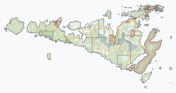
| Province | Ontario |
| District | Manitoulin |
| Incorporated | May 1, 1998 |
| Government | |
| • Reeve | Richard Stephens |
| • Federal riding | Sudbury East—Manitoulin—Nickel Belt |
| • Prov. riding | Algoma—Manitoulin |
| Area | |
| • Land | 427.61 km2 (165.10 sq mi) |
| Population (2021) [1] | |
• Total | 2,235 |
| • Density | 5.2/km2 (13/sq mi) |
| Time zone | UTC-5 (EST) |
| • Summer (DST) | UTC-4 (EDT) |
| Postal Code FSA | P0P |
| Area code | 705 |
| Website | www |
Central Manitoulin is a township in the Canadian province of Ontario. It is located on Manitoulin Island and in Manitoulin District.
Contents
The Township of Central Manitoulin was formed on May 1, 1998, through the annexation of the unorganized geographic township of Sandfield by Carnarvon Township. [2] Carnarvon Township was incorporated in 1871, and named after Henry Herbert, 4th Earl of Carnarvon. [3]

