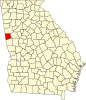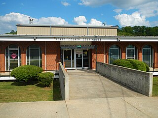
Heard County is a county located in the west central portion of the U.S. state of Georgia. At the 2020 census, the population was 11,412, down from 11,834 in 2010. The county seat is Franklin. The county was created on December 22, 1830.
Jackson's Gap is a town in Tallapoosa County, Alabama, United States. It incorporated in 1980. At the 2010 census the population was 828, up from 761.

Roopville is a town in Carroll County, Georgia, United States. The population was 231 in 2020, up from 218 at the 2010 census.

Temple is a city in Carroll and Haralson counties in the U.S. state of Georgia. The population was 5,089 at the 2020 census, up from 4,228 in 2010, a 20.36% increase.

Tyrone is a town in Fayette County, Georgia, United States. The population was 7,658 in 2020. The estimated population in 2018 was 7,388. It is a part of the Atlanta metropolitan area.

Gibson is a city and the county seat of Glascock County, Georgia, United States, and is home to the Glascock County Courthouse, a National Register of Historic Places listed site. The population was 663 at the 2010 census, and 630 in 2020.

Buchanan is a city and the county seat of Haralson County, Georgia, United States. The population was 1,104 at the 2010 census, up from 941 at the 2000 census.

Tallapoosa is a city in Haralson County, Georgia. The population was 3,170 at the 2010 census, up from 2,789 at the 2000 census.

Ephesus is a city in Heard County, Georgia, United States. The city was founded as "Loftin", and was incorporated as "Ephesus" in 1964, after the local church and school, which had been named for the biblical city of Ephesus in present-day Turkey. The population was 471 in 2020.

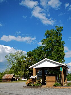
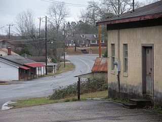
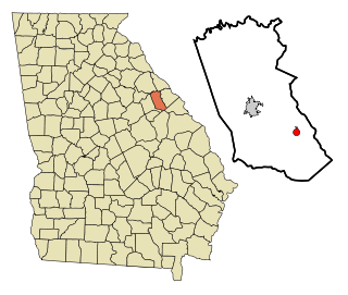
Franklin is a city in Heard County, Georgia, United States. The population was 950 in 2020. Franklin is the county seat of Heard County. The city is named after Benjamin Franklin.

Hampton is a city in southwestern Henry County, Georgia, United States. The population as of the 2020 census was 8,368. It is a southeastern suburb in the Atlanta metropolitan area.

Shady Dale is a town in Jasper County, Georgia, United States. The population was 252 in 2020.

Gray is a city in Jones County, Georgia, United States. The population was 3,276 at the 2010 census, up from 1,811 at the 2000 census. In 2020, its population was 3,436. The city is the county seat of Jones County. It is part of the Macon metropolitan area.

Cadwell is a town in Laurens County, Georgia, United States. The population was 381 in 2020.

Lincolnton is a city and the county seat of Lincoln County, Georgia, United States. The population was 1,480 at the 2020 census. It contains numerous houses and historic districts listed on the National Register of Historic Places. Both the city and the county were named for General Benjamin Lincoln, who served in the Continental Army during the American Revolution.
Dearing is a town in McDuffie County, Georgia, United States. The population was 529 at the 2020 census. It is part of the Augusta metropolitan area.
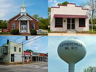
Luthersville is a city in Meriwether County, Georgia, United States. The population was 776 at the 2020 census, down from 874 in 2010.

Buckhead is a town in Morgan County, Georgia, United States. As of the 2020 census, the town had a population of 194.

Rutledge is a city in Morgan County, Georgia, United States. Founded in 1871, the city had a population of 871 at the 2020 census, up from 781 in 2010.

Deepstep is a town in Washington County, Georgia, United States. The population was 117 in 2020.