
Route 129 is a 34.08-mile-long (54.85 km) east–west Massachusetts state route that runs from Route 4 and Route 110 in Chelmsford to Route 114 in Marblehead. Along the way it intersects several major highways including U.S. Route 3 in Chelmsford, Interstate 93 (I-93) in Wilmington, I-95 and Route 128 in Wakefield, and US 1 in Saugus and Lynnfield.

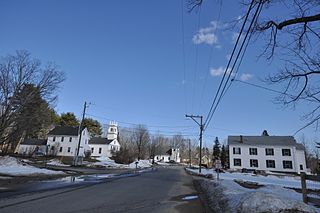
North Billerica is an unincorporated village of the town of Billerica, Massachusetts, United States, one of the nine sections (hamlets) that make up the Town of Billerica. It is the home to Faulkner and Talbot mills and the North Billerica Train Depot. The Middlesex Canal was built through the village in 1783 and the Boston and Lowell Railroad was put through in the 1840s.

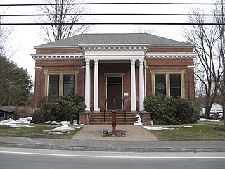
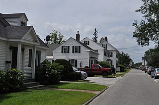
The Fiske House is a historic house located at 1 Billerica Road in Chelmsford Center, Massachusetts, US.

The Montague Center Historic District encompasses the well-preserved 19th century village center of Montague, Massachusetts. Montague Center, one of the town's five villages, is the civic heart of the town, and was also an active industrial area in the 19th century. The district was listed on the National Register of Historic Places in 2001.

The Hadley Center Historic District is an expansive, 2,500-acre (1,000 ha) historic district encompassing the village center of Hadley, Massachusetts. When it was first listed on the National Register of Historic Places in 1977, the district encompassed the town green and 17 buildings that faced it, at the junction of Russell Street and Middle Street. The district was expanded significantly in 1994, adding more than 400 buildings representative of the village's growth from colonial days into the first decades of the 20th century. This expansion encompasses the entirety of a tongue of land extending west from East Street and bounded by a bend in the Connecticut River, which separates Hadley from Northampton. Its oldest property, the Samuel Porter House on West Street, was built in 1713.
The Southampton Center Historic District encompasses the densely built center of the otherwise predominantly rural town of Southampton, Massachusetts. The district extends from Fomer Road in the south, along High Street and College Highway to Maple Street, and includes a line of houses along East Street from College to Elm. This area is the historic heart of the town, being first laid out in the 1730s. The district includes, in addition to a number of 18th- and 19th-century residences, the town's only church, the town hall, and the old public library. The district was listed on the National Register of Historic Places in 1991.

Boxborough Old Town Center is a historic district encompassing the historic center of Boxborough, Massachusetts. It consists of a cluster of properties that lie primarily along Hill Road, extending from point a short way north of its junction with Schoolhouse Lane to a bend in road just south Middle Street. The 52 contributing properties range in date from the 1770s to the early 20th century, spanning much of the town's history. The town was bypassed by significant economic development in the 19th century, and has retained much of its rural charm, despite growing suburbanization in the second half of the 20th century. This particular area constituted the civic heart of the town until about 1900, when the current town hall was built in a more central location. It includes the town's oldest cemetery, adjacent to the site of its first meeting house. It also has one the town's five surviving one-room schoolhouses, including a privy which was used into the mid-20th century. The district was listed on the National Register of Historic Places in 2006.

The Marlborough Center Historic District is a historic district encompassing the civic and commercial heart of Marlborough, Massachusetts. It is centered on a stretch of Main Street between Mechanic Street to the west and Bolton Street to the east, and includes properties on adjacent streets. The center is reflective of the city's prosperity as an industrial center from the mid-19th century to the mid-20th century. The district was listed on the National Register of Historic Places in 1998.

The Common Historic District is a historic district encompassing the civic and institutional heart of Reading, Massachusetts. The district is centered on the town common, at the intersection of Main and Salem Streets. The common has been communally owned since at least 1737, with the original burying ground to the north. In 1769 the area's first meeting house was built, giving the area a sense of identity separate from portions of Reading that would later be set off as Wakefield and North Reading. Since then the area has become a focal point for religious and civic institutions in the town.

The Common District encompasses the main civic center of Wakefield, Massachusetts. It is centered on the historic town common, just south of Lake Quannapowitt, which was laid in 1644, when it became the heart of Old Reading. The area was separated from Reading as South Reading in 1818, and renamed Wakefield in 1868. The 25 acre district includes the buildings that line the common on Common Street and Main Street, which include the town hall, public library, YMCA, post office, and several churches. It was listed on the National Register of Historic Places in 1990.

The Brookline Town Green Historic District encompasses the historic colonial heart of the town of Brookline, Massachusetts. Centered on a stretch of Walnut Street between Warren and Chestnut Streets, this area is where the town's first colonial meeting house and cemetery were laid out, and was its center of civic life until the early 19th century. The district was listed on the National Register of Historic Places in 1980.

The Amherst Village Historic District encompasses the historic village center of Amherst, New Hampshire. Centered on the town's common, which was established about 1755, Amherst Village is one of the best examples of a late-18th to early-19th century New England village center. It is roughly bounded on the north by Foundry Street and on the south by Amherst Street, although it extends along some roads beyond both. The western boundary is roughly Davis Lane, the eastern is Mack Hill Road, Old Manchester Road, and Court House Road. The district includes the Congregational Church, built c. 1771-74, and is predominantly residential, with a large number of Georgian, Federal, and Greek Revival houses. Other notable non-residential buildings include the Farmer's Bank, a Federal-style brick building built in 1806, and the Amherst Brick School, a brick Greek Revival structure that has served as the School Administrative Unit 39 offices since 1997.

The Monson Center Historic District is a historic district encompassing the historic 19th century economic and civic heart of Monson, Massachusetts, a small town in eastern Hampden County. The district was listed on the National Register of Historic Places in 1991.

The Charlestown Main Street Historic District encompasses the historic heart of Charlestown, New Hampshire. It is located along Main Street, roughly between Lower Landing Road and Bridge Street, and encapsulates more than two hundred years of the town's history. The district was listed on the National Register of Historic Places in 1987.
The Deerfield Center Historic District encompasses the heart of the rural New Hampshire town of Deerfield. It extends northwest along Church Street from its junction with North Road, Candia Road, and Raymond Road. It includes many of the town's municipal buildings, as well as a church and private residences, most of which were built before about 1920. The district was listed on the National Register of Historic Places in 2002.
The Newington Center Historic District encompasses the historic civic heart of Newington, New Hampshire. It consists of a section of Nimble Hill Road between its junction with Little Bay Road, and a gate at the southern end marking the start of territory formerly associated with Pease Air Force Base. This area includes the town common, laid out in 1640, a cluster of civic buildings, and several private residences, as well as remnants of the state's oldest town forest. The district was listed on the National Register of Historic Places in 1987; in 1991 an additional 69 acres (28 ha) of former town forest, now part of the airfield, were added to the district.

The Town Center Historic District encompasses the historic village center of South Hampton, New Hampshire. Centered around the Barnard Green, the town common, on New Hampshire Route 107A, it includes architectural reminders of the town's growth and change over time. The district was listed on the National Register of Historic Places in 1983.
The North Town Hall is one of two historic 19th-century town halls in Chelmsford, Massachusetts. Located at 31 Princeton Street, near the North Chelmsford village center, it is a 2+1⁄2-story wood-frame structure with Greek Revival styling. It was built in 1853, and was used, alternating with the Centre Town Hall, for town meetings until 1885. It was thereafter used as a community meeting hall and polling station, a role it served until 1967, when the town moved its school administration offices there. In 2011 the building underwent a full restoration, and is again used as a community center.
The Federal Street Historic District of Brunswick, Maine encompasses a part of the town whose development was influenced by its 18th-century success as a shipping center, and by the presence of Bowdoin College, whose historic central campus is part of the district. In addition to the campus, the district includes a series of relatively high-style Federal and later-period houses along Federal Street and Maine Street, which join the campus to downtown Brunswick. The district was listed on the National Register of Historic Places in 1976.

The Dudley Hill Historic District encompasses the historic heart of Dudley, Massachusetts. The historic district is essentially linear, extending along Center Street between Dudley Hill and Tanyard Roads. This area was the first to be settled in the mid-17th century, and is composed mainly of civic, religious, and residential buildings dating to the 18th and 19th centuries. The district listed on the National Register of Historic Places in 2001.


