Churchill, Montana

Last updated

Churchill, Montana
CDP
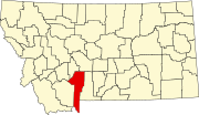
Gallatin County Montana Incorporated and Unincorporated areas Amsterdam-Churchill Highlighted.svg
Location of Amsterdam-Churchill, Montana
Coordinates: 45°45′00″N111°18′37″W / 45.75000°N 111.31028°W / 45.75000; -111.31028
Country United States
State Montana
County Gallatin
Area
[1]
  Total3.55 sq mi (9.20 km2)
  Land3.55 sq mi (9.20 km2)
  Water0.00 sq mi (0.00 km2)
Elevation
[2]
4,584 ft (1,397 m)
Population
 (2020)
  Total1,030
  Density289.98/sq mi (111.95/km2)
Time zone UTC-7 (Mountain (MST))
  Summer (DST) UTC-6 (MDT)
Area code 406
FIPS code 30-01550
GNIS ID 2629943 [2]

Churchill is a census-designated place (CDP) in Gallatin County, Montana, United States. The population was 1,030 at the 2020 census. It is part of the Bozeman, MT Micropolitan Statistical Area. It was formerly part of the Amsterdam-Churchill CDP.

Contents

Geography

According to the United States Census Bureau, the CDP has a total area of 3.6 square miles (9.3 km2), all land.

The area near town is agricultural, so fields and small creeks are plentiful. The town is bordered by the Camp Creek on the west, Godfrey Creek to the south and east, and Valley Ditch to the east and north. Though part of the immense Gallatin National Forest, there are few trees in the area. Located in the Gallatin valley, Churchill has views of the Horseshoe Hills to the north, the Bridger Mountains to the northeast, and the Gallatin Mountains to the southeast, the Spanish Peaks- the Madison Range to the south, and the Tobacco Root Mountains to the west.

History

Church Hill, or Churchill as it was later shortened by the Gallatin County Road Department, is at the center of Montana's largest Dutch settlement. The area runs from Manhattan to Little Holland 14 miles (23 km) to the south.

While Amsterdam may have been the retail center of the Dutch settlement, Churchill was the cultural center. The town was the site of the Dutch community's original church- the 1st Christian Reformed Church, today known as Manhattan Christian Reformed Church. Related to the church is the parent-operated private school, Manhattan Christian School. [3] Both exist today along with Bethel Christian Reformed Church (a spin off of the original church) and Churchill Retirement Home. The large church on the hill is the probable origin of the name, and once was the largest wooden structure west of the Mississippi River. [4]

In the late 1890s, Dutch immigrants came to the Gallatin Valley, with the aid of the Manhattan Malting Company, [3] and created a "linear settlement" of homes, farms, and ranches that stretched roughly 14 miles south of Manhattan, with Amsterdam and Churchill roughly in the middle. Recognizing the growth of the community, the Northern Pacific designated a siding called Amsterdam to the west of "the hill" along its Anceney Spur. Not to be outdone, the C.M. & St. Paul Railway (aka:the Milwaukee Road) created a siding for agricultural goods about two miles to the east of Churchill along its Gallatin Valley Railway called the "Holland Siding", subsequently the "east of the hill" became known on maps as Holland. Seven miles to the south of Churchill, near an area where many Dutch settlers homesteaded, is an area called "Little Holland" and today is marked by one of the two cemeteries established by the original Dutch settlers, while the other cemetery is located in Churchill.[ citation needed ]

Demographics

Historical population
CensusPop.Note
2020 1,030
U.S. Decennial Census [5]

Education

Elementary students in public schools attend either Amsterdam School or Manhattan Elementary School. High school students attend Manhattan High School. In 2022, the high school had 260 students with 18.8 full-time equivalency teachers. [6]

Manhattan Christian School is a private school in Churchill. [7] It is a Class C school, a designation used in Montana for sports competitions.

Media

Churchill is located in the Bozeman media market.

The FM radio station KXLB is licensed in Churchill. [8] KXLB airs a country music format to the greater Bozeman area.

Local news is published in the Bozeman Daily Chronicle .

Infrastructure

Churchill is located 8 miles (13 km) south of Interstate 90 and 6 miles (10 km) west of Montana Highway 85.

The nearest airport is Bozeman Yellowstone International Airport.

Related Research Articles

<span class="mw-page-title-main">Park County, Montana</span> County in Montana, United States

Park County is a county in the U.S. state of Montana. At the 2020 census, the population was 17,191. Its county seat is Livingston. A small part of Yellowstone National Park is in the southern part of the county.

<span class="mw-page-title-main">Gallatin County, Montana</span> County in Montana, United States

Gallatin County is a county located in the U.S. state of Montana. With its county seat in Bozeman, it is the second-most populous county in Montana, with a population of 118,960 in the 2020 Census.

<span class="mw-page-title-main">Crow Agency, Montana</span> Census designated place in Montana, United States

Crow Agency is a census-designated place (CDP) in Big Horn County, Montana, United States and is near the actual location for the Little Bighorn National Monument and re-enactment produced by the Real Bird family known as Battle of the Little Bighorn Reenactment. The population was 1,616 at the 2010 census. It is the governmental headquarters of the Crow Native Americans. It is also the location of the "agency offices" where the federal Superintendent of the Crow Indian Reservation and his staff interacts with the Crow Tribe, pursuant to federal treaties and statutes.
<span class="mw-page-title-main">Belgrade, Montana</span> City in Montana, United States

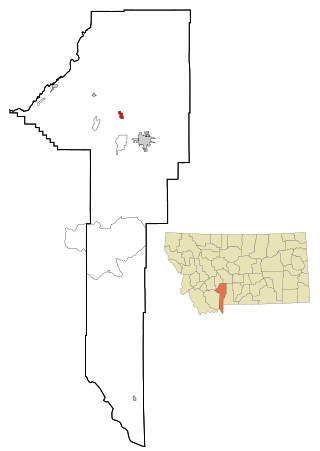
Belgrade is a city in Gallatin County, Montana, United States. The population was 10,460 at the 2020 census. Belgrade is part of the Bozeman, MT Micropolitan Statistical Area. It is the most populous city in Montana that is not a county seat.

<span class="mw-page-title-main">Bozeman, Montana</span> City in the United States

Bozeman is a city in and the county seat of Gallatin County, Montana, United States. Located in southwest Montana, the 2020 census put Bozeman's population at 53,293 making it the fourth-largest city in Montana. It is the principal city of the Bozeman, Montana, Micropolitan Statistical Area, consisting of all of Gallatin County with a population of 118,960. It is the fastest growing micropolitan statistical area in the United States in 2018, 2019 and 2020, as well as the second-largest of all Montana's statistical areas.

<span class="mw-page-title-main">Four Corners, Montana</span> Census-designated place in Montana, United States

Four Corners is a census-designated place (CDP) in Gallatin County, Montana, United States. The population was 5,901 at the 2020 census, up from 3,146 in 2010. It is part of the Bozeman, MT Micropolitan Statistical Area.

<span class="mw-page-title-main">Manhattan, Montana</span> Town in Montana, United States

Manhattan is a town in Gallatin County, Montana, United States. The population was 2,086 at the 2020 census. It is part of the 'Bozeman Micropolitan Statistical Area'.

<span class="mw-page-title-main">Willow Creek, Montana</span> Census-designated place in Gallatin County, Montana, United States.

Willow Creek is a census-designated place (CDP) in Gallatin County, Montana, United States. The population was 210 at the 2010 census. It is part of the Bozeman, MT Micropolitan Statistical Area.

<span class="mw-page-title-main">Big Horn, Wyoming</span> CDP in Wyoming, United States

Big Horn is an unincorporated community and census-designated place (CDP) in Sheridan County, Wyoming, United States. The population was 457 at the 2020 census.

<span class="mw-page-title-main">Big Sky, Montana</span> Census-designated place in Montana, United States

Big Sky is an unincorporated community and census-designated place (CDP) in Gallatin and Madison counties in southwestern Montana, United States. As of the 2020 census, it had a population of 3,591, up from 2,308 in 2010. It is 44 miles (71 km) by road southwest of Bozeman. The primary industry of the area is tourism.

<span class="mw-page-title-main">Gallatin River</span> River in Wyoming and Montana, United States

The Gallatin River is a tributary of the Missouri River, approximately 120 mi (193 km) long, in the U.S. states of Wyoming and Montana. It is one of three rivers, along with the Jefferson and Madison, that converge near Three Forks, Montana, to form the Missouri.

<span class="mw-page-title-main">East Gallatin River</span> River in Montana, United States

The East Gallatin River flows 42 miles (68 km) in a northwesterly direction through the Gallatin valley, Gallatin County, Montana. Rising from the confluence of Rocky Creek and several other small streams, the East Gallatin begins about one mile (1.6 km) east of downtown Bozeman, Montana. The river joins the main stem of the Gallatin River 2.3 miles (3.7 km) north of Manhattan, Montana. Throughout its course, the river traverses mostly valley floor ranch and farm land with typical summer flows of approximately 50 cu ft/s (1.4 m3/s).

<span class="mw-page-title-main">Bridger Range</span> Mountain range in the U.S. state of Montana

The Bridger Range, also known as the Bridger Mountains, is a subrange of the Rocky Mountains in southwestern Montana in the United States. The range runs mostly in a north–south direction between Bozeman and Maudlow. It is separated from the Gallatin Range to the south by Bozeman Pass; from the Horseshoe Hills to the west by Dry Creek; from the Crazy Mountains to the east by the Shields River valley; and from the Big Belt Mountains to the north by Sixteen Mile Creek. The highest point in the Bridger Range is Sacagawea Peak, which is visible to the northeast from Bozeman.

Gallatin Gateway is a census-designated place (CDP) in Gallatin County, Montana, United States. As of the 2010 census it had a population of 856. Elevation is 4,953 ft.

<span class="mw-page-title-main">Montana Highway 85</span> State highway in Montana, United States

Highway 85 is a 6.704-mile-long (10.789 km) north–south state highway traversing the central Gallatin Valley in the U.S. State of Montana. The highway's southern terminus, just north of Bozeman Hot Springs and about 7 miles (11 km) west of Bozeman, is a census-designated place (CDP) known as "Four Corners." From Four Corners, U.S. Route 191 (US 191) runs east to Bozeman, and south to West Yellowstone; MT 84 travels west to Norris; and MT 85 runs north to Belgrade. The designated MT 85 terminates near the southern end of Belgrade, at an interchange with Interstate 90 (I-90).

Norris is an unincorporated community and census-designated place in northeastern Madison County, Montana, United States, at the intersection of U.S. Route 287 and Montana Highway 84. As of the 2020 census, the first where it was listed as a CDP, the population was 46.

Johnson Siding is an unincorporated community in Pennington County, South Dakota, United States. The population as of the 2020 census was 614. It is located in the Rimrock Area, approximately 10 miles west of Rapid City. Johnson Siding is surrounded by the Black Hills National Forest. It is the only significant business district in the Rimrock Area, with a gas station/general store, deli, casino, tavern, the Johnson Siding Volunteer Fire Department firehouse, the Rimrock Evangelical Free Church meetinghouse, and a community center. However, most inhabitants work in Rapid City or Deadwood.
<span class="mw-page-title-main">KXLB</span> Radio station in Churchill, Montana

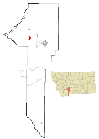
KXLB is a radio station licensed to serve Churchill, Montana. The station is owned by Townsquare Media and the broadcast license is held by Townsquare License, LLC.

<span class="mw-page-title-main">Amsterdam, Montana</span> CDP in Montana, United States

Amsterdam is a census-designated place (CDP) in Gallatin County, Montana, United States. The population was 206 at the 2020 census. It is part of the Bozeman, MT Micropolitan Statistical Area. It was formerly part of the Amsterdam-Churchill CDP.

Bridger is a census-designated place (CDP) in Gallatin County, Montana, United States. It comprises the Bridger Bowl Ski Area and some nearby residences on the eastern side of the Bridger Range in southwestern Montana. As of the 2010 census the Bridger CDP had a population of 30.

References

  1. "ArcGIS REST Services Directory". United States Census Bureau. Retrieved September 5, 2022.
  2. 1 2 U.S. Geological Survey Geographic Names Information System: Churchill, Montana
  3. 1 2 "Churchill, Montana". Discovering Montana. Retrieved September 20, 2023.
  4. Aarstad, Rich, Ellie Arguimbau, Ellen Baumler, Charlene Porsild, and Brian Shovers. Montana Place Names from Alzada to Zortman Archived October 8, 2009, at the Wayback Machine . Montana Historical Society Press.
  5. "Census of Population and Housing". Census.gov. Retrieved June 4, 2016.
  6. "Manhattan H S". National Center for Education Statistics. Retrieved September 20, 2023.
  7. "Manhattan Christian School". Manhattan Christian School. Retrieved April 17, 2021.
  8. "KXLB". FCC. Retrieved September 20, 2023.