Climax, Pennsylvania | |
---|---|
Unincorporated community | |
Coordinates: 40°59′03″N79°22′34″W / 40.98417°N 79.37611°W | |
Country | United States |
State | Pennsylvania |
County | Armstrong |
Township | Mahoning |
Elevation | 1,076 ft (328 m) |
Time zone | UTC-5 (Eastern (EST)) |
• Summer (DST) | UTC-4 (EDT) |
ZIP code | 16242 |
Area code | 814 |
GNIS feature ID | 1172006 [1] |
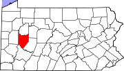
Climax is an unincorporated community in Armstrong County, Pennsylvania, United States, [1] located near New Bethlehem and Clarion. The community is known for its mining industry, namely gypsum. Its ZIP code is 16242. [2]
A ZIP Code is a system of postal codes used by the United States Postal Service (USPS). Introduced on July 1, 1963, the basic format consisted of five digits. In 1983, an extended ZIP+4 code was introduced; it included the five digits of the ZIP Code, followed by a hyphen and four digits that designated a more specific location.
ZIP Code Tabulation Areas (ZCTAs) are statistical entities developed by the United States Census Bureau for tabulating summary statistics. These were introduced with the Census 2000 and continued with the 2010 Census and 5 year American Community Survey data sets. This new entity was developed to overcome the difficulties in precisely defining the land area covered by each ZIP code. Defining the extent of an area is necessary in order to tabulate census data for that area.
Climax is an unincorporated community on the border of Guilford and Randolph counties, North Carolina, United States. Its ZIP code is 27233. The center of the community is in Fentress Township in Guilford County, but development with Climax mailing addresses extends south into Providence Township in Randolph County. The community is located along North Carolina Highway 62, west of its junction with the U.S. Highway 421 freeway. North Carolina Highway 22 leads south from NC 62 in the east part of Climax into Randolph County. Climax is just south of the town of Pleasant Garden.
Rincon is an unincorporated community in San Diego County, California, United States. Its elevation is 1030 feet above sea level. Its coordinates are 33 degrees north, 117 degrees west. Its ZIP code is 92061. The community is located near the Rincon Indian Reservation, from which the name is derived.
Scotts is an unincorporated community and census-designated place (CDP) in Kalamazoo County in the U.S. state of Michigan. The community is located on the boundary between Climax Township and Pavilion Township.
Springtown is an unincorporated community in Springfield Township in extreme northern Bucks County, Pennsylvania. The community is located at the junction of Routes 212 and 412 and is drained by the Cooks Creek east into the Delaware River.
Zionhill is an unincorporated community located in Springfield Township, Bucks County, Pennsylvania, United States. It is located on Old Bethlehem Pike east of the Unami Creek. While the village has its own box post office with the ZIP Code of 18981, surrounding areas use the Coopersburg ZIP Code of 18036 or the Quakertown ZIP Code of 18951.
Colmar is a suburban unincorporated community located in Montgomery County, Pennsylvania, United States, along State Route 309 just northeast of Lansdale. The West Branch Neshaminy Creek forms the community's natural northern boundary and flows eastward into the Neshaminy Creek. It is located in Hatfield and Montgomery Townships. It is served by the North Penn School District and is part of the North Penn Valley region that is centered on the borough of Lansdale. Colmar is important to transportation in the northern Delaware Valley due to its location on Route 309 and having the Colmar station on the Lansdale/Doylestown Line of SEPTA Regional Rail. While Colmar has its own post office, with the ZIP code of 18915, nearby areas use the Hatfield ZIP code of 19440 or the Lansdale ZIP code of 19446.
Line Lexington is an unincorporated community located in the Delaware Valley on Route 309 in Bucks and Montgomery counties in Pennsylvania, United States. It is split between the Bucks County townships of Hilltown and New Britain and the Montgomery County township of Hatfield. The Montgomery County portion of the village is in the North Penn School District and is part of the North Penn Valley region that is centered on the borough of Lansdale. The Bucks County portion is also served by the North Penn School District. While it has its own post office with the ZIP code of 18932, portions use the Colmar ZIP code of 18915, the Chalfont ZIP code of 18914 or the Hatfield ZIP code of 19440. It is served by SEPTA Suburban Bus Route 132 and the nearest SEPTA Regional Rail stations are nearby in Colmar and Chalfont on the Lansdale/Doylestown Line. The Line Lexington telephone exchange uses area code 215.
Sassamansville (SAS-a-minz-vil) is an unincorporated community in northwestern Montgomery County, Pennsylvania, United States on Hoffmansville Road, approximately 1 1/2 miles northwest of Route 663.
Climax is a hamlet in the town of Coxsackie, Greene County, New York, United States. The zipcode is 12042.
Seminole is an unincorporated community in Armstrong County, Pennsylvania, United States. The community is 3.3 miles (5.3 km) south of New Bethlehem. Seminole had its own post office until September 28, 2002; it still has its own ZIP code, 16253.
Marsteller is an unincorporated community in Cambria County, Pennsylvania, United States. The community is located 1.5 miles (2.4 km) west of Northern Cambria. Marsteller had its own post office until April 23, 2005; it still has its own ZIP code, 15760.
Alverda is an Census-designated place in Indiana County, Pennsylvania, United States. The community is located on Pennsylvania Route 553, 15.5 miles (24.9 km) east of Indiana in Pine Township.
Monocacy Station is an unincorporated community that is located in Amity Township in Berks County, Pennsylvania, United States.
Kantner is an unincorporated community in Somerset County, Pennsylvania, United States. The community is located along Pennsylvania Route 403 near its junction with U.S. Route 30, 1 mile (1.6 km) east of Stoystown. Kantner had a post office until December 20, 2003; it still has its own ZIP code, 15548.
Listie is an unincorporated community in Somerset County, Pennsylvania, United States. The community is located 3.7 miles (6.0 km) east-northeast of Somerset. Listie had a post office until September 28, 2002; it still has its own ZIP code, 15549.
Indian Head is an unincorporated community in Fayette County, Pennsylvania, United States. The community is located along Pennsylvania Route 381, 10.4 miles (16.7 km) east of Connellsville. Indian Head has a post office with ZIP code 15446, which opened on December 17, 1853. The community was named for its location near the headwaters of Indian Creek.
Sproul is an unincorporated community in Blair County, Pennsylvania, United States. The community is located along U.S. Route 220 Business, 10.5 miles (16.9 km) south of Duncansville. Sproul had a post office until September 28, 2002; it still has its own ZIP code, 16682.
Lecontes Mills is an unincorporated community in Clearfield County, Pennsylvania, United States. The community is located along Pennsylvania Route 879, 9 miles (14 km) east-northeast of Clearfield. Lecontes Mills had a post office from February 29, 1856, until January 27, 1967; it still has its own ZIP code, 16850.