Climax, Georgia

Last updated
Climax, Georgia
Climax City Hall.JPG
Climax City Hall
Decatur County Georgia Incorporated and Unincorporated areas Climax Highlighted.svg
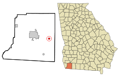
Location in Decatur County and the state of Georgia
Usa edcp location map.svg
Red pog.svg
Climax
Location of the City of Climax, Georgia.
USA Georgia location map.svg
Red pog.svg
Climax
Climax (Georgia)
Coordinates: 30°52′34″N84°25′53″W / 30.8760°N 84.4313°W / 30.8760; -84.4313 (Climax, Georgia) [1]
Country United States
State Georgia
County Decatur County
Government
  MayorDr. Joseph Melvin Kelly
Area
[2]
  Total
0.80 sq mi (2.08 km2)
  Land0.80 sq mi (2.08 km2)
  Water0.00 sq mi (0.00 km2)
Elevation
[1]
285 ft (87 m)
Population
 (2020)
  Total
276
  Density343.71/sq mi (132.69/km2)
Time zone UTC-5 (Eastern (EST))
  Summer (DST) UTC-4 (EDT)
ZIP codes
31734, 39834
Area code 229
GNIS pop ID 355192
GNIS city ID 2404075
FIPS code 13-16908

Climax is a small city in Decatur County, Georgia, United States. The town was named "Climax" because it is located at the highest point of the railroad between Savannah, Georgia, and the Chattahoochee River. [3] [4] The population was 276 at the 2020 census, down from 280 at the 2010 census. It is part of the Bainbridge, Georgia Micropolitan Statistical Area.

Contents

History

Climax was platted in 1833, and named for its lofty elevation. [5] The Georgia General Assembly incorporated the place in 1905 as the "Town of Climax", with the municipal corporate limits extending in a one-half mile radius from the town's central water well. [6]

Geography

Climax is located in eastern Decatur County at coordinates 30°52′34″N84°25′53″W / 30.8760°N 84.4313°W / 30.8760; -84.4313 (Climax, Georgia) . [1] It sits on the crest of Curry Hill, a 300-foot-high (91 m) escarpment that forms the southwestern side of the Flint River valley.

U.S. Route 84 passes through Climax, leading west 10 miles (16 km) to Bainbridge, the Decatur County seat, and east 15 miles (24 km) to Cairo.

According to the United States Census Bureau, the town of Climax has a total area of 0.81 square miles (2.1 km2), all land. [7]

Demographics

Historical population
CensusPop.Note
1910 328
1920 3455.2%
1930 45130.7%
1940 372−17.5%
1950 3730.3%
1960 329−11.8%
1970 275−16.4%
1980 40748.0%
1990 226−44.5%
2000 29731.4%
2010 280−5.7%
2020 276−1.4%
U.S. Decennial Census [8]
1850-1870 [9] 1870-1880 [10]
1890-1910 [11] 1920-1930 [12]
1940 [13] 1950 [14] 1960 [15]
1970 [16] 1980 [17] 1990 [18]
2000 [19] 2010 [20]

As of the census of 2000, [19] there were 297 people, 116 households, and 78 families residing in the town. By 2020, there were 276 people in the town.

Swine Time Festival

Climax's annual festival is held on the first Saturday after Thanksgiving. The event is attended by 35,000 people annually, a large number in light of Climax's sub-300 population. Contests and events include best-dressed pig, corn shucking, hog calling, eating chitterlings, pig racing, syrup making, baby crawling, and the great greased pig chase. The festival is kicked off with a parade down Main Street that leads up to the event grounds. There is also a beauty contest for different age groups where the winner is crowned Miss and Little Miss Swine Time.

See also

Related Research Articles

<span class="mw-page-title-main">Seminole County, Georgia</span> County in Georgia, United States

Seminole County is a county located in the southwestern corner of U.S. state of Georgia. As of the 2020 census, the population was 9,147. The county seat is Donalsonville.

<span class="mw-page-title-main">Mitchell County, Georgia</span> County in Georgia, United States

Mitchell County is a county in the U.S. state of Georgia. As of the 2020 census, the population was 21,755. The county seat is Camilla. Mitchell County was created on December 21, 1857.

<span class="mw-page-title-main">Grady County, Georgia</span> County in Georgia, United States

Grady County is a county located in the U.S. state of Georgia. As of the 2020 census, the population was 26,236. The county seat is Cairo.

<span class="mw-page-title-main">Decatur County, Georgia</span> County in Georgia, United States

Decatur County is a county located in the U.S. state of Georgia. As of the 2020 census, the population was 29,367. The county seat is Bainbridge.

<span class="mw-page-title-main">Baker County, Georgia</span> County in Georgia, United States

Baker County is a county in Georgia. As of the 2020 census, the population was 2,876, making it the fifth-least populous county in Georgia. The county seat and only city is Newton. The county was created December 12, 1825, from the eastern portion of Early County by an act of the Georgia General Assembly and is named for Colonel John Baker, a hero of the American Revolutionary War.

<span class="mw-page-title-main">St. Marys, Georgia</span> City in Georgia, United States of America

St. Marys is a city in Camden County, Georgia, United States, located on the southern border of Camden County on the St. Marys River in the state's Low Country. It had a population of 18,256 at the 2020 census, up from 17,121 at the 2010 census. It is part of the Kingsland, Georgia Micropolitan Statistical Area. The Florida border is just to the south across the river, Cumberland Island National Seashore is to the northeast, and Kingsland, Georgia, is to the west. Jacksonville, Florida, is 38 miles south, and Savannah, Georgia, is 110 miles north.

<span class="mw-page-title-main">Fort Gaines, Georgia</span> City in Georgia, United States

Fort Gaines is a city in and the county seat of Clay County, Georgia, United States. It has a population of 995 as of the 2020 census.

<span class="mw-page-title-main">Attapulgus, Georgia</span> City in Georgia, United States

Attapulgus is a city in Decatur County, Georgia, United States. As of the 2020 census, the city had a population of 454, up from 449 at the 2010 census. It is part of the Bainbridge, Georgia Micropolitan Statistical Area.

<span class="mw-page-title-main">Bainbridge, Georgia</span> City in Georgia, United States

Bainbridge is a city in Decatur County, Georgia, United States. The city is the county seat of Decatur County. As of the 2020 census, the city had a population of 14,468, up from 12,697 at the 2010 census. It is the principal city of the Bainbridge, Georgia Micropolitan Statistical Area and a principal city in the Tallahassee—Bainbridge, FL-GA Combined Statistical Area.

<span class="mw-page-title-main">Brinson, Georgia</span> Town in Georgia, United States

Brinson is a town in Decatur County, Georgia, United States. As of the 2020 census, the city had a population of 217, up from 215 at the 2010 census. It is part of the Bainbridge, Georgia Micropolitan Statistical Area.

<span class="mw-page-title-main">North Decatur, Georgia</span> Place in Georgia, United States

North Decatur is an unincorporated community and census-designated place (CDP) in DeKalb County, Georgia, United States. The population was 18,511 in 2020.

<span class="mw-page-title-main">Jakin, Georgia</span> City in Georgia, United States

Jakin is a city in Early County, Georgia, United States. Incorporated in 1895, Jakin's population was 131 in 2020.

<span class="mw-page-title-main">Cairo, Georgia</span> City in Georgia, United States

Cairo is a city in Grady County, Georgia, United States. As of the 2020 census, the city had a population of 10,179. The city is the county seat of Grady County.

<span class="mw-page-title-main">Whigham, Georgia</span> City in Georgia, United States

Whigham is a city in Grady County, Georgia, United States. The population was 428 in 2020.

<span class="mw-page-title-main">Greensboro, Georgia</span> City in Georgia, United States

Greensboro is a city in and the county seat of Greene County, Georgia, United States. Its population was 3,648 as of the 2020 census. The city is located approximately halfway between Atlanta and Augusta on Interstate 20.

<span class="mw-page-title-main">Sparta, Georgia</span> City in Georgia, United States

Sparta is a city in and the county seat of Hancock County, Georgia, United States. The city's population was 1,357 at the 2020 census.

<span class="mw-page-title-main">Wrens, Georgia</span> City in Georgia, United States

Wrens is a city in Jefferson County, Georgia, United States. The population was 2,217 at the 2020 census. It is located on U.S. Route 1, thirty miles west of Augusta.

<span class="mw-page-title-main">Colquitt, Georgia</span> City in Georgia, United States

Colquitt is a city and the county seat of Miller County, in the southwestern portion of the U.S. state of Georgia. The population was 2,001 at the 2020 census. Colquitt has been the county seat of Miller County since Miller County was incorporated by the Georgia Legislature in 1856. The city formally incorporated on December 19, 1860, and is Miller County's only incorporated municipality. Colquitt is named for U.S. Congressman and Senator Walter Terry Colquitt.

<span class="mw-page-title-main">Iron City, Georgia</span> Town in Georgia, United States

Iron City is a town in Seminole County, Georgia, United States. The population was 312 in 2020.

<span class="mw-page-title-main">Waynesboro, Georgia</span> City in Georgia, United States

Waynesboro is a city and the county seat of Burke County, Georgia, United States. The population was 5,472 at the 2024 census. It is part of the Augusta, Georgia metropolitan area.

References

  1. 1 2 3 "Climax, Georgia". Geographic Names Information System . United States Geological Survey, United States Department of the Interior . Retrieved January 31, 2025.
  2. "2020 U.S. Gazetteer Files". United States Census Bureau. Retrieved December 18, 2021.
  3. Climax, GA Historical Marker at the Historical Marker Database
  4. "New Georgia Encyclopedia entry for Decatur County". Archived from the original on October 12, 2012. Retrieved September 19, 2009.
  5. Krakow, Kenneth K. (1975). Georgia Place-Names: Their History and Origins (PDF). Macon, GA: Winship Press. p. 46. ISBN   0-915430-00-2.
  6. Acts and Resolutions of the General Assembly of the State of Georgia. State printer. 1905. p. 730.
  7. "Geographic Identifiers: 2010 Demographic Profile Data (G001): Climax city, Georgia". U.S. Census Bureau, American Factfinder. Retrieved October 20, 2015.[ dead link ]
  8. "Decennial Census of Population and Housing by Decade". United States Census Bureau.
  9. "1870 Census of Population - Georgia - Population of Civil Divisions less than Counties" (PDF). United States Census Bureau. 1870.
  10. "1880 Census of Population - Georgia - Population of Civil Divisions less than Counties" (PDF). United States Census Bureau. 1880.
  11. "1910 Census of Population - Georgia" (PDF). United States Census Bureau. 1910.
  12. "1930 Census of Population - Georgia" (PDF). United States Census Bureau. 1930. pp. 251–256.
  13. "1940 Census of Population - Georgia" (PDF). United States Census Bureau. 1940.
  14. "1950 Census of Population - Georgia" (PDF). United States Census Bureau. 1950.
  15. "1960 Census of Population - Population of County Subdivisions - Georgia" (PDF). United States Census Bureau. 1960.
  16. "1970 Census of Population - Population of County Subdivisions - Georgia" (PDF). United States Census Bureau. 1970.
  17. "1980 Census of Population - Number of Inhabitants - Georgia" (PDF). United States Census Bureau. 1980.
  18. "1990 Census of Population - Summary Social, Economic, and Housing Characteristics - Georgia" (PDF). United States Census Bureau. 1990.
  19. 1 2 "2000 Census of Population - General Population Characteristics - Georgia" (PDF). United States Census Bureau. 2000.
  20. "2010 Census of Population - General Population Characteristics - Georgia" (PDF). United States Census Bureau. 2010.