Cobbtown, Georgia | |
|---|---|
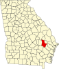
| Location in Tattnall County and the state of Georgia | |
| Coordinates: 32°16′53″N82°8′18″W / 32.28139°N 82.13833°W | |
| Country | United States |
| State | Georgia |
| County | Tattnall |
| Area | |
• Total | 0.68 sq mi (1.76 km2) |
| • Land | 0.67 sq mi (1.73 km2) |
| • Water | 0.01 sq mi (0.03 km2) |
| Elevation | 246 ft (75 m) |
| Population (2020) | |
• Total | 341 |
| • Density | 509.72/sq mi (196.87/km2) |
| Time zone | UTC-5 (Eastern (EST)) |
| • Summer (DST) | UTC-4 (EDT) |
| ZIP code | 30420 |
| Area code | 912 |
| FIPS code | 13-17272 [2] |
| GNIS feature ID | 0355208 [3] |
Cobbtown is a city in Tattnall County, Georgia, United States. The population was 341 in 2020.
A variant name was "Corsica". [4] The Georgia General Assembly incorporated the place as the "Town of Cobbtown" in 1905. [5]
Cobbtown is located at 32°16′53″N82°8′18″W / 32.28139°N 82.13833°W (32.281376, -82.138288). [6]
According to the United States Census Bureau, the city has a total area of 0.7 square miles (1.8 km2), all of it land.
| Census | Pop. | Note | %± |
|---|---|---|---|
| 1910 | 254 | — | |
| 1920 | 325 | 28.0% | |
| 1930 | 295 | −9.2% | |
| 1940 | 275 | −6.8% | |
| 1950 | 288 | 4.7% | |
| 1960 | 280 | −2.8% | |
| 1970 | 321 | 14.6% | |
| 1980 | 494 | 53.9% | |
| 1990 | 338 | −31.6% | |
| 2000 | 311 | −8.0% | |
| 2010 | 351 | 12.9% | |
| 2020 | 341 | −2.8% | |
| U.S. Decennial Census [7] | |||
As of the census [2] of 2000, there were 311 people, 139 households, and 91 families residing in the city. By 2020, its population was 341.