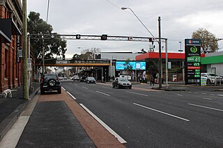
Abbotsford is an inner-city suburb in Melbourne, Victoria, Australia, 2 km (1.2 mi) north-east of Melbourne's Central Business District, located within the City of Yarra local government area. Abbotsford recorded a population of 9,088 at the 2021 census.

The City of Melville is a local government area in the southern suburbs of the Western Australian capital city of Perth, east of the port city of Fremantle and about 12 kilometres (7.5 mi) south of Perth's central business district. The City covers an area of 52.73 square kilometres (20.36 sq mi) and had a population of about 98,000 as at the 2016 Census.

Greenwood is a suburb of Perth, Western Australia, located in the City of Joondalup. The suburb is located 18 km from Perth's central business district. It is bordered by the Mitchell Freeway, Hepburn ave, Wanneroo road and Warwick road.

Sorrento is a northern coastal suburb of Perth, the capital city of Western Australia in the local government area of the City of Joondalup. At its northwestern corner is the Hillarys Boat Harbour, built in the late 1980s.

Burswood is an inner southeastern suburb of Perth, Western Australia, located immediately across the Swan River from Perth's central business district (CBD). Its local government area is the Town of Victoria Park. Burswood is the location of the State Tennis Centre, Perth Stadium, Belmont Park Racecourse, and the Crown Perth casino and hotel complex.

The North Albany Football and Sporting Club, more often referred to as North Albany, is an Australian rules football club located in Albany, Western Australia. Nicknamed the Kangas, the club play in the Great Southern Football League, with home games being hosted at Collingwood Park. Since being formed in 1897, netball and association football teams have played under banners of North Albany or Kangas.

Ongerup is a town and locality in the Shire of Gnowangerup, Great Southern region of Western Australia. It is 410 kilometres (250 mi) south-east of Perth and 54 kilometres (34 mi) east of Gnowangerup. At the 2021 census Ongerup had a population of 114.

Pelican Point is a northeastern suburb of Bunbury, Western Australia, that is six kilometres from the centre of Bunbury and adjoins the suburb of Eaton. It is within the City of Bunbury local government area.

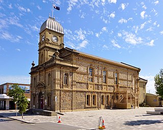
The City of Albany is a local government area in the Great Southern region of Western Australia, about 410 kilometres (255 mi) south-southeast of Perth, the capital of Western Australia. It covers an area of 4,312.3 square kilometres (1,665 sq mi), including the Greater Albany metropolitan area and the Port of Albany, as well as the surrounding agricultural district and some national parks. The City of Albany had a population of over 36,000 at the 2016 census.
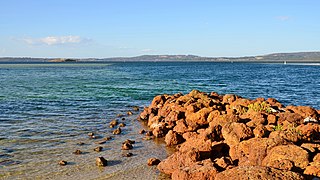
Bayonet Head is an outer north-eastern suburb of Albany, Western Australia, on the west bank of Oyster Harbour. Its local government area is the City of Albany. Until the 1980s, it was known as Flinders Park.
Centennial Park is an inner suburb of Albany, Western Australia, immediately north of the CBD within the local government area of the City of Albany. It contains a light industrial area and numerous sporting facilities which serve the entire Albany catchment area.
Collingwood Heights is a north-eastern suburb of Albany, Western Australia, between the Albany city centre and Emu Point within the local government area of the City of Albany.

Binalup/Middleton Beach is a coastal suburb of Albany, Western Australia, located within the City of Albany approximately 4 kilometres (2.5 mi) east of the city centre. The traditional owners, the Noongar peoples, know the place as Binalup meaning the place of first light since the sun rises over the waters in the morning. The main road between the city and the locality is via Middleton Road. It is home to a caravan park and numerous holiday units which provide accommodation for visitors to the Albany region.
Mount Clarence is an inner suburb of Albany, Western Australia, between the Albany city centre and Middleton Beach. Its local government area is the City of Albany, and over three-quarters of its land area is either parkland or forest, including Albany's Heritage Park. Mount Clarence was gazetted as a suburb in 1979.
Spencer Park is a north-eastern suburb of Albany in southern Western Australia north-northeast of Albany's central business district. Its local government area is the City of Albany, and the suburb was gazetted in 1954.
Mira Mar is a northeastern locality of the City of Albany in the Great Southern region of Western Australia.
West End is a western suburb of Geraldton, Western Australia. Its local government area is the City of Greater Geraldton.
Spalding is a northeastern suburb of Geraldton, Western Australia. Its local government area is the City of Greater Geraldton.

Collingwood Park is a stadium located in the suburb Collingwood Park in the city of Albany, Western Australia.

Emu Point is a north-eastern suburb of the City of Albany in the Great Southern region of Western Australia. It is located north-east of Albany's central business district.


