
Woodanilling is a small town and locality in the Shire of Woodanilling, Great Southern region of Western Australia.

The Shire of Jerramungup is a local government area in the Great Southern region of Western Australia, about 180 kilometres (112 mi) northeast of Albany and about 440 kilometres (273 mi) southeast of the state capital, Perth. The Shire covers an area of 6,507 square kilometres (2,512 sq mi) with Bremer Bay its largest town. The seat of government is the town of Jerramungup.
South Stirling is a townsite and locality of the City of Albany in the Great Southern region of Western Australia. The entirety of the townsite is now located within the South Stirling Nature Reserve. it is located 75 kilometres (47 mi) north-east of Albany. At the 2021 census, it had a population of 22. It is situated at the foot of the Stirling Range. Other close small towns are Mount Barker, Wellstead, and Manypeaks.
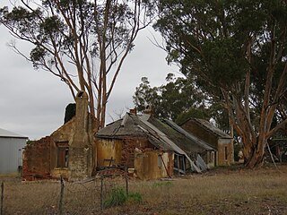
Moojebing is an abandoned townsite and locality on the Boyerine Creek in the Great Southern region of Western Australia, southeast of Woodanilling and north north west of Katanning. It is located within the Shire of Katanning.
Moornaming is an abandoned townsite in the locality of Nyabing, Shire of Kent, in the Great Southern region of Western Australia. Much of the gazetted area of the former townsite is now covered by the Moornaming Nature Reserve.
Pootenup is a townsite in the Great Southern region of Western Australia. Pootenup is located in both the Shire of Cranbrook and the Shire of Broomehill-Tambellup. The Great Southern Highway forms the shire boundary in this area and the area of the townsite of Pootenup spans either side of the highway. Because of its location across two shires, Tunney has two postcodes, 6320 for the eastern part, located in Broomehill-Tambellup, and 6321 for the western part, located in Cranbrook. Parts of the gazetted area of the former townsite is now covered by the Pootenup Nature Reserve.
Peringillup is an abandoned townsite in the Shire of Broomehill-Tambellup of the Great Southern region of Western Australia. Peringillup is located on the Great Southern Highway. The gazetted area of the town is not contiguous. While the majority of it is located east of the Great Southern Highway, a small exclave is to the west of the highway, south-west of the main area of Peringillup. All of the gazetted area of the former townsite is now covered by the Peringillup Nature Reserve.
Marbelup is a townsite and locality of the City of Albany in the Great Southern region of Western Australia. The South Coast Highway runs through the locality west to east while the Great Southern Railway passes through it from north to south. The Marbelup Nature Reserve surrounds the remaining gazetted townsite, just 4,052 square metres (43,620 sq ft) in size, on three sides but no town actually exists at location.
Mettler is a locality of the City of Albany in the Great Southern region of Western Australia, located along the Southern Ocean. The South Coast Highway passes through the northern part of the locality. Mettler is home to two nature reserves, the Mettler Lake Nature Reserve and the Basil Road Nature Reserve, while the far eastern end on Hassell National Park extends into the west of the locality.
Redmond West is a rural locality of the City of Albany in the Great Southern region of Western Australia. The north-western corner of the locality is taken up by the south-eastern section of the Mount Lindesay National Park and the Blue Gum Creek Nature Reserve is also located within Redmond West. The Hay River passes through it and also forms its boundary in the south-west.
Palmdale is a rural locality of the City of Albany in the Great Southern region of Western Australia. The Kalgan River forms the western boundary of the locality, with the Granite Hill Nature Reserve stretching along the river in the north of Palmdale.
Napier is a rural locality of the City of Albany in the Great Southern region of Western Australia. The Kalgan River forms the north-eastern boundary of the locality, with the Granite Hill Nature Reserve stretching along the river in this section. The Napier Nature Reserve is also located within Napier. Chester Pass Road passes through Napier from south to north.
Broomehill West is a rural locality of the Shire of Broomehill–Tambellup of the Great Southern region of Western Australia, adjacent to the town of Broomehill. The Great Southern Highway and the Great Southern Railway, for the most part, form the eastern border of the locality. A small part of the gazetted townsite of Peringillup and a major part of the Peringillup Nature Reserve are located within Broomehill West.
Broomehill East is a rural locality of the Shire of Broomehill–Tambellup of the Great Southern region of Western Australia, adjacent to the town of Broomehill. The Great Southern Highway and the Great Southern Railway, for the most part, form the western border of the locality. The majority of the gazetted townsite of Peringillup and parts of the Peringillup Nature Reserve are located within Broomehill East.
Wansbrough is a rural locality of the Shire of Broomehill–Tambellup in the Great Southern region of Western Australia. The Great Southern Highway and the Great Southern Railway run through the locality from north to south, while the Gordon River forms its north-eastern boundary. The Wansbrough and the Beejenup Nature Reserves are fully located in the locality, while the far northern end of the Balicup Lake Nature Reserve protrudes into the south of Wansbrough. The small eastern part of the gazetted townsite of Pootenup is located in Wansbrough, while the western part is located in Cranbrook, with the border running parallel to the railway line.
Lake Toolbrunup is a rural locality of the Shire of Broomehill–Tambellup in the Great Southern region of Western Australia. The Anderson Lake and the Three Swamps Nature Reserves are located within Lake Toolbrunup.
Boyerine is a town and locality of the Shire of Woodanilling in the Great Southern region of Western Australia. The Great Southern Highway and the Great Southern Railway run through the locality from north to south. The Flagstaff Nature Reserve is located at the western border of Boyerine.
South Glencoe is a rural locality of the Shire of Katanning in the Great Southern region of Western Australia. The Johns Well Nature Reserve is located within South Glencoe, as is a small part of the unnamed WA24282 Nature Reserve.
Coblinine is a rural locality of the Shire of Katanning in the Great Southern region of Western Australia. The Coblinine Nature Reserve, situated along the Coblinine River, is located in Coblinine.
Woogenellup, sometimes also spelled Woogenilup, is a rural locality of the Shire of Plantagenet in the Great Southern region of Western Australia. The eastern border of Woogenellup is formed by Chester Pass Road, while the southern boundary of the Stirling Range National Park forms its northern border. The Kalgan River runs through the locality from north-west to south-east, and the Kalgan Plains Nature Reserve is located within Woogenellup, south of the river.

